geo.wikisort.org - Mountains
Storheia is the highest mountain in Bymarka in the municipality of Trondheim in Trøndelag county, Norway. The 565-metre (1,854 ft) tall mountain lies about 3 kilometres (1.9 mi) east of the village of Langørjan. On clear days, one can stand atop Storheia and see as far as the mountain Snøhetta, about 130 kilometres (81 mi) away. The smaller mountain Gråkallen lies just to the northeast.[2]
| Storheia | |
|---|---|
 Storheia. | |
| Highest point | |
| Elevation | 565 m (1,854 ft) |
| Prominence | 420 m (1,380 ft) |
| Isolation | 15.72 to 15.74 km (9.77 to 9.78 mi) |
| Coordinates | 63.4022°N 10.2010°E[1] |
| Geography | |
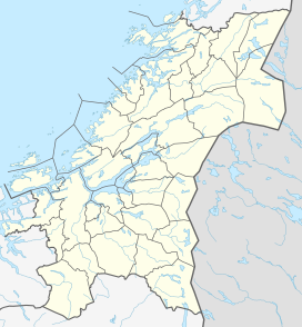 Storheia Location of the mountain  Storheia Storheia (Norway) | |
| Location | Trøndelag, Norway |
| Topo map | 1621 IV Trondheim |
Name
The first element is stor which means "big" and the last element is the finite form of hei which means "upland" or "hill".
References
- "Storheia, Trondheim (Trøndelag)" (in Norwegian). yr.no. Retrieved 2017-03-23.
- Store norske leksikon. "Bymarka" (in Norwegian). Retrieved 2011-03-24.
This Trøndelag location article is a stub. You can help Wikipedia by expanding it. |
На других языках
- [en] Storheia
[es] Storheia
Storheia es la montaña más alta de Bymarka, cerca de Trondheim, Noruega. Storheia mide 565 metros sobre el nivel del mar y es el punto más alto de Trondheim.[1]Текст в блоке "Читать" взят с сайта "Википедия" и доступен по лицензии Creative Commons Attribution-ShareAlike; в отдельных случаях могут действовать дополнительные условия.
Другой контент может иметь иную лицензию. Перед использованием материалов сайта WikiSort.org внимательно изучите правила лицензирования конкретных элементов наполнения сайта.
Другой контент может иметь иную лицензию. Перед использованием материалов сайта WikiSort.org внимательно изучите правила лицензирования конкретных элементов наполнения сайта.
2019-2026
WikiSort.org - проект по пересортировке и дополнению контента Википедии
WikiSort.org - проект по пересортировке и дополнению контента Википедии