geo.wikisort.org - Mountains
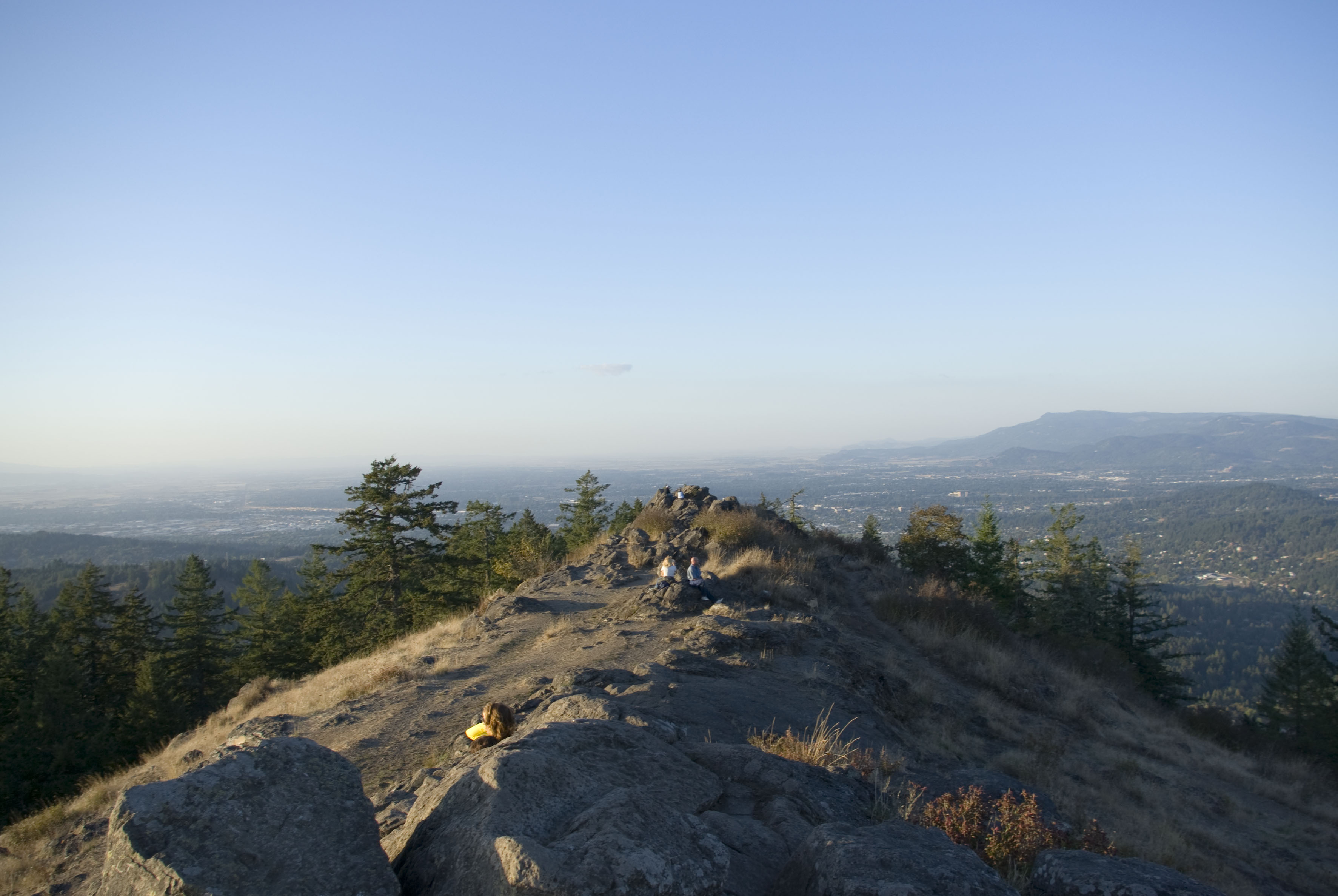
Spencer Butte is a prominent landmark in Lane County, Oregon, United States, described in the National Geodetic Survey as "a prominent timbered butte with a bare rocky summit" on the southern edge of Eugene, with an elevation of 2,058 feet (627 m).[1] Spencer Butte is accessible from Spencer Butte Park and has several hiking trails to the summit.[2] The tree cover on the butte is predominantly Douglas fir; however, the butte is treeless at its summit. The butte is the tallest point visible when looking south from downtown Eugene.
| Spencer Butte | |
|---|---|
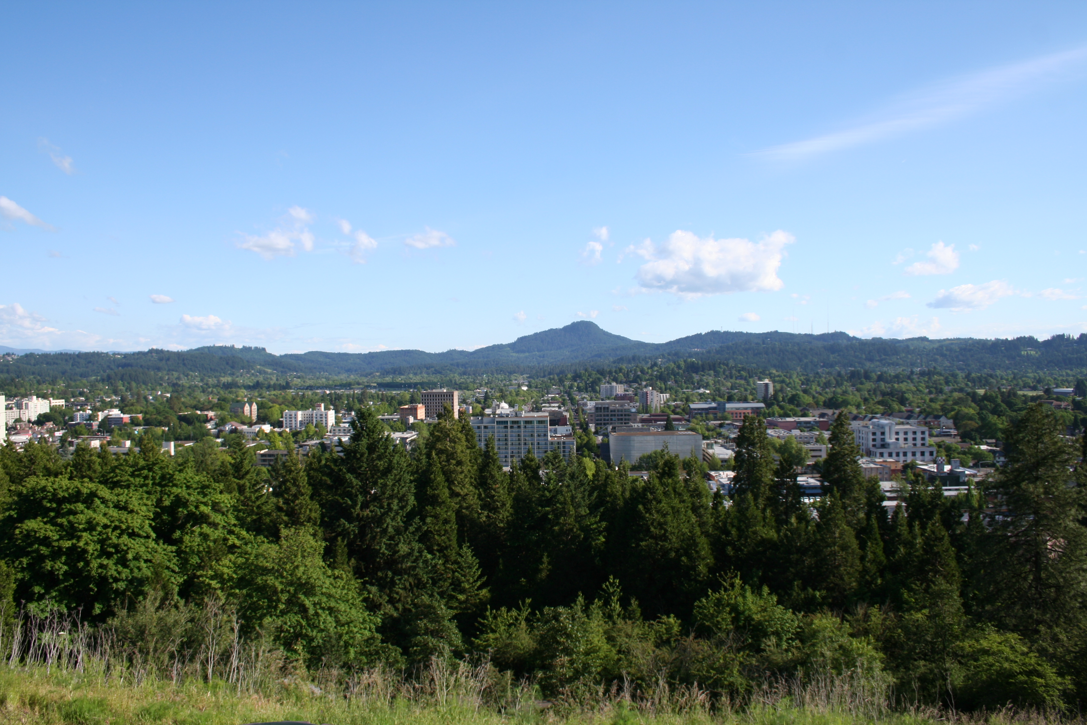 View of Eugene from Skinner Butte, with Spencer Butte in the distance | |
 Spencer Butte | |
| Location | South of Eugene, Oregon, USA |
| Coordinates | 43°58′59″N 123°05′45″W |
| Range | Cascade Volcanoes |
| Part of | Little Butte Volcanics[1] |
| Highest point | 2,058 feet (627 m)[1] |
| Formed by | Intrusion of lava through sandstone base, and subsequent erosion of sandstone |
| Geology | Butte |
| Age | approximately 23 to 30 million years |
| Orogeny | Phanerozoic orogen |
Name
The butte was called Champ-a te or Cham-o-tee by the native Kalapuya, meaning rattlesnake.[3]
One popular theory is that Spencer Butte was named for a young Englishman of the Hudson's Bay Company named Spencer, who was said to have been killed by the Kalapuya after climbing the hill alone.[4] Another, less popular theory holds that the butte was named after Secretary of War John C. Spencer in July 1845 by Elijah White.[2][3] Spencer was no longer Secretary of War by 1845, however.
In popular culture
- The song "All Of Me Wants All You" by Sufjan Stevens mentions Spencer Butte twice; the song is from the album Carrie & Lowell, which also includes a song titled "Eugene" after the city, and makes many other references to places in Oregon.[5]
References

- "Spencer Butte - NGS Data Sheet". U.S. National Geodetic Survey. Retrieved January 20, 2013.
- Sullivan, William (2005). 100 Hikes in the Central Oregon Cascades (3rd ed.). Eugene, Oregon: Navillus Press. pp. 176–177. ISBN 0-9677830-6-2.
- "Spencer Butte Park History" (PDF). City of Eugene. Archived from the original (PDF) on July 21, 2011. Retrieved 2008-05-05.
- "Indians, Surveyors, Incidents Gave Names to Streams, Lakes and Mountains". Eugene Register-Guard. 4 January 1942. p. 5. Retrieved 23 April 2015.
- Wright, Craig. "Emerald Recommends the best albums of 2015". Emerald Media. Retrieved April 15, 2016.
External links
 Media related to Spencer Butte at Wikimedia Commons
- Official website
Authority control | |
|---|---|
| General |
|
| National libraries | |
This Lane County, Oregon state location article is a stub. You can help Wikipedia by expanding it. |
Другой контент может иметь иную лицензию. Перед использованием материалов сайта WikiSort.org внимательно изучите правила лицензирования конкретных элементов наполнения сайта.
WikiSort.org - проект по пересортировке и дополнению контента Википедии