geo.wikisort.org - Mountains
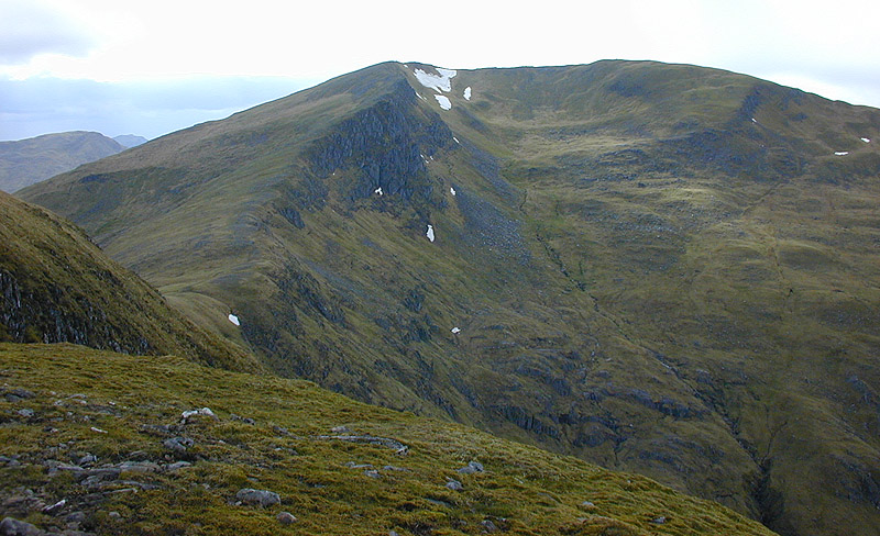
Sgurr an Doire Lethain (1,010 m) is a mountain in the Northwest Highlands of Scotland. It is located south of Glen Shiel in the Kintail area.
| Sgurr an Doire Lethain | |
|---|---|
 Sgurr an Doire Lethain | |
| Highest point | |
| Elevation | 1,010 m (3,310 ft)[1] |
| Prominence | 189 m (620 ft) |
| Listing | Munro, Marilyn |
| Coordinates | 57°08′12″N 5°16′53″W |
| Geography | |
| Location | Highland, Scotland |
| Parent range | Northwest Highlands |
| OS grid | NH015098 |
| Topo map | OS Landranger 33 |
One of seven Munros on the long Glen Sheil ridge, it is usually climbed in the conjunction with the other six. The nearest village is Shiel Bridge.[2]
References
- "Sgurr an Doire Lethain". hill-bagging.co.uk. Retrieved 1 June 2019.
- "walkhighlands Sgurr an Doire Lethain". walkhighlands.co.uk. Retrieved 1 June 2019.
This Scottish location article is a stub. You can help Wikipedia by expanding it. |
На других языках
[de] Sgùrr an Doire Leathain
Der Sgùrr an Doire Leathain ist ein 1.010 m (3.314 ft) hoher, als Munro und Marilyn eingestufter Berg in Schottland. Sein gälischer Name kann in etwa mit Spitze des breiten Eichendickichts übersetzt werden.[1] Der Gipfel liegt in der Council Area Highland in den Northwest Highlands in der weitläufigen Berglandschaft zwischen Loch Cluanie und Loch Quoich, etwa 35 Kilometer nordwestlich von Fort William. In der Bergkette der South Glen Shiel Ridge südlich von Glen Shiel in Kintail ist er der zweithöchste von insgesamt sieben Munros.- [en] Sgurr an Doire Leathain
Текст в блоке "Читать" взят с сайта "Википедия" и доступен по лицензии Creative Commons Attribution-ShareAlike; в отдельных случаях могут действовать дополнительные условия.
Другой контент может иметь иную лицензию. Перед использованием материалов сайта WikiSort.org внимательно изучите правила лицензирования конкретных элементов наполнения сайта.
Другой контент может иметь иную лицензию. Перед использованием материалов сайта WikiSort.org внимательно изучите правила лицензирования конкретных элементов наполнения сайта.
2019-2026
WikiSort.org - проект по пересортировке и дополнению контента Википедии
WikiSort.org - проект по пересортировке и дополнению контента Википедии