geo.wikisort.org - Mountains
Serra de Pàndols is a limestone mountain chain located at the southern end of the Catalan Pre-Coastal Range, in Catalonia, Spain.[1]
| Serra de Pàndols | |
|---|---|
 Serra de Pàndols seen from Hill 705 | |
| Highest point | |
| Elevation | 705 m (2,313 ft) |
| Coordinates | 41°01′13.68″N 00°27′27.88″E |
| Geography | |
 Serra de Pàndols Catalonia, Spain | |
| Location | Terra Alta, Spain |
| Parent range | Catalan Pre-Coastal Range |
| Geology | |
| Mountain type | Limestone |
| Climbing | |
| Easiest route | Drive from Gandesa or El Pinell de Brai |
There is a project to install wind turbines on the Serra de Pàndols and neighboring Serra de Cavalls which has met with public protests.[2] The Serra de Paüls mountain range is located to the south of this range.
Hill 705
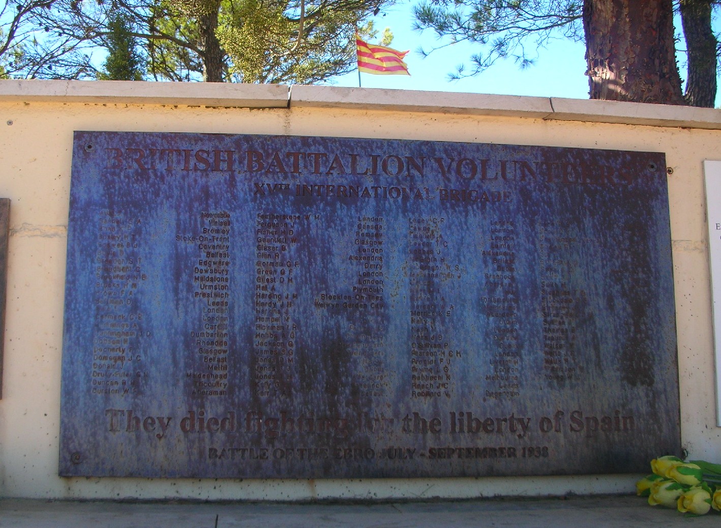
The ridge's highest point is Punta Alta (705.5 m). This summit was known as Hill 705 (Cota 705) during the Battle of the Ebro, the bloodiest and most protracted series of combats in the Spanish Civil War (1936–39). The Battle was also the last action of the International Brigades, who were withdrawn midway through it.
Close to the peak stands a monument to those who died in the battles.[3] Hill 705 was a key position to control the Serra de Pàndols range at the time of the Battle of the Ebro. The summit lies within the Pinell de Brai municipal term.
 |
 |
See also
- Battle of the Ebro
- 11th Division (Spain)
- International Brigades
- Catalan Pre-Coastal Range
References
- "Mapa Topogràfic de Catalunya". Institut Cartogràfic de Catalunya. Retrieved 9 September 2010.
- Edmon Castell i Oriol Nel·lo El parc eòlic de les Serres de Pàndols i Cavalls. Energia, valors ambientals i memòria històrica (Ed.). 2003. Aquí, No! Els conflictes territorials a Catalunya. Barcelona: Editorial Empúries.
- The Battle of the Ebro in one day Archived 2011-07-19 at the Wayback Machine
Bibliography
- Jaume Aguadé i Sordé, El diari de guerra de Lluís Randé i Inglés; Batalles del Segre i de l’Ebre i camps de concentració (abril 1938 - juliol 1939), El Tinter ISBN 84-9791-082-6
External links
- Serres de Pàndols-Cavalls, proposta d'ampliació del Parc Natural del Port
- Pinell de Brai Town Hall Webpage
- La Batalla de l'Ebre
This article about a location in Catalonia is a stub. You can help Wikipedia by expanding it. |
На других языках
- [en] Serra de Pàndols
[es] Sierra de Pàndols
La sierra de Pàndols (en catalán, Serra de Pàndols) es una sierra española perteneciente a la cordillera Prelitoral y localizada en la zona de la Tierra Alta, en la provincia de Tarragona. Se encuentra situada entre los municipios de Gandesa y Pinell de Bray. Es conocida por los combates que allí tuvieron lugar durante la guerra civil española.Другой контент может иметь иную лицензию. Перед использованием материалов сайта WikiSort.org внимательно изучите правила лицензирования конкретных элементов наполнения сайта.
WikiSort.org - проект по пересортировке и дополнению контента Википедии