geo.wikisort.org - Mountains
The Selter is a ridge, up to 395 m above NN, in the Lower Saxon Hills in the districts of Hildesheim, Holzminden and Northeim in the German state of Lower Saxony.
| Selter | |
|---|---|
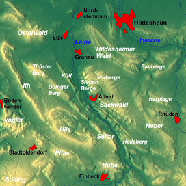 Overview map: Selter roughly lower centre, Ith and Hils to the left of it with the Wallensen Basin in between
| |
| Highest point | |
| Peak | Hohe Egge (Selter) |
| Elevation | 395 m above NN |
| Dimensions | |
| Length | 11 km (6.8 mi) |
| Geography | |
| Country | Germany |
| State | Lower Saxony |
| Range coordinates | 51°54′18″N 9°53′32″E |
| Parent range | Leine Uplands |
| Geology | |
| Age of rock | Middle Jurassic, Upper Jurassic |
| Type of rock | limestone, marl, claystone, siltstone, sandstone |
Geography
Location
The Selter is a narrow ridge in the Alfeld Uplands, part of the Leine Uplands in the Lower Saxon Hills. It is about 11 kilometres long and lies in the rectangle formed by the villages of Alfeld, Freden, Kreiensen and Delligsen. It lies between Delligsen to the northwest, Imsen to the north, Freden to the east, Erzhausen to the southeast, Greene to the south-southeast, Naensen to the south, Stroit and Ammensen to the southwest and Varrigsen to the west. Its virtual centre lies near Freden.
Hills
Amongst the hills of the Selter are the following − sorted by height in metres above sea level (NN)
- Hohe Egge (395.0 m)
- Kohlberg (ca. 380 m)
- Thödingsberg (ca. 366 m)
- Nollen (300.0 m)
- Hasenberg (ca. 290 m)
- Spielberg (ca. 290 m)
- Ziegenrücken (ca. 260 m)
References
На других языках
[de] Selter (Höhenzug)
Der Selter ist ein bis 395 m ü. NHN[1] hoher Höhenzug des Niedersächsischen Berglands in den Landkreisen Hildesheim, Holzminden und Northeim.- [en] Selter (hills)
Другой контент может иметь иную лицензию. Перед использованием материалов сайта WikiSort.org внимательно изучите правила лицензирования конкретных элементов наполнения сайта.
WikiSort.org - проект по пересортировке и дополнению контента Википедии