geo.wikisort.org - Mountains
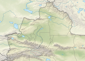
Sauyr Zhotasy (Kazakh: Сауыр жотасы, Sauyr jotasy), also known as Muz Tau (Chinese: 木斯岛山; pinyin: Mùsīdǎo Shān), at 3,840 m is the highest point in the Saur Range and of the entire Saur-Tarbagatai mountain system, part of the Tien Shan, on the border between Kazakhstan and China. It lies 100 kilometres (60 mi) southeast of Zaysan Lake. Despite its low elevation, it is well separated from higher ranges in its area (the Saur-Tarbagatai System being separated from the Altai Mountains by the Irtysh River valley, and from the Dzungarian Alatau, by the Dzungarian Gate); it is therefore ranked highly by topographic prominence.
| Sauyr Zhotasy | |
|---|---|
 Sauyr Zhotasy Location in Xinjiang Uygur Autonomous Region, China  Sauyr Zhotasy Location in Kazakhstan | |
| Highest point | |
| Elevation | 3,840 m (12,600 ft)[1] |
| Prominence | 3,252 m (10,669 ft)[1] Ranked 68th |
| Isolation | 287 km (178 mi) |
| Listing | Ultra |
| Coordinates | 47°02′57″N 85°34′00″E[1] |
| Geography | |
| Location | China–Kazakhstan border |
| Parent range | Saur, Tien Shan |
| Climbing | |
| First ascent | Unclimbed |
There have been two documented ascents to sub-summits of Sauyr Zhotasy, occurring in 2017 and 2018 by Ed Hannam and his team,[2][3] but no official ascents to the main summit have been recorded.
See also
- List of Ultras of Central Asia
References
- "The Central Asian Republics: Ultra-Prominence Page". Peaklist.org. Retrieved 2014-05-26.
- Hannam, Ed (2018). "Sauyr Zhotasy East, First Known Ascent". American Alpine Club. Retrieved 30 October 2020.
- Hannam, Ed (2019). "Muz Tau (Sauyr Zhotasy), Attempt from the Northeast". The American Alpine Club. Retrieved 30 October 2020.
External links
This Chinese location article is a stub. You can help Wikipedia by expanding it. |
This Kazakhstan location article is a stub. You can help Wikipedia by expanding it. |
На других языках
[de] Mustau
Der Mustau (auch Muz Tau oder Muztau, kasachisch für Eisberg; chinesisch .mw-parser-output .Hans{font-size:110%}木斯岛山, Pinyin Mùsīdǎo Shān; kasachisch/russisch Сауыр жотасы, Saýyr Jotasy, engl. Transkription Sauyr Zhotasy, lokal nicht verwendet[1]) ist der höchste Berg im Saurgebirge, an der Grenze zwischen China und Kasachstan.- [en] Sauyr Zhotasy
[es] Sauyr Zhotasy
Sauyr Zhotasy[1] también conocido como Muz Tau, es el punto más alto de la Cordillera de Saur, parte del Tien Shan, en la frontera entre Kazajistán y China. Se encuentra a 100 kilómetros al sureste del lago Zaysan. A pesar de su baja altitud, está bien separado de una cordillera más alta en su área, y por lo tanto altamente clasificado por su prominencia topográfica (68º del mundo). No hay subidas registradas o que hayan salido a la luz y es potencialmente uno de los picos más prominentes no escalados.[it] Sauyr Zhotasy
Il Sauyr Zhotasy (3.840 m s.l.m.) è una montagna kazako-cinese facente parte della catena montuosa Tien Shan.Другой контент может иметь иную лицензию. Перед использованием материалов сайта WikiSort.org внимательно изучите правила лицензирования конкретных элементов наполнения сайта.
WikiSort.org - проект по пересортировке и дополнению контента Википедии