geo.wikisort.org - Mountains
Sant Llorenç del Munt is a largely rocky mountain massif in central Catalonia, Spain. The highest summit, where the Monestir de Sant Llorenç del Munt is located, has an elevation of 1,104.2 metres (3,623 ft) above sea level and is known as La Mola.[1] Montcau 1,056.8 metres (3,467 ft) is another important peak of the massif. On the massif, there is a protected area under the name Parc Natural de Sant Llorenç del Munt i l'Obac.
| Sant Llorenç del Munt | |
|---|---|
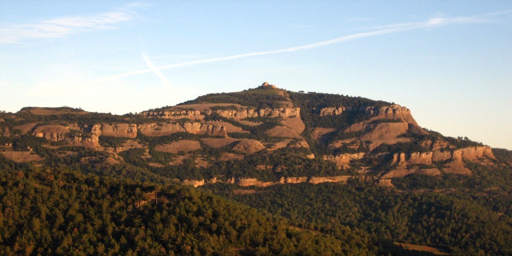 La Mola with the monastery on top | |
| Highest point | |
| Elevation | 1,104 m (3,622 ft) |
| Coordinates | 41°38′29″N 02°01′05″E |
| Geography | |
| Location | Bages, Vallès Occidental, Catalonia |
| Parent range | Catalan Pre-Coastal Range |
| Geology | |
| Mountain type | Conglomerate |
| Climbing | |
| First ascent | Unknown |
| Easiest route | Camí dels Monjos from Sant Cugat del Vallès |
See also
- Mountains of Catalonia
- Catalan symbols
References
- "Mapa Topogràfic de Catalunya". Institut Cartogràfic de Catalunya. Retrieved 9 September 2010.
External links
- Parc natural de Sant Llorenç del Munt i l'Obac
- Rev. Anton Vergés i Mirassó «Sant Llorens del Munt: son passat, son present y venider», Barcelona 1871
This article about a location in Catalonia is a stub. You can help Wikipedia by expanding it. |
На других языках
- [en] Sant Llorenç del Munt
[es] Sant Llorenç del Munt
San Lorenzo del Munt (en catalán y oficialmente Sant Llorenç del Munt) es un macizo situado entre las comarcas del Vallés Occidental y Bages (Cataluña, España). Sus principales cumbres son el Montcau (1056,8 m) y la Mola (1104 m), donde se encuentra el Monasterio de Sant Llorenç del Munt. Juntamente con la sierra del Obac, conforma el parque natural de Sant Llorenç del Munt i l'Obac, gestionado por la Diputación de Barcelona.Текст в блоке "Читать" взят с сайта "Википедия" и доступен по лицензии Creative Commons Attribution-ShareAlike; в отдельных случаях могут действовать дополнительные условия.
Другой контент может иметь иную лицензию. Перед использованием материалов сайта WikiSort.org внимательно изучите правила лицензирования конкретных элементов наполнения сайта.
Другой контент может иметь иную лицензию. Перед использованием материалов сайта WikiSort.org внимательно изучите правила лицензирования конкретных элементов наполнения сайта.
2019-2025
WikiSort.org - проект по пересортировке и дополнению контента Википедии
WikiSort.org - проект по пересортировке и дополнению контента Википедии