geo.wikisort.org - Mountains
Salcantay,[9] Salkantay or Sallqantay (in Quechua) is the highest peak in the Vilcabamba mountain range, part of the Peruvian Andes. It is located in the Cusco Region, about 60 km (40 mi) west-northwest of the city of Cusco. It is the 38th-highest peak in the Andes and the twelfth-highest in Peru. However, as a range highpoint in deeply incised terrain, it is the second most topographically prominent peak in the country, after Huascarán.

| Salcantay | |
|---|---|
 View from the southwest. | |
| Highest point | |
| Elevation | 6,271 m (20,574 ft)[1][2][3][4] or 6,264 m (20,551 ft)[5][6] |
| Prominence | 2,540 metres (8,330 ft)[5][6] |
| Isolation | 151 km (94 mi) |
| Listing | Ultra |
| Coordinates | 13°20′01″S 72°32′40″W |
| Geography | |
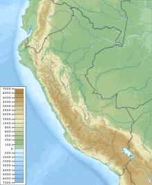 Salcantay Peru | |
| Location | Cusco Region, Peru |
| Parent range | Vilcabamba, Andes[3][4][6][7][8] |
| Climbing | |
| First ascent | August 4, 1952, by Fred D. Ayres, David Michael Jr., W. V. Graham Matthews, George Irving Bell, Claude Kogan, M. Bernard Pierre |
| Easiest route | Northeast ridge: technical glacier/snow/ice climb (French grade AD)[4] |
Salcantay's proximity to Machu Picchu makes trekking around it an alternative to the oversubscribed Inca Trail; this is known as the Salkantay trek.
History

The name Salkantay is from sallqa, a Quechua word meaning wild, uncivilized, savage, or invincible, and was recorded as early as 1583.[10] The name is thus often translated as "Savage Mountain".
Directly to the north of Salkantay lies Machu Picchu, which is at the end of a ridge that extends down from this mountain. Viewed from Machu Picchu's main sundial, the Southern Cross is above Salkantay's summit when at its highest point in the sky during the rainy season. The Incas associated this alignment with concepts of rain and fertility, and considered Salkantay to be one of the principal deities controlling weather and fertility in the region west of Cuzco.[11]
Mountaineering
Salcantay is a large, steep peak with great vertical relief, particularly above the low valleys to the north, which are tributaries of the Amazon River.
The standard route on the mountain is the Northeast ridge. Accessing the route typically involves three days of travel from Cusco. The climb involves about 1,800 m (5,900 ft) of vertical gain, on glaciers, snow, ice, and some rock.[4]
Mountaineering history
Salcantay was first climbed in 1952 by a French-American expedition comprising Fred D. Ayres, David Michael Jr., John C. Oberlin, W. V. Graham Matthews, Austen F. Riggs, George Irving Bell, Claude Kogan, M. Bernard Pierre, and Jean Guillemin. All except Oberlin, Riggs, and Guillemin reached the summit.[12] Two years later Fritz Kasparek fell through a cornice near the summit on the NE ridge.[citation needed]
On June 17, 2013, Nathan Heald (USA), Thomas Ryan (USA), and Luis Crispin (Peru) made the summit at 10:30 am after nine hours of climbing from a high camp at 5,500 m. on the NE ridge. This makes Crispin the first Peruvian climber to summit the mountain. The team took a reading of 6,279 m, S 13° 20.027’, W 72° 32.596’, on a GPS device.[13] On July 31, 2013 a second team led by Nathan Heald (USA), consisting of James Lissy (USA) and Edwin Espinoza Sotelo (Peru) made the summit by the NE ridge. This makes Heald the only person to have summited the mountain twice.[14] Due to glacial retreat, the route is now calculated to be graded D on the French adjectival scale.
This section needs expansion. You can help by adding to it. (May 2008) |
See also
- Padreyoc or Quishuar
- List of mountains in Peru, all peaks above 6,000 metres
References
- This elevation is from a Peruvian military survey, quoted in the American Alpine Journal, 1973
- INEI, Perú: Compendio Estadístico 2005, op. cit.
- Encarta/Spanish, "Cordillera Vilcabamba" and "Salcantay", op. cit.
- Biggar 2005, op. cit.
- Ferranti 2005, "Peru ultra-Prominences", op. cit.
- Peakbagger, "Salcantay, Peru", op. cit.
- INEI, Perú: Compendio Estadístico 2005, op. cit., attaches three peaks including the Salcantay to the Cordillera Vilcanota instead of Vilcabamba, but this was identified as a typo, and all other sources disagreed. Details in the endnotes to article "List of mountains in Peru".
- Rachowiecki 1991, op. cit.
- Peru 1:100 000, Machupicchu (27-q). IGN (Instituto Geográfico Nacional - Perú).
- Rose, Mark (1999-09-01). "Exploring the Inca Heartland". Archaeological Institute of America.
- Reinhard, Johan; Ceruti, Constanza (2005). "Sacred Mountains, Ceremonial Sites, and Human Sacrifice Among the Incas". Archaeoastronomy: The Journal of Astronomy in Culture. 19: 1–43. Archived from the original on 2010-04-12.
- John C. Oberlin and W. V. Graham Matthews, "The First Ascent of Mount Salcantay", American Alpine Journal, 1953, pp. 387-396.
- Archived 2013-11-01 at the Wayback Machine, Diario de la Republica, 27 June 2013
- https://www.youtube.com/watch?v=5GR-mkHbOxE, Barrabes, Revista de Esqui y Montaña, 3 October 2013
Further reading
- Biggar, John (2020). The Andes: A Guide for Climbers and Skiers. Scotland: Andes Publishing. p. 133. ISBN 978-0-9536087-6-8.
- Encarta/Spanish (2007). "Cordillera Vilcabamba". Enciclopedia Microsoft (in Spanish). Archived from the original on 2007-11-23. Retrieved 2007-08-18.
Su máxima elevación es el pico Salcantay o Sarkantay (6.271 m) [...]
- Encarta/Spanish (2007). "Salcantay". Enciclopedia Microsoft (in Spanish). Archived from the original on 2009-06-01. Retrieved 2007-08-18.
[...] constituye una de las principales elevaciones de la cordillera de Vilcabamba, [...] Alcanza una altitud de 6.271 metros.
- Ferranti, Jonathan de (compiler); et al. (2005). "Peru ultra-Prominences". Peaklist.org. Retrieved 2007-08-18.
- Instituto Nacional de Estadística e Informática, Perú (2005). Perú: Compendio Estadístico 2005 (in Spanish). Lima: INEI. p. 22. – Also stored at List of mountains in Peru.
- Peakbagger (2007). "Salcantay, Peru". Peakbagger.com. Retrieved 2007-08-18.
- Rachowiecki, Rob (1991). Peru: a travel survival kit. Hawthorn, Australia: Lonely Planet Publications. p. 206. ISBN 0-86442-095-1.
- Responsible People; et al. (2009). "Salkantay Trek Devastation and Animal Exploitation". Responsiblepeople.org. Retrieved 2019-01-30.
На других языках
[de] Salcantay
Der Salcantay oder Salkantay ist mit einer Höhe von 6264 m der höchste Berg in der Region Cordillera Vilcabamba, einem Teil der peruanischen Anden.- [en] Salcantay
[es] Salcantay
El Salcantay o Salkantay (en quechua, Sallqantay) es un nevado del Perú, ubicado en la Cordillera Vilcabamba, en el distrito de Santa Teresa, provincia de La Convención, Departamento de Cusco. Se eleva a 6264 m s. n. m.[fr] Salcantay
Le Salcantay ou Salkantay ou Sallqantay en quechua est le plus haut sommet de la cordillère de Vilcabamba, une section des Andes péruviennes. Avec une altitude de 6 271 m, il est le 38e sommet le plus haut des Andes et le 12e le plus haut au Pérou.[it] Salcantay
Il Salcantay (Nevado Salcantay) o Salkantay (Nevado Salkantay) è una montagna del Perù alta 6271 metri. È la vetta più alta della Cordillera Vilcabamba, a circa 60 km a nord ovest di Cusco. Si tratta della trentottesima più alta cima delle Ande e la dodicesima del Perù.[ru] Салкантай
Салканта́й (исп. Salcantay, Nevado Salcantay) — самая высокая вершина хребта Кордильера-Вилькабамба, Перуанские Анды. Высота — 6271 м, относительная высота — 2540 м[1]. Считается одним из ультра-пиков Южной Америки. Имеет два пика — Восточный и Западный, практически одинаковые по высоте. Занимает 12-е место по высоте в Перу и 38-е в Андах.Другой контент может иметь иную лицензию. Перед использованием материалов сайта WikiSort.org внимательно изучите правила лицензирования конкретных элементов наполнения сайта.
WikiSort.org - проект по пересортировке и дополнению контента Википедии