geo.wikisort.org - Mountains
The Rothenbachkopf is a mountain, 1,315 metres high, in the High Vosges in France. Only a few metres to the west of the summit runs the Route des Crêtes heading south from the Col de la Schlucht. Several Vosges Club hiking trails run over the top. A few kilometres north of the Rothenbachkopfs the border between Alsace and Lorraine turns and heads southwest.
| Rothenbachkopf | |
|---|---|
 The Rothenbachkopf from the north | |
| Highest point | |
| Elevation | 1,315 m (4,314 ft) |
| Coordinates | 48°00′04″N 6°58′50″E |
| Geography | |
 Rothenbachkopf | |
| Parent range | Vosges |
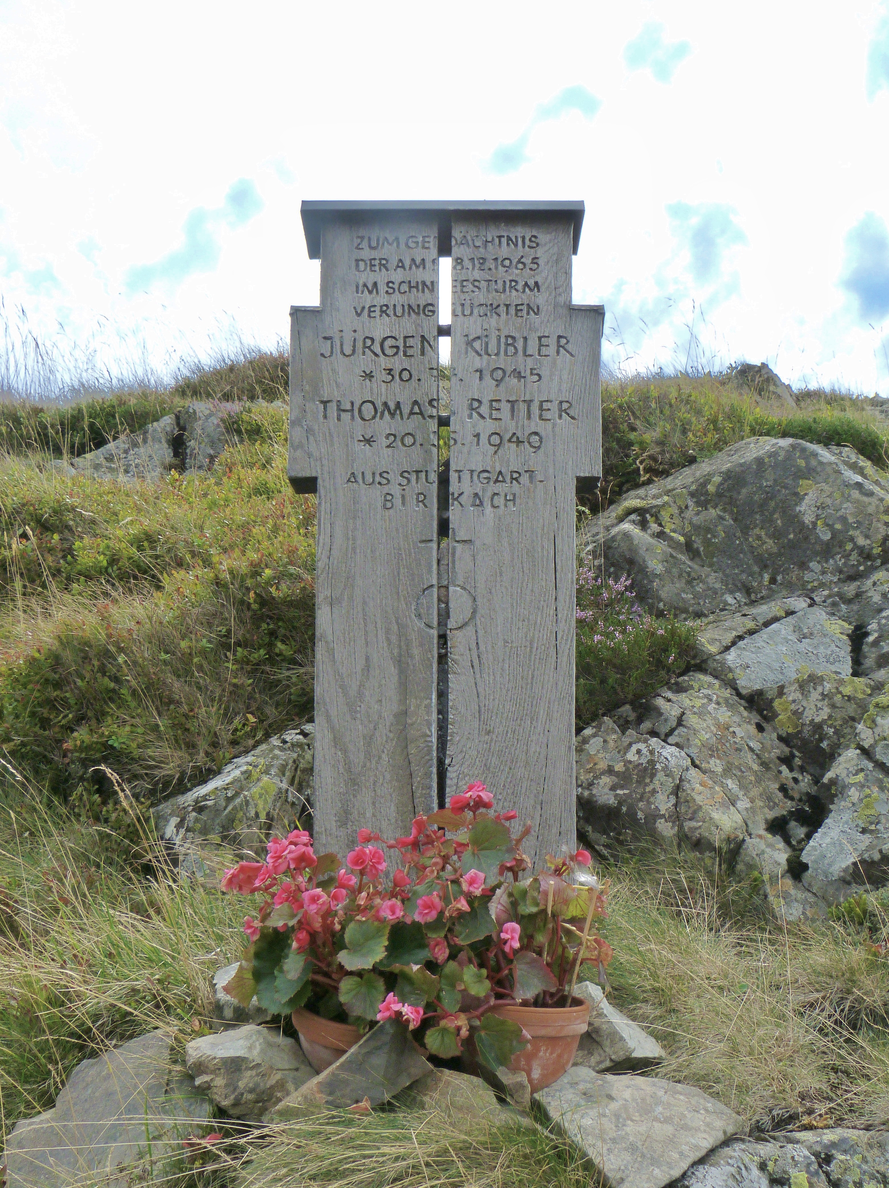
The summit ridge is used as a cross-country ski course for the crossing of the Vosges mountains. Great care is recommended in winter because of the cornices, the possible fog and the violent and icy winds that can occur. On 28 December 1965, two inexperienced young German hikers, became lost in the fog and cold and died on the Rothenbachkopf.[1]
References
Mapping
Cartes IGN 31 (Série verte): St-Dié – Mulhouse – Bâle, 1:100.000, Edition 8, Institut Géographique Nationale, Paris, 1990
External links
На других языках
[de] Rothenbachkopf
Der Rothenbachkopf ist ein 1315 m hoher Berg in den Hochvogesen. Nur wenige Meter westlich des Gipfels verläuft die Route des Crêtes vom Col de la Schlucht nach Süden. Über den Gipfel führen Wanderwege des Vogesenclubs. Wenige km nördlich des Rothenbachkopfs biegt die Grenze zwischen dem Elsass und Lothringen nach SW ab.- [en] Rothenbachkopf
[fr] Rothenbachkopf
Le Rothenbachkopf est un sommet du massif des Vosges situé à cinq kilomètres au sud du Hohneck, et à une altitude de 1 316 m. La crête du Rothenbachkopf, située entre Wildenstein et Mittlach dans le Haut-Rhin (Grand Est), se prolonge jusqu'au Rainkopf au nord, à la limite avec le département des Vosges.Другой контент может иметь иную лицензию. Перед использованием материалов сайта WikiSort.org внимательно изучите правила лицензирования конкретных элементов наполнения сайта.
WikiSort.org - проект по пересортировке и дополнению контента Википедии