geo.wikisort.org - Mountains
The Ras Koh Hills is a range of granite hills forming part of the Sulaiman Mountain Range in the Chagai District in Pakistan's Balochistan province. The word "Ras" means "gateway" and the word "Koh" means "mountain" in Balochi. Ras Koh, therefore, means "Gateway to the Mountains." Pakistan's first nuclear tests were carried out in the Ras Koh Hills on 28 May 1998.
This article needs additional citations for verification. (February 2017) |
| Ras Koh Hills | |
|---|---|
 Ras Koh Hills Balochistan, Pakistan 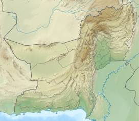 Ras Koh Hills Ras Koh Hills (Balochistan, Pakistan) | |
| Highest point | |
| Coordinates | 28°49′42.71″N 65°11′41.83″E |
| Geography | |
| Location | Balochistan, Pakistan |
Location

The Ras Koh Hills are situated in the Chagai District of Pakistan's Balochistan province and lie to the south of the Chagai Hills and between the higher Sulaiman Mountains to the northeast and the lower Kirthar Mountains to the southwest.
Topography
Plateaus and basins predominate the Ras Koh Hills with an average elevation of 600 metres, but in areas, the hills can reach elevations up to 3,000 metres. The Ras Koh Hills are composed of granite, are carved out by innumerable channels, but the arid climate restricts rain and for the most part leaves these channels dry. Although little water reaches the low-lying basins, numerous alluvial fans are found in the area.[citation needed]
A structural depression separates the Chagai Hills and the Ras Koh Hills, consisting of flood plains and areas covered with thin layers of salt.
Unlike the Toba Kakar Range to the north-east, which has scattered juniper, tamarisk and pistachio trees, the Ras Koh Hills are largely barren and devoid of vegetation. Most of people in the area, therefore, lead a nomadic life, raising camels, sheep and goats.
Climate
The Ras Koh Hills lie in an arid zone, which is outside the monsoon belt. The Ras Koh Hills receive scanty and irregular rainfall (an average of 100 mm (4 inches) annually). The temperature is extreme: very hot in summer and very cold in winter. The average minimum temperature is 2.4 °C (36.3 °F) in January and the average maximum temperature is 42.5 °C (108.5 °F) in July.
Wildlife sanctuary
Ras Koh Wildlife Sanctuary covers an area of 994.98 km2. It was designated in 1962 by the Government of Pakistan.[1]
Nuclear tests
Ras Koh Hills was the site of Pakistan's Chagai-I nuclear tests.[2]
References
- UNEP-WCMC (2022). Protected Area Profile for Ras Koh from the World Database of Protected Areas. Accessed 30 January 2022. https://www.protectedplanet.net/6807
- The Preparatory Commission for the Comprehensive Nuclear-Test-Ban Treaty Organization (CTBTO). 28 May 1998 - Pakistan Nuclear Tests. https://www.ctbto.org/specials/testing-times/28-may-1998-pakistan-nuclear-testings
На других языках
[de] Ras Koh Hills
Die Ras Koh Hills sind eine bis zu 3009 m hohe Bergkette in der pakistanischen Provinz Belutschistan. Dort befindet sich, nordwestlich von Kharan, das Kernwaffentestgelände, wo Pakistan am 28. Mai 1998 seine ersten unterirdischen Nuklearexplosionen durchführte. Das Wort „Ras“ in Belutschi bedeutet „Tor“ und „Koh“ bedeutet Berg, so dass Ras Koh Tor zu den Bergen bedeutet.[1]- [en] Ras Koh Hills
Другой контент может иметь иную лицензию. Перед использованием материалов сайта WikiSort.org внимательно изучите правила лицензирования конкретных элементов наполнения сайта.
WikiSort.org - проект по пересортировке и дополнению контента Википедии