geo.wikisort.org - Mountains
The Rakaposhi-Haramosh Mountains are a subrange of the Karakoram range. They are located in the Bagrot Valley Gilgit and Nagar Districts, in the Gilgit-Baltistan of Pakistan.
| Rakaposhi-Haramosh Mountains | |
|---|---|
 Rakaposhi-Haramosh Mountains Location of the Rakaposhi-Haramosh Mountains within the greater Karakoram region 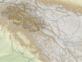 Rakaposhi-Haramosh Mountains Rakaposhi-Haramosh Mountains (Gilgit Baltistan) | |
| Highest point | |
| Peak | Rakaposhi |
| Elevation | 7,788 metres (25,551 ft) |
| Coordinates | 36°2′N 74°44′E |
| Geography | |
| Countries | Pakistan |
| Regions | Gilgit-Baltistan |
| Parent range | Karakoram |
 | |
Geography
Rakaposhi-Haramosh Mountains are bordered by Barpu and the Chogo Lungma Glaciers in the north, by the Shigar River in the east, by the Gilgit and Indus Rivers in the south, and by the Hunza River in the west.[1]
The two namesake peaks, Rakaposhi (7,788 m/25,551 ft) and Haramosh (7,409 m/24,308 ft), are among the largest in the world in terms of rise above local terrain, due to their positions near very low valleys. Rakaposhi rises dramatically[2] above a bend in the Hunza River, forming the western anchor of the range, while Haramosh stands on the north side of the Indus River, in the south-central portion of the range.[1]
Selected peaks
| Mountain | Height (m) | Height (ft) | Coordinates | Prominence (m) | Parent mountain | First ascent | Ascents (attempts) |
|---|---|---|---|---|---|---|---|
| Rakaposhi | 7,788 | 25,551 | 36°08′33″N 74°29′21″E | 2,818 | K2 | 1958 | 8 (13) |
| Malubiting | 7,458 | 24,469 | 36°00′06″N 74°52′33″E | 2,193 | Rakaposhi | 1971 | 2 (6) |
| Haramosh | 7,409 | 24,308 | 35°50′24″N 74°53′51″E | 2,277 | Malubiting | 1958 | 4 (3) |
| Diran | 7,266 | 23,839 | 36°07′19″N 74°39′40″E | 1,325 | Malubiting | 1968 | 12 (8) |
See also
- List of highest mountains
References
- Jerzy Wala, Orographical Sketch Map of the Karakoram, Swiss Foundation for Alpine Research, Zurich, 1990.
- Andy Fanshawe and Stephen Venables, Himalaya Alpine-Style, Hodder and Stoughton, 1995.
This Gilgit-Baltistan location article is a stub. You can help Wikipedia by expanding it. |
На других языках
[de] Rakaposhi-Haramosh-Berge
Die Rakaposhi-Haramosh-Berge sind ein Gebirgszug im Karakorum in der pakistanischen Region Gilgit-Baltistan. Sie gehören nicht zum Hauptkamm des Karakorums – den Muztagh-Ketten –, sondern zählen zum sogenannten kleinen Karakorum. Nordwestlicher Eckpfeiler ist der 7788 m hohe Rakaposhi, gleichzeitig der höchste Berg des Gebirgszugs. Nach Osten folgen Diran und Malubiting, südlich davon liegt der Haramosh.- [en] Rakaposhi-Haramosh Mountains
[fr] Monts Rakaposhi-Haramosh
Les monts Rakaposhi-Haramosh sont une chaîne de montagnes située dans le massif du Karakoram, dans le district de Gilgit, dans le territoire autonome du Gilgit-Baltistan, au Nord du Pakistan. Ils sont entourés par le glacier Barpu et le glacier Chogo Lungma au nord, par la rivière Shigar à l'est, par la rivière Gilgit et le fleuve Indus au sud et par la Hunza à l'ouest[1].Другой контент может иметь иную лицензию. Перед использованием материалов сайта WikiSort.org внимательно изучите правила лицензирования конкретных элементов наполнения сайта.
WikiSort.org - проект по пересортировке и дополнению контента Википедии