geo.wikisort.org - Mountains
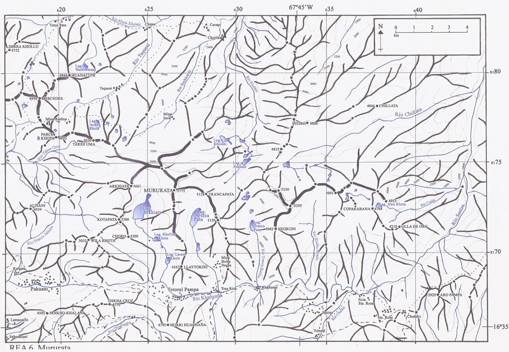
Qutapata (Aymara quta lake, pata step,[2] also spelled Kkotapata, Kotapata) is a 5,300-metre-high (17,388 ft) mountain in the Cordillera Real in the Bolivian Andes. It is situated in the La Paz Department, Sud Yungas Province, Irupana Municipality, near the border with the Murillo Province, Palca Municipality. Qutapata lies south-west of the mountain Mururata and north-east of the mountain Wila Quta.[1][3]
| Qutapata | |
|---|---|
 Qutapata Bolivia La Paz Department | |
| Highest point | |
| Elevation | 5,300 m (17,400 ft)[1] |
| Coordinates | 16°32′7″S 67°50′45″W |
| Geography | |
| Location | Bolivia La Paz Department |
| Parent range | Andes, Cordillera Real |
References
- "Cordillera Real". huayna-potosi.com. Retrieved August 25, 2014.
- Radio San Gabriel, "Instituto Radiofonico de Promoción Aymara" (IRPA) 1993, Republicado por Instituto de las Lenguas y Literaturas Andinas-Amazónicas (ILLLA-A) 2011, Transcripción del Vocabulario de la Lengua Aymara, P. Ludovico Bertonio 1612 (Spanish-Aymara-Aymara-Spanish dictionary)
- "Irupana". INE, Bolivia. Archived from the original on March 26, 2016. Retrieved August 25, 2014.
This La Paz Department geography article is a stub. You can help Wikipedia by expanding it. |
Текст в блоке "Читать" взят с сайта "Википедия" и доступен по лицензии Creative Commons Attribution-ShareAlike; в отдельных случаях могут действовать дополнительные условия.
Другой контент может иметь иную лицензию. Перед использованием материалов сайта WikiSort.org внимательно изучите правила лицензирования конкретных элементов наполнения сайта.
Другой контент может иметь иную лицензию. Перед использованием материалов сайта WikiSort.org внимательно изучите правила лицензирования конкретных элементов наполнения сайта.
2019-2026
WikiSort.org - проект по пересортировке и дополнению контента Википедии
WikiSort.org - проект по пересортировке и дополнению контента Википедии