geo.wikisort.org - Mountains
Proffit Mountain is a mountain located in Reynolds County, Missouri, the highest in the county. It is the location of the upper reservoir for the Taum Sauk Hydroelectric Power Station.
| Proffit Mountain | |
|---|---|
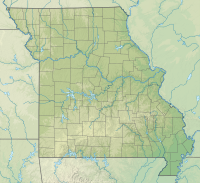 Proffit Mountain Reynolds County, Missouri | |
| Highest point | |
| Elevation | 1,700 ft (518 m)[1] |
| Prominence | 361 ft (110 m)[1] |
| Coordinates | 37°34′8″N 90°46′53″W[2] |
| Geography | |
| Location | Reynolds County, Missouri |
| Parent range | St. Francois Mountains |
See also
References
- "Proffit Mountain, Missouri". Peakbagger.com. Retrieved 2020-10-10.
- "Proffit Mountain". Geographic Names Information System. United States Geological Survey. Retrieved 2020-10-10.
Текст в блоке "Читать" взят с сайта "Википедия" и доступен по лицензии Creative Commons Attribution-ShareAlike; в отдельных случаях могут действовать дополнительные условия.
Другой контент может иметь иную лицензию. Перед использованием материалов сайта WikiSort.org внимательно изучите правила лицензирования конкретных элементов наполнения сайта.
Другой контент может иметь иную лицензию. Перед использованием материалов сайта WikiSort.org внимательно изучите правила лицензирования конкретных элементов наполнения сайта.
2019-2026
WikiSort.org - проект по пересортировке и дополнению контента Википедии
WikiSort.org - проект по пересортировке и дополнению контента Википедии