geo.wikisort.org - Mountains
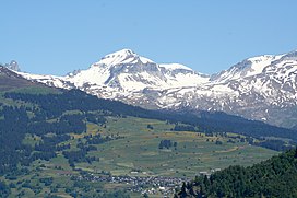
Piz Segnas is a mountain in the Glarus Alps, located on the border between the cantons of Glarus and Graubünden. Piz Sardona is on the same ridge to the north, from where the Trinserhorn or Piz Dolf lies to the southeast. The Tschingelhoerner with the famous Martinsloch (hole of St.Martin) lies to the west, with the Pass dil Segnas between the two mountains.[2][3]
| Piz Segnas | |
|---|---|
 Piz Segnas | |
| Highest point | |
| Elevation | 3,099 m (10,167 ft) |
| Prominence | 607 m (1,991 ft)[1] |
| Parent peak | Ringelspitz |
| Listing | Alpine mountains above 3000 m |
| Coordinates | 46°54′28.5″N 9°14′22.5″E |
| Geography | |
| Location | Glarus/Graubünden, Switzerland |
| Parent range | Glarus Alps |
| Climbing | |
| Easiest route | To go up from the Pass dil Segnas along the ridge to the summit is the easiest route, only for experienced hikers though. |
The mountain lies in the municipalities of Flims, in the canton of Graubünden, and Glarus Süd, in the canton of Glarus. The nearest settlements are the villages of Flims, to the south, and Elm, to the west. A path crosses the Pass dil Segnas between the two villages. The easiest access to the area is an aerial cableway to Fil de Cassons (not active since 2015)from Flims or the hike to this ridge lying southeast of Piz Segnas.[2][3]
On 4 August 2018, a Junkers Ju 52 aircraft, operating a sightseeing flight, crashed into the western flank of the mountain, killing all 20 persons aboard.[4]
References
- Retrieved from the Swisstopo topographic maps. The key col is the Trinser Furgga (2,492 m).
- "Hiking Switzerland Graubünden Fil de Cassons". Graubünden Tourism. Archived from the original on 2011-07-06. Retrieved 9 February 2011.
- map.geo.admin.ch (Map). Swiss Confederation. Retrieved 8 August 2018.
- "Switzerland crash: Twenty dead in WW2 plane crash". BBC News. BBC. 5 August 2018. Retrieved 5 August 2018.
External links
На других языках
[de] Piz Segnas
Der Piz Segnas ist ein Berg in der Schweiz. Der Gipfelaufbau besteht – ebenso wie der des benachbarten Piz Sardona – aus den sehr alten Gesteinen der Verrucano-Decke, die bei Auffaltung der Alpen über die viel jüngeren Flyschschichten geschoben wurde, die den Sockel des Berges bilden. Im ganzen Gebiet sieht man an den Bergflanken die durch diesen Vorgang entstandene markante Überschiebungslinie der Glarner Hauptüberschiebung, bekannt auch als Tektonikarena Sardona, sie ist unter diesem Namen seit dem Jahr 2008 als UNESCO-Weltnaturerbe gelistet.- [en] Piz Segnas
[fr] Piz Segnas
Le Piz Segnas est un sommet qui s'élève à 3 099 m d'altitude dans les Alpes glaronaises, en Suisse orientale.[it] Piz Segnas
Il Piz Segnas (3.099 m s.l.m.) è una montagna delle Alpi Glaronesi. Si trova tra il Canton Glarona ed il Canton Grigioni in Svizzera.Другой контент может иметь иную лицензию. Перед использованием материалов сайта WikiSort.org внимательно изучите правила лицензирования конкретных элементов наполнения сайта.
WikiSort.org - проект по пересортировке и дополнению контента Википедии
