geo.wikisort.org - Mountains
The Piton des Neiges (Snow Peak) is a massive 3,069 m (10,069 ft) shield volcano on Réunion, one of the French volcanic islands in the Mascarene Archipelago in the southwestern Indian Ocean. It is located about 800 kilometres (500 mi) east of Madagascar. Piton des Neiges is the highest point on Réunion and is considered to be the highest point in the Indian Ocean. The volcano was formed by the Réunion hotspot and emerged from the sea about two million years ago. Now deeply eroded, the volcano has been inactive for 20,000 years and is surrounded by three massive crater valleys, the Cirques. Piton des Neiges forms the northwestern two thirds of Réunion, with the very active Piton de la Fournaise comprising the rest. As its name suggests, snow is occasionally seen on its summit in winter.
This article needs additional citations for verification. (May 2022) |
| Piton des Neiges | |
|---|---|
| Snow Peak | |
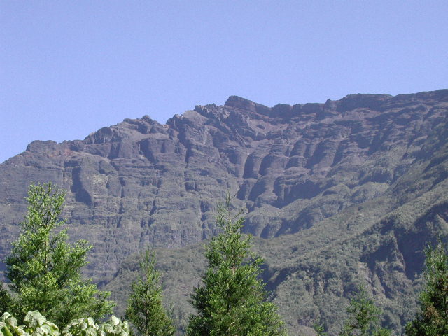 Piton des Neiges, October 2003 | |
| Highest point | |
| Elevation | 3,070 m (10,070 ft)[1] |
| Prominence | 3,070 m (10,070 ft)[1] Ranked 82nd |
| Isolation | 2,767 km (1,719 mi) |
| Listing | Ultra |
| Coordinates | 21°05′54″S 55°28′51″E |
| Naming | |
| English translation | Snow Peak |
| Language of name | French |
| Geography | |
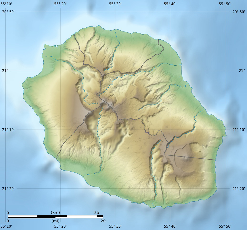 Piton des Neiges Réunion, Indian Ocean | |
| Geology | |
| Age of rock | Pliocene |
| Mountain type | Shield volcano |
| Last eruption | 20,000 years ago |
The volcanic island is considered to be about three million years old (Pliocene); the other two islands in the archipelago, Mauritius and Rodrigues, are 7.8 million (Miocene) and 11⁄2 million (Pleistocene) years old, respectively. The island possesses a high endemism of flowering plants (about 225); this has justified the creation of a biological reserve on the lower slopes of the Piton des Neiges.

Tourism
This section does not cite any sources. (May 2022) |

There are three medium-difficulty tracks leading up to the peak, one from the Cirque de Salazie, one from the Cirque de Cilaos and one from La Plaine des Cafres. They meet at a staffed mountain hut about an hour's walk below the peak at la Caverne Dufour. Walkers often arrive there after a long day trek up the mountain, and start out very early the next day to watch the sunrise from the summit. The hike can be done in a long one-day 10- to 12-hour hike, but it is often preferable to make it a two-day hike - many hikers like to get up early on the second day and make the (easy) remaining ascent with torches, so as to see the sunrise from the mountaintop. The mountain hut offers heated indoor lodging, outdoor tent lodging, and meals. It is best to make reservations.
The hike starting from Cilaos is about 6.5 hours up and 4 hours down. To reach the start of the hike, drive through Cilaos toward la Mare à St Joseph. About 3 km (1.9 mi) past Cilaos, you will see a sign and some parking on both sides of the street. You may also leave your car downtown and follow the road to the trail head (sometimes there is no parking at the trail head). The hike is very steep (a climb of 1700m or 5,577 ft from trail head, almost 2000m or 6,562 ft from downtown), and one should be cautious if the trail is wet. The trail is well marked.
The hike starting from la Plaine des Cafres is about 8 hours up and 5 hours down with a change in elevation of 1700 m (5,577 ft). To access the hike, follow RN3 past Le Tampon, all the way to La Plaine des Cafres and Bourg Murat. 2.5 km (1.6 mi) after Bourg Murat, take a left on the GR R2 road toward Savane Mare à Boue, follow for 2 km (1.2 mi) and park at the trail head. The trail is well marked.


See also
- List of volcanoes in Réunion
- List of islands by highest point
- List of Ultras of Africa
- Piton des Neiges – Gros Morne Important Bird Area
References
- "Africa Ultra-Prominences" Peaklist.org. Retrieved 2011-11-19. Note: Some sources give an elevation of 3,071 m for this peak.
External links
| Wikimedia Commons has media related to Piton des Neiges. |
Authority control | |
|---|---|
| General |
|
| National libraries | |
| Other |
|
На других языках
[de] Piton des Neiges
Der Piton des Neiges (frz. ‚Schneegipfel‘) ist mit 3070 m der höchste Berg des französischen Übersee-Départements La Réunion und des Indischen Ozeans. Der Gipfel ist schneelos. An wenigen Tagen des Jahres ist er von Raureif überzogen, ganz selten mit etwas Schnee bedeckt. Vor etwa 5 Millionen Jahren bildete sich durch einen Hot-Spot auf dem Grund des Indischen Ozeans ein Vulkan. Mit dem Aufsteigen des Piton des Neiges bildete sich vor etwa drei Millionen Jahren die Insel La Réunion. Der Vulkan erhebt sich mehr als 7000 m über den Meeresgrund und hat an seiner Basis einen Umfang von 800 km. Damit ist er einer der größten Vulkane der Erde. Es wird vermutet, dass der Piton des Neiges einmal eine Höhe von 4.300 m hatte. Seine heutige Höhe hat er durch strombolianische Ausbrüche, Explosionen und intensive Erosion erhalten. Im Gegensatz zum deutlich jüngeren, noch aktiven Piton de la Fournaise ist er bereits vor ungefähr 12.000 Jahren erloschen.- [en] Piton des Neiges
[fr] Piton des Neiges
Le piton des Neiges est le point culminant de l'île de La Réunion (France), à 3 070 mètres d'altitude. Il est parfois considéré comme le point culminant de l'océan Indien[2], bien que cette affirmation soit discutable puisque des volcans de Sumatra, Java, Bali et Lombok sont plus élevés.[it] Piton des Neiges
Il Piton des Neiges è un vulcano nonché la cima più elevata dell'isola francese della Riunione. È la 14^ montagna al mondo in termini di isolamento topografico.[1][ru] Питон-де-Неж
Питон-де-Неж (фр. Piton des Neiges) — потухший[2] вулкан на острове Реюньон.Другой контент может иметь иную лицензию. Перед использованием материалов сайта WikiSort.org внимательно изучите правила лицензирования конкретных элементов наполнения сайта.
WikiSort.org - проект по пересортировке и дополнению контента Википедии