geo.wikisort.org - Mountains
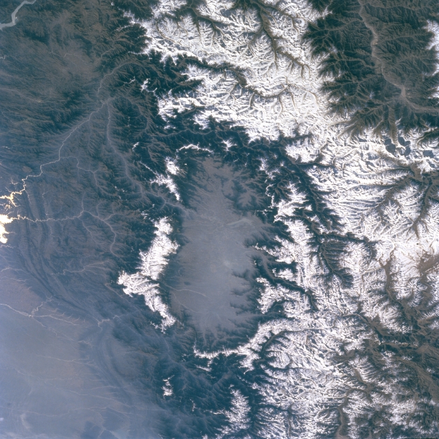
The Pir Panjal Range (Kashmiri: Pīr Pantsāl) is a group of mountains in the Lesser Himalayan region, running from east-southeast (ESE) to west-northwest (WNW) across the Indian territories of Himachal Pradesh and Jammu and Kashmir and then Pakistan's Azad Kashmir and Punjab. The average elevation varies from 1,400 m (4,600 ft) to 4,100 m (13,500 ft).[1] The Himalayas show a gradual elevation towards the Dhauladhar and Pir Panjal ranges. Pir Panjal is the largest range of the Lesser Himalayas. Near the bank of the Sutlej River, it dissociates itself from the Himalayas and forms a divide between the Beas and Ravi rivers on one side and the Chenab on the other. The renowned Galyat mountains are also located in this range.
This article needs additional citations for verification. (July 2011) |

Etymology
The Pir Panjal range is named after the Pir Panjal Pass, whose original name as recorded by Srivara, is Panchaladeva (IAST: Pāñcāladeva, meaning the deity of Panchala). Panchala is a country mentioned in the Mahabharata in the northwest Uttar Pradesh. However, there are also traditions that place the Mahabharata regions in western Punjab and southern Kashmir. Scholar Dineshchandra Sircar has analysed the geography described in the Shakti‐sangama Tantra, where this is indeed the case.[2] Scholar M. A. Stein believes that the concept of deity must have been translated into that of a Pir after the region was Islamised.[3]
Peaks of the range
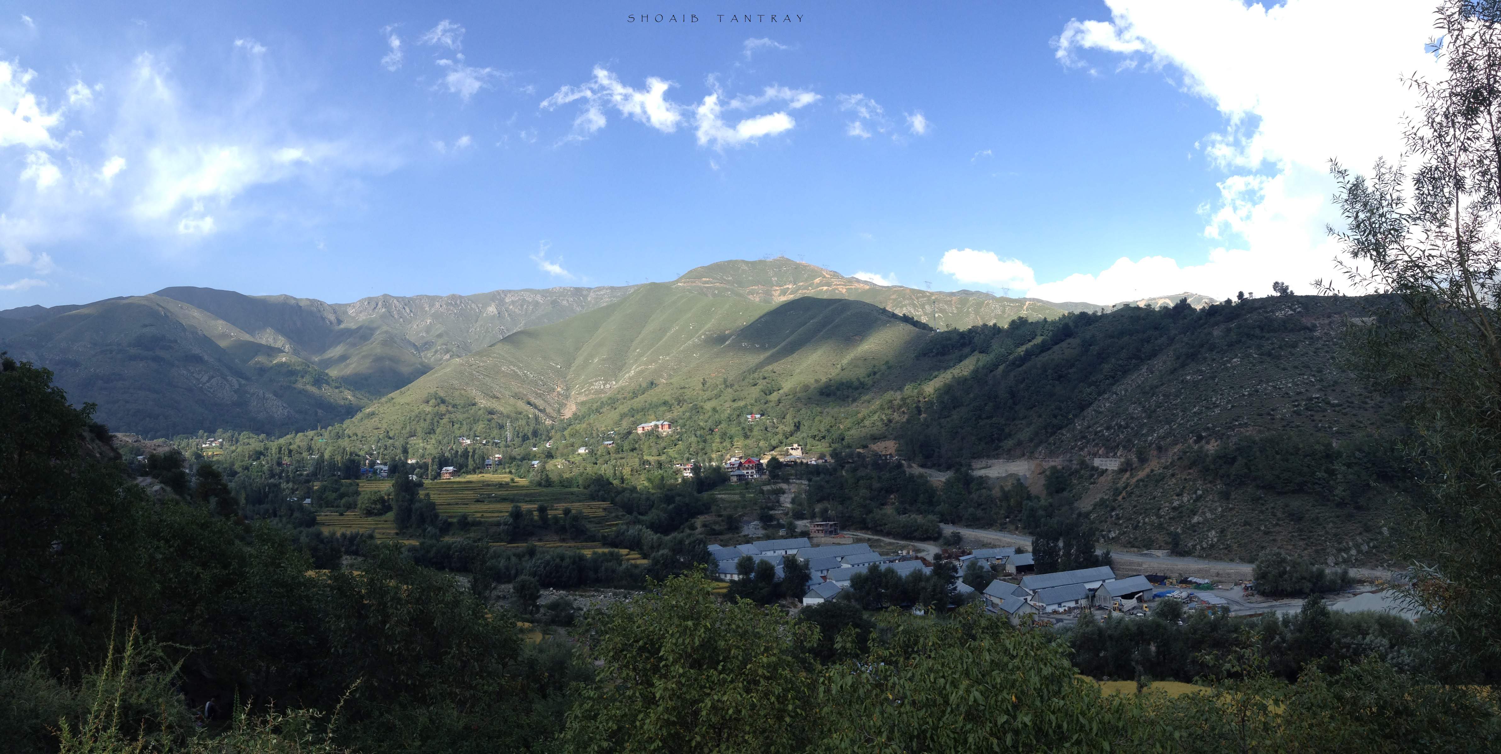
Deo Tibba (6,001 m (19,688 ft)) and Indrasan (6,221 m (20,410 ft)) are two important peaks at the eastern end of the mountain range. They can be approached from both the Parvati-Beas Valley (Kulu District), Upper Belt of Chamba Himachal Pradesh and the Chandra (Upper Chenab) Valley (Lahaul and Spiti District) in Himachal Pradesh. The hill station of Gulmarg in Kashmir lies in this range.[4]
Passes
Haji Pir Pass (altitude 2,637 m (8,652 ft)) on the western Pir Panjal range on the road between Poonch and Uri in Indian-administered Kashmir. Despite taking the pass twice in military operations (in 1948 and 1965), India left the pass under Pakistani control.
The Pir Panjal Pass (also called Peer Ki Gali) connects the Kashmir valley with Rajouri and Poonch via the Mughal Road. It is the highest point of the Mughal Road at 3,490 m (11,450 ft) and lies to the southwest of the Kashmir Valley.[5] The nearest town to the pass in the Kashmir valley is shopian.
The Banihal pass (2,832 m (9,291 ft)) lies at the head of the Jhelum River at the southern end of the Kashmir Valley. Banihal and Qazigund lie on either side of the pass.
The Sinthan pass connects Jammu and Kashmir with Kishtwar.
Rohtang La (altitude 3,978 m (13,051 ft)) is a mountain pass on the eastern Pir Panjal range connecting Manali in the Kullu Valley to Keylong in the Lahaul Valley.
Tunnels
Jawahar Tunnel
The Jawahar Tunnel is a 2.5 km (1.6 mi) long tunnel through Pir Panjal mountain under the Banihal pass connects Banihal with Qazigund on the other side of the mountain. The Jawahar Tunnel was named after the first Prime Minister of India was constructed in the early 1950s and commissioned in December 1956 to ensure snow-free passage throughout the year. It is at elevation of about 2,100 m (6,900 ft). It was designed for 150 vehicles per day but now used by more than 7,000 vehicles per day.[6] Therefore, a new wider and longer tunnel has been planned at a lower elevation.
Banihal Qazigund Road Tunnel
Construction of a new 8.45 km (5.25 mi) long twin-tube Banihal Qazigund Road Tunnel started in 2011 and was commissionedin 2021. The new tunnel is at a lower elevation than the existing Jawahar tunnel and has reduced the road distance between Banihal and Qazigund by 16 km (9.9 mi). It is also less prone to snow avalanches as it is at a lower elevation.[7]
Atal Tunnel
The Atal Tunnel has been built under the Rohtang Pass in the eastern Pir Panjal range of the Himalayas on the Leh-Manali Highway. With 8.8 km (5.5 mi) length, the tunnel is the second longest road tunnel in India and has reduced the distance between Manali and Keylong by about 60 km (37 mi). The tunnel is at 3,100 metres (10,171 ft) elevation whereas the Rohtang pass is at 3,978 metres (13,051 ft) elevation. Lying on the Manali-Leh axis, this is one of the two routes to Ladakh.
Banihal Railway Tunnel
The Pir Panjal Railway Tunnel, an 11.215 kilometres (6.969 mi) railway tunnel, passes through the Pir Panjal Range in Jammu and Kashmir. It connects Quazigund and Banihal and is a part of the Udhampur-Srinagar-Baramulla railway project. The tunnel was commissioned on 26 June 2013 for regular service. It is India's longest railway tunnel.[8]
See also
- Ganga Choti
- Banni Mata Temple
References
- "Home ministry chalks out plan to settle Kashmiri Pandits".
- Sircar, Dineschandra (1971), Studies in the Geography of Ancient and Medieval India, Motilal Banarsidass, pp. 204–205, ISBN 978-81-208-0690-0
- Stein, M. A. (1900), Kalhana's Rajatarangini: A chronicle of the kings of Kasmir, Volume 2, Westminster: Archibald Constable and Co., pp. 397–398, ISBN 978-81-208-0370-1
- Pir Panjal Range (mountain system, Asia) – Britannica Online Encyclopedia
- Kapadia, Harish (1999), Across Peaks & Passes in Ladakh, Zanskar & East Karakoram, Indus Publishing, p. 23, ISBN 978-81-7387-100-9
- Beacon Light in the Tunnel Archived 1 September 2012 at the Wayback Machine
- "Passages of employment to Srinagar's denizens". The Hindu.
- "India's longest railway tunnel unveiled in Jammu & Kashmir". The Times of India. 14 October 2011. Archived from the original on 29 June 2013.
Further reading
- Jreat, Manoj (2004), Tourism in Himachal Pradesh, Indus Publishing, pp. 15–, ISBN 978-81-7387-157-3
- Minhas, Poonam (1998), Traditional Trade & Trading Centres in Himachal Pradesh: With Trade-routes and Trading Communities, Indus Publishing, pp. 28–, ISBN 978-81-7387-080-4
На других языках
[de] Pir Panjal
Der Pir Panjal ist eine Berggruppe im Vorderen Himalaya.- [en] Pir Panjal Range
[es] Cordillera de Pir Panjal
La cordillera de Pir Panjal (cachemir: Pīr Pantsāl), también llamada Panchaladeva en las escrituras hindúes, es un grupo de montañas en la región del Himalaya Menor, que se extiende de este-sudeste (ESE) a oeste-noroeste (WNW) a través del estado indio de Himachal Pradesh, el Territorio de la Unión de Jammu y Cachemira administrado por la India y el territorio administrado por Pakistán de Azad Cachemira, donde la elevación media varía de 1.400 m a 4.100 m.[1] El Himalaya muestra una elevación gradual hacia las cordilleras de Dhauladhar y Pir Panjal. Pir Panjal es la mayor cordillera del Himalaya menor. Cerca de la orilla del río Sutlej, se disocia del Himalaya y forma una división entre los ríos Beas y Ravi en un lado y el Chenab en el otro. Las famosas montañas Galyat también se encuentran en esta cordillera. La región está conectada con el Valle de Cachemira a través de la carretera Mughal y solía ser la conexión histórica de Cachemira con la India.[fr] Pir Panjal
La chaîne Pir Panjal, en ourdou پیر پنجال, en pendjabi ਪੀਰ ਪੰਜਾਲ, est un massif de montagnes d'Asie situé en Inde et au Pakistan et faisant partie de l'Himalaya. Il entoure intégralement la vallée du Cachemire et culmine à 6 221 mètres d'altitude à l'Indrasan.[it] Monti Pir Panjal
I monti Pir Panjal sono una catena montuosa situata nella parte settentrionale del subcontinente indiano. Appartengono al gruppo dell'Himalaya occidentale (o del Punjab), la propaggine più a ovest del vasto sistema himalayano.[ru] Пир-Панджал
Хребет Пир-Панджал — горная цепь Малых Гималаев, тянущихся с востока-юга-востока на запад-северо-запад, пересекая границу Химачал-Прадеш и Джамму и Кашмир в Индии, а также пакистанский Гилгит-Балтистан. Восточная часть хребта является водоразделом, отделяющим бассейн реки Чинаб (Чандрабхага) от бассейна рек Беас и Рави.Другой контент может иметь иную лицензию. Перед использованием материалов сайта WikiSort.org внимательно изучите правила лицензирования конкретных элементов наполнения сайта.
WikiSort.org - проект по пересортировке и дополнению контента Википедии