geo.wikisort.org - Mountains
The Pic de Ger is a French Pyrenean summit, culminating at 2,613 m (8,573 ft), located in the Ossau Valley in the Béarn province.
This article does not cite any sources. (June 2014) |
| Pic de Ger | |
|---|---|
 Vue depuis les coteaux de Cuqueron | |
| Highest point | |
| Elevation | 2,613 m (8,573 ft) |
| Coordinates | 42°56′12″N 0°21′15″E |
| Geography | |
 Pic de Ger Pyrenees | |
| Location | Pyrénées-Atlantiques, Aquitaine, France |
| Parent range | Pyrénées |

Toponymy
The name ger means "mountain meadows" in Gascon.
Topography
It lies between the Col d'Aubisque and the Pic du Midi d'Ossau.
Access
From Laruns, or further up from Eaux-Bonnes or Gourette.
Legend of Clara "la Dame au Châle"
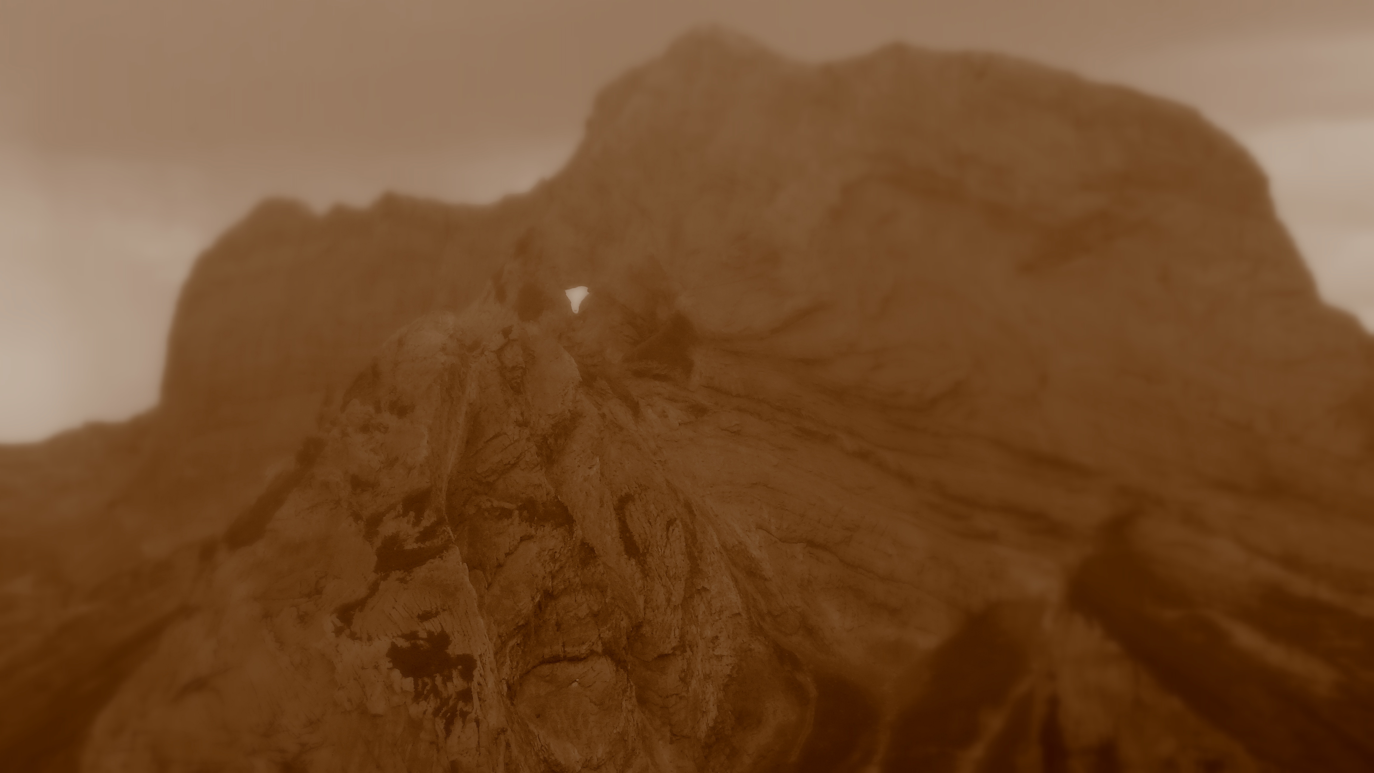
It is told in the Ger and in the Col d'Aubisque, that a very old woman named Clara was taken by surprise above 2,000 m (6,600 ft) by the cold and snowy weather, only wearing a thick shawl with a walking stick. She was surprised by a bear, also in despair. Awestruck, she threw the baton so hard that it pierced the Pic de Ger at around 2,500 m (8,200 ft) high. The frightened bear fled. This moment of local history, surely inspired by an unsourced true tale, is still carved in the rock. In fact, under the summit of the Pic de Ger, the hole still exists, while at the bottom the face of the woman with her shawl and chapped lips.
На других языках
- [en] Pic de Ger
[fr] Pic de Ger
Le pic de Ger est un sommet pyrénéen de la vallée d'Ossau dans le département des Pyrénées-Atlantiques.Другой контент может иметь иную лицензию. Перед использованием материалов сайта WikiSort.org внимательно изучите правила лицензирования конкретных элементов наполнения сайта.
WikiSort.org - проект по пересортировке и дополнению контента Википедии