geo.wikisort.org - Mountains
Phnom Tumpor (Khmer: ភ្នំទំព័រ; Tumpor Mountain) is a mountain in Pursat Province of western Cambodia. There is a village nearby named Tumpor that lies on the Stung Pouthisat River.[3] The mountain is part of the Cardamom Range and has an elevation of 1,551 metres (5,089 ft).[4]
| Phnom Tumpor | |
|---|---|
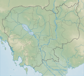 Phnom Tumpor Location of Phnom Tumpor in Cambodia | |
| Highest point | |
| Elevation | 1,551 m (5,089 ft)[1] |
| Coordinates | 12°22′00″N 103°04′00″E[2] |
| Geography | |
| Location | Pursat Province, Cambodia |
| Parent range | Cardamom Mountains |
References
- Small carnivore records from the Cardamom Mountains - Philautus cardamonus
- Phnom Tumpor - Cambodia
- DK Travel Guides (1 June 2011). DK Eyewitness Travel Guide: Cambodia & Laos. Dorling Kindersley Limited. p. 88. ISBN 978-1-4053-4985-7.
- Naron, Hang Chuon (1 February 2012). Cambodian Economy: Charting the Course of a Brighter Future. Institute of Southeast Asian Studies. p. 15. ISBN 978-981-4311-60-1. Retrieved 1 January 2013.
This Cambodian location article is a stub. You can help Wikipedia by expanding it. |
Текст в блоке "Читать" взят с сайта "Википедия" и доступен по лицензии Creative Commons Attribution-ShareAlike; в отдельных случаях могут действовать дополнительные условия.
Другой контент может иметь иную лицензию. Перед использованием материалов сайта WikiSort.org внимательно изучите правила лицензирования конкретных элементов наполнения сайта.
Другой контент может иметь иную лицензию. Перед использованием материалов сайта WikiSort.org внимательно изучите правила лицензирования конкретных элементов наполнения сайта.
2019-2026
WikiSort.org - проект по пересортировке и дополнению контента Википедии
WikiSort.org - проект по пересортировке и дополнению контента Википедии