geo.wikisort.org - Mountains
Peñas del Chache is the highest altitude of the island of Lanzarote, Canary Islands, Spain, with a height of 672 meters above sea level. It is located in the north of the island, in the municipality of Haría.
| Peñas del Chache | |
|---|---|
 Las Peñas del Chache, with the facilities of the Air Force Barracks | |
| Highest point | |
| Elevation | 672 m (2,205 ft)[1] |
| Prominence | 672 m (2,205 ft)[1] |
| Coordinates | 29°07′10″N 13°31′15″W[1] |
| Geography | |
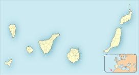 Peñas del Chache Location in the Canary Islands, on the island of Lanzarote | |
| Location | Haría, Lanzarote, Canary Islands, Spain |
| Geology | |
| Mountain type | Stratovolcano |
Toponymy
The term Chache is of probably of Guanche origin. As for its possible meaning, the philologist Maximiano Trapero has proposed its translation as 'the height'.[2][3]
Characteristics
Peñas del Chache is a rocky mountain located in the Famara massif. The top is occupied by an installation of the Air Surveillance Squadron.
Geology
Peñas del Chache is a basaltic intrusive formation dating from the Miocene period, and is part of the Famara volcanic edifice, one of the oldest massifs on the island.[4][5]
Vegetation
The surroundings of the Peñas del Chache were characterized by thickets of the Canarian thermophilic forest in the past. However, historical human activity has caused its near disappearance, finding itself dominated by substitution thickets such as bitter tabaibal in modern times, dominated by the wild spurge Euphorbia regis-jubae, and the tojio thickets Asteriscus intermedius and Lavandula dentata.[6]
Archeological sites
Nearby, archaeological remains of the ancient inhabitants of Lanzarote, the majos, have been found.[7]
References
- "Peñas del Chache, Spain". Peakbagger.com. Retrieved 29 January 2022.
- Trapero, Maximiano; Santana, Eladio. "Peñas del Chache". Toponimia de Lanzarote. Retrieved 19 October 2021.
- Trapero, Maximiano (2018). Diccionario de Toponimia de Canarias: Los guanchismos. Vol. I. Santa Cruz de Tenerife: IDEA. ISBN 978-84-17-36009-2.
- "Visor de Grafcan". Sistema de Información Territorial de Canarias IDECanarias. Retrieved 19 October 2021.
- Carracedo, Juan Carlos; Rodríguez Badiola, Eduardo (1993). Evolución geológica y magmática de la isla de Lanzarote (Islas Canarias) (PDF). Revista de la Academia Canaria de Ciencias. Vol. V. San Cristóbal de La Laguna: Academia Canaria de Ciencias. p. 25-58. ISSN 1130-4723. Retrieved 19 October 2021.
- Marcelino del Arco Aguilar, ed. (2006). Mapa de vegetación de Canarias. Memoria general (PDF). Santa Cruz de Tenerife: Grafcan Ediciones. p. 207. ISBN 978-84-611-3811-1.
- Perera Betancort, María Antonia (2015). Julio Afonso-Carrillo (ed.). Lanzarote: naturaleza entre volcanes (PDF). Puerto de la Cruz: Instituto de Estudios Hispánicos de Canarias. p. 13-59. ISBN 978-84-608-1557-0.
External links
| Wikimedia Commons has media related to Peñas del Chache. |
На других языках
- [en] Peñas del Chache
[es] Peñas del Chache
Peñas del Chache es el punto más alto de la isla de Lanzarote ―Canarias, España―, alcanzando una altitud de 672 metros sobre el nivel del mar.[fr] Peñas del Chache
Les Peñas del Chache (signifiant en français les « roches du Chache ») sont le point culminant de l'île de Lanzarote, dans les îles Canaries, avec une altitude de 674 mètres. Ils sont situés sur le territoire de la commune de Haría.Другой контент может иметь иную лицензию. Перед использованием материалов сайта WikiSort.org внимательно изучите правила лицензирования конкретных элементов наполнения сайта.
WikiSort.org - проект по пересортировке и дополнению контента Википедии