geo.wikisort.org - Mountains
The Pay-Khoy Range[1] (Russian: хребет Пай-Хой) is a mountain range at the northern end of the Ural Mountains. It lies within the Nenets Autonomous Okrug.
| Pay-Khoy Range | |
|---|---|
| хребет Пай-Хой | |
 Folded layers of rock of the Pay-Khoy Range at the Silovayaha River | |
| Highest point | |
| Peak | Morye-Iz |
| Elevation | 423 m (1,388 ft) |
| Coordinates | 69°25′39″N 62°12′32″E |
| Geography | |
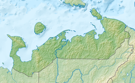 Location in Nenets Autonomous Okrug | |
| Country | Russia |
| Federal subject | Nenets Autonomous Okrug |
| Range coordinates | 69°12′13″N 62°36′28″E |
| Parent range | Urals |
| Geology | |
| Orogeny | Cimmerian Orogeny |
| Age of rock | Late Triassic - Early Jurassic. |
| Type of rock | Sandstone, marl, limestone and crystalline shale |
| Climbing | |
| Easiest route | From Amderma |
Geography

The ridge is extended from northwest to southeast. It is located on the Yugorsky Peninsula, in the eastern part of the Nenets Autonomous Okrug. The ridge continues to Vaygach Island, thus separating the Barents Sea and the Kara Sea. The highest point of Pay-Khoy is the mountain of Moreiz (467 metres (1,532 ft)).[2] The range separates the drainage basins of the Korotaikha River (west, Barents Sea) and the Kara River (east, Kara Sea).
The areas around Pay-Khoy do not have permanent population. The closest permanent settlements are Amderma and Ust-Kara, Nenets Autonomous Okrug The range is located in the tundra, to the north of the tree line.
Geology
The Pay-Khoy range forms a curved orogen together with the Ural Mountains, Vaygach Island and the Novaya Zemlya archipelago. The Pay-Khoy and Novaya Zemlya are younger than the orogeny that formed the Ural mountains. They were formed during the Cimmerian Orogeny between the Late Triassic and Early Jurassic.[3]
Bibliography
- Kovalskiy, M.A. Northern Urals and the Coastal Range Pai-Khoi. Volume 1. Research Expeditions of the Imperial Russian Geographic Society in 1847, 1848 and 1850. ISBN 5519416656
References
- Yushkinite from Dolgozhdannyi Waterfall, Pai-Khoi Range
- Пай-Хой. Great Soviet Encyclopedia.
- Lindquist, Sandra J. (1999). The Timan-Pechora Basin Province of Northwest Arctic Russia: Domanik – Paleozoic Total Petroleum System (PDF). U. S. Geological Survey. p. 11. Retrieved 28 December 2021.
| Authority control: National libraries |
|---|
На других языках
[de] Pai-Choi-Gebirge
Das Pai-Choi-Gebirge (oder Paj-Choj, russ. Пай-Хой) ist ein Mittelgebirge im Norden Russlands.- [en] Pay-Khoy Range
[es] Cordillera de Pai Joi
La cordillera de Pay Choy (en ruso: Пай-Хой) es una línea de montes bajos en el norte de la Rusia europea, en el ókrug autónomo Yamalo-Nénets, al sur del mar de Kara, considerado frontera entre Europa y Asia, por lo que estas montañas, así como la doble isla del océano Ártico de Nueva Zembla pertenecen a Europa.[fr] Monts Paï-Tchoï
Les monts Paï-Tchoï (russe : хребет Пай-Хой) forment l'extrémité septentrionale de la chaîne de l'Oural. Ils traversent le district autonome de Nénétsie du nord-ouest au sud-est.[it] Paj-Choj
Il Paj-Choj (in russo: Пай-Хой?, talvolta traslitterato come Pay-Khoy) è un massiccio montuoso corrispondente all'estremità settentrionale della catena degli Urali; è situato nel circondario autonomo dei Nenec, in Russia.[ru] Пай-Хой
Пай-Хой — старый, сильно разрушенный горный кряж в центре Югорского полуострова. Образующие его каменистые гряды и холмы протянулись примерно на 200 км от северной части Полярного Урала к проливу Югорский Шар, а орографическое продолжение их прослеживается на острове Вайгач, разделяющем Баренцево и Карское моря[1][2].Другой контент может иметь иную лицензию. Перед использованием материалов сайта WikiSort.org внимательно изучите правила лицензирования конкретных элементов наполнения сайта.
WikiSort.org - проект по пересортировке и дополнению контента Википедии