geo.wikisort.org - Mountains
Ol Doinyo Lengai (Oldoinyo Lengai), "Mountain of God" in the Maasai language,[3] is an active volcano located in the Gregory Rift, south of Lake Natron within the Arusha Region of Tanzania, Africa. Part of the volcanic system of the East African Rift, it uniquely produces natrocarbonatite lava. The 1960 eruption of Ol Doinyo Lengai led to geological investigations that finally confirmed the view that carbonatite rock is derived from magma.[4][note 1]
This article needs additional citations for verification. (July 2016) |
| Ol Doinyo Lengai (Oldoinyo Lengai) | |
|---|---|
 | |
| Highest point | |
| Elevation | 3,188 m (10,459 ft)[1] |
| Prominence | 1,360 m (4,460 ft) |
| Isolation | 16.68 km (10.36 mi) |
| Coordinates | 02°45′52″S 35°54′58″E |
| Geography | |
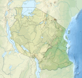 Ol Doinyo Lengai (Oldoinyo Lengai) Tanzania | |
| Parent range | East African Rift |
| Geology | |
| Mountain type | Stratovolcano |
| Last eruption | 2019[2] |
| Climbing | |
| Easiest route | Scramble |
Geology
Ol Doinyo Lengai is unique among active volcanoes in that it produces natrocarbonatite lava, a unique occurrence of volcanic carbonatite. A few older extinct carbonatite volcanoes are located nearby, including Homa Mountain.
Lava
Whereas most lavas are rich in silicate minerals, the lava of Ol Doinyo Lengai is a carbonatite. It is rich in the rare sodium and potassium carbonates, nyerereite and gregoryite. Due to this unusual composition, the lava erupts at relatively low temperatures of approximately 510 °C (950 °F). This temperature is so low that the molten lava appears black in sunlight, rather than having the red glow common to most lavas. It is also much more fluid than silicate lavas, often less viscous than water. The sodium and potassium carbonate minerals of the lavas erupted at Ol Doinyo Lengai are unstable at the Earth's surface and susceptible to rapid weathering, quickly turning from black to grey in colour. The resulting volcanic landscape is different from any other in the world.
Ecology
The carbonatite ash spread over the surrounding grasslands leads to a uniquely succulent, enriched pasture. This makes the area a vital stage on the annual wildebeest migration, where it becomes the nursery for the birth of several thousand calves.
Eruptive activity
1883-1915
The record of eruptions on the mountain dates to 1883. Flows were recorded between 1904 and 1910 and between 1913 and 1915.[5]
1917
A major eruption in June 1917 deposited volcanic ash up to 48 kilometres (30 mi) away.[5]
1926
An eruption took place for several months in 1926.[5]
1940
An eruption between July and December 1940 deposited ash as far as Loliondo, 100 kilometres (62 mi) away.[5]
1950s
Several minor eruptions of lava were observed in 1954, 1955, and 1958.[5]
1960s
Minor eruptions of lava were observed in the early 1960s.
A major eruption occurred on 14 August 1966. Geologists J. B. Dawson and G. C. Clark visited the crater a week later and reported seeing "a thick column of black ash" that rose for approximately 1,000 metres (3,000 ft) above the volcano and drifted away northwards towards Lake Natron. When they climbed the cone-shaped vent, they reported seeing a continuous discharge of gas and whitish-grey ash and dust from the centre of the pit.
2007
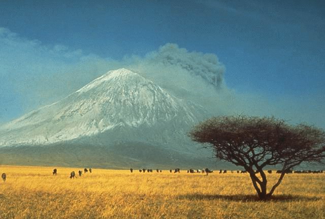
Volcanic activity in the mountain caused daily earth tremors in Kenya and Tanzania from 12 July 2007 until 18 July 2007 at 8.30pm in Nairobi. The strongest tremor measured 6.0 on the Richter scale. Geologists suspected that the sudden increase of tremors was indicative of the movement of magma through the Ol Doinyo Lengai. The volcano erupted on 4 September 2007, sending a plume of ash and steam at least 18 kilometres (11 mi) downwind and covering the north and west flanks in fresh lava flows.
2008
The 2007 eruption continued intermittently into 2008. At the end of February it was reported to be gathering strength, with a major outburst taking place on 5 March. Periods of inactivity were followed by eruptions on 8 and 17 April. Eruptive activity continued until late August 2008. A visit to the summit in September 2008 discovered that lava emission had resumed from two vents in the floor of the new crater. Visits to the crater in March/April 2009 showed that this activity appeared to have ceased.[6]
2010
In October 2010, two separate lava flows and a small lava lake were photographed in an overflight.[citation needed]
2013
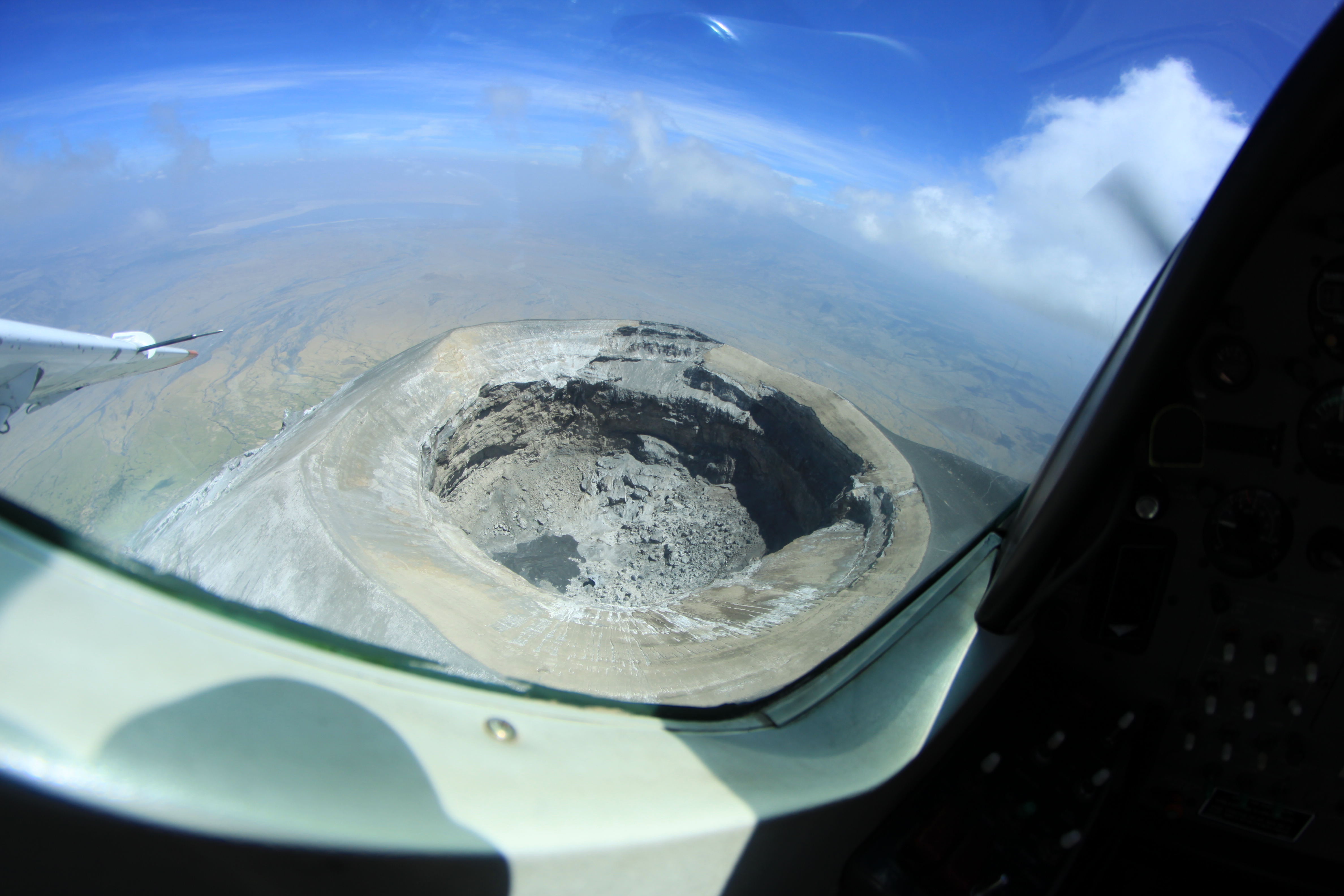
The volcano resumed natrocarbonatite lava flow which started to fill the large crater from the 2007-2008 eruption. As of July 2013, there is a large active hornito on the western edge of the crater floor. During June, residents near the volcano reported several earthquakes. The new crater is inaccessible and climbers have only occasionally glimpsed into it.[citation needed]
Gallery
 Ol Doinyo Lengai erupting in March 2008.
 Ol Doinyo Lengai after an explosive eruption.
 Image of the volcano sending a plume of ash and steam southward.
 Aerial photo of Oldoinyo Lengai in 2011.
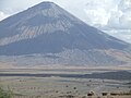 Ol Doinyo Lengai in October 2011.
 Image of 1966 eruption
 Solidified lava in the crater of Ol Doinyo Lengai.
 Crater of Ol Doinyo Lengai in January 2011.


See also
Notes
- The magmatic origin of carbonatite had been claimed in 1948 by Swedish geologist Harry von Eckermann based on his study of the Alnö Complex.[4]
References
- Tanzania in figures 2012, National Bureau of Statistics, Ministry of Finance, June 2013, page 9 Archived 2013-11-26 at the Wayback Machine
- "Ol Doinyo Lengai". Global Volcanism Program. Smithsonian Institution. Retrieved 2021-06-24.
- Northern Tanzania with Kilimanjaro and Zanzibar by Phillip Briggs 2006 page 194 ISBN 1-84162-146-3
- Hode Vuorinen, Jaana (2005). The Alnö alkaline and carbonatitic complex, east central Sweden – a petrogenetic study (Ph.D.). Stockholm University. pp. 1–28. Archived from the original on 2017-10-06. Retrieved 2016-10-24.
- "Mt. Ol Doinyo Lengai". Sacred Sites: World Pilgrimage Guide. Archived from the original on 2021-04-14. Retrieved 2021-05-28.
- Ol Doinyo Lengai, The Mountain of God, Website maintained by Frederick A. Belton.
External links
- Ol Doinyo Lengai at nationalgeographic.com
- Ol Doinyo Lengai at Stromboli Online
- Ol Doinyo Lengai at Volcano World
- St Lawrence University Oldoinyo Lengai
- Fred Belton's Ol Doinyo Lengai site
- Ol Doinyo Lengai Photos 2001
- Volcano Discovery Ol Doinyo Lengai volcano, Tanzania
- Video of molten carbonatite lava flow eruptions at Ol Doinyo Lengai volcano
Authority control | |
|---|---|
| General |
|
| National libraries | |
На других языках
[de] Ol Doinyo Lengai
Der Ol Doinyo Lengai ist ein aktiver Schichtvulkan des Ostafrikanischen Grabenbruchs im Norden Tansanias. Er liegt ca. 120 km nordwestlich von Arusha am Natronsee.- [en] Ol Doinyo Lengai
[es] Ol Doinyo Lengai
Ol Doinyo Lengai es un volcán situado al sur del lago Natron, en el extremo sur del brazo oriental del Gran Valle del Rift, en el noroeste de Tanzania. La etapa de formación del cono de este volcán simétrico de 370.000 años de antigüedad finalizó hace unos 15.000 años. Su cima la forman dos cráteres. El del sur, inactivo, está cubierto de vegetación y de ceniza volcánica. En el del norte, la actividad se centra en torno a varios hornitos (hileras de materiales empujados hacia arriba por un flujo de agua subyacente) y pequeños conos.[fr] Ol Doinyo Lengaï
L'Ol Doinyo Lengaï est un stratovolcan de Tanzanie situé dans la vallée du Grand Rift qui parcourt l'Afrique orientale du Nord au Sud. C'est le seul volcan actif de Tanzanie. Ol Doinyo Lengaï est un terme maa, la langue des Masaïs dont elle est la montagne sacrée, qui signifie « Montagne des Dieux » en français. Il fait partie du massif du Ngorongoro et une savane s'étend à ses pieds.[it] Ol Doinyo Lengai
L'Ol Doinyo Lengai è uno stratovulcano che si trova nei pressi della Rift Valley, nel territorio della Tanzania settentrionale. Il suo nome significa "Montagna di Dio" nella lingua della popolazione Masai che vive in quest'area.[ru] Ол-Доиньо-Ленгаи
Ол-Доиньо-Ленгаи[2][3][4] или Олдоиньо-Ленгаи[5][6] (суахили Ol Doinyo Lengai) — стратовулкан на севере Танзании. Один из самых молодых и, возможно, самый активный вулкан Восточной Африки[7]. Имеет уникальный карбонатитовый состав лавы[6]. На языке местного племени масаев название вулкана означает «гора Бога»[7].Другой контент может иметь иную лицензию. Перед использованием материалов сайта WikiSort.org внимательно изучите правила лицензирования конкретных элементов наполнения сайта.
WikiSort.org - проект по пересортировке и дополнению контента Википедии