geo.wikisort.org - Mountains
The Ogo Mountains, also known as the Galgodon Highlands,[1] (Somali: Buuraha Oogo, Arabic: جبل أوغو) are a mountain range in Somaliland. They cross the Sanaag and Togdheer regions. With a mean peak height of 2,450 m (8,040 ft), the ecology of this landform is semi-desert.
This article needs additional citations for verification. (December 2018) |
| Ogo Mountains Galgodon Highlands[1] Buuraha Oogo جَبَل أوغو | |
|---|---|
 Cal Madow, a subrange of the Ogo Mountains | |
| Highest point | |
| Peak | Shimbiris |
| Elevation | 2,450 m (8,040 ft) |
| Coordinates | 10°44′03.3″N 47°13′56.6″E |
| Geography | |
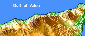 Map of the Ogo Mountains
| |
| Country | |
| Regions | Sanaag and Togdheer |
Ecology

Due to the Ogo Mountains' elevated, highland location in Somaliland, the range has an unexpectedly temperate climate.[2] The mountains also catch the precipitation of the Indian Ocean's monsoon winds, resulting in a rainy season that lasts from June until mid-September.[citation needed]
Climate
The average annual temperature in the Ogo Mountains is 20 to 26 °C (68 to 79 °F). Precipitation reaches a maximum in March, with a minimum of rainfall in August. The average annual precipitation around 500–700 mm (20–28 in).[2]
The data provided below derives from the Gudaado station. It illustrates a subtropical highland climate with strong continental Mediterranean characteristics (Köppen: "Cwb"), given the two marked wet seasons that span between March–May and September–November, albeit the latter being briefer and more subtle. The climatic situation here is most similar to the Altiplano region, due to its semi-arid patterns of rain, huge diurnal temperature variations, adjacence to the Somali desert, and seasonal variations that are neither too cold nor too hot in the extremes.
| Climate data for Gudaado (10°44'03.3"N 47°13'56.6"E) (elev. 2239 metres above sea level) | |||||||||||||
|---|---|---|---|---|---|---|---|---|---|---|---|---|---|
| Month | Jan | Feb | Mar | Apr | May | Jun | Jul | Aug | Sep | Oct | Nov | Dec | Year |
| Average high °C (°F) | 22.6 (72.7) |
23.7 (74.7) |
24.1 (75.4) |
23.8 (74.8) |
24.6 (76.3) |
27.1 (80.8) |
27.1 (80.8) |
26.9 (80.4) |
26.4 (79.5) |
23.0 (73.4) |
22.3 (72.1) |
22.2 (72.0) |
24.5 (76.1) |
| Daily mean °C (°F) | 16.7 (62.1) |
17.8 (64.0) |
19.0 (66.2) |
19.6 (67.3) |
20.0 (68.0) |
22.0 (71.6) |
22.3 (72.1) |
22.1 (71.8) |
21.3 (70.3) |
18.1 (64.6) |
17.0 (62.6) |
16.4 (61.5) |
19.4 (66.8) |
| Average low °C (°F) | 11.7 (53.1) |
12.8 (55.0) |
14.3 (57.7) |
15.6 (60.1) |
16.1 (61.0) |
17.3 (63.1) |
17.8 (64.0) |
17.8 (64.0) |
17.1 (62.8) |
13.9 (57.0) |
12.5 (54.5) |
11.6 (52.9) |
14.9 (58.8) |
| Average rainfall mm (inches) | 9 (0.4) |
17 (0.7) |
58 (2.3) |
160 (6.3) |
140 (5.5) |
6 (0.2) |
1 (0.0) |
3 (0.1) |
22 (0.9) |
90 (3.5) |
35 (1.4) |
12 (0.5) |
553 (21.8) |
| Source: Climate Data[2] | |||||||||||||
See also
- Lamadaya waterfalls
References
- "Galgodon Highlands". Encyclopædia Britannica. Retrieved 25 June 2013.
- "Climate Guadaado, Somalia". Climate Data. Retrieved 9 April 2012.
This Somaliland location article is a stub. You can help Wikipedia by expanding it. |
Другой контент может иметь иную лицензию. Перед использованием материалов сайта WikiSort.org внимательно изучите правила лицензирования конкретных элементов наполнения сайта.
WikiSort.org - проект по пересортировке и дополнению контента Википедии