geo.wikisort.org - Mountains
Mount William is a prominent snowy mountain in Antarctica, standing 1,600 metres (5,200 ft) tall, and located 6 kilometres (3.7 mi) north-northeast of Cape Lancaster which is the south extremity of Anvers Island, in the Palmer Archipelago. This is the tallest mountain visible from Biscoe Bay, near the south end of the island's Osterrieth Range which also includes Mount Français (the tallest mountain on the island).[2]
| Mount William | |
|---|---|
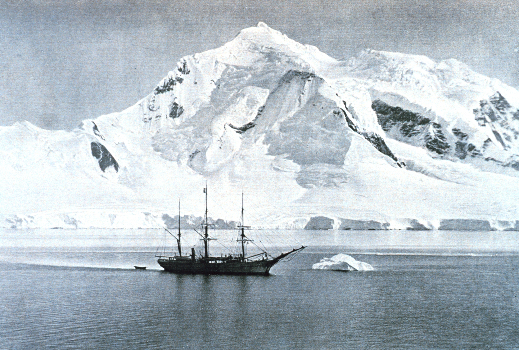 RV Belgica anchored at Mount William circa 1898. | |
| Highest point | |
| Elevation | 1,600 m (5,200 ft) [1] |
| Coordinates | 64°47′S 63°41′W [1] |
| Geography | |
| Location | Anvers Island, Antarctica |
This mountain was discovered on February 21, 1832, by John Biscoe who incorrectly believed it to be part of the mainland of Antarctic Peninsula, instead of on an island. He named it for William IV, then King of the United Kingdom.[1]
Mountain climbers from the U.K. were the first to ascend this peak, in 1956. In 2003, after climbing this mountain, two Americans skied down.[3]
A rock ridge leading northwest from Mount William leads to Shewry Peak.
References
- "Mount William". Geographic Names Information System. United States Geological Survey, United States Department of the Interior. Retrieved 13 March 2007.
- Taylor, Andrew. Two Years Below the Horn: Operation Tabarin, Field Science, and Antarctic Sovereignty, 1944-1946, p. 116 (Univ. of Manitoba Press, 2017).
- Gildea, Damien. Antarctic Peninsula - Mountaineering in Antarctica: Travel Guide, p. 39 (Primento, 2015).
This Anvers Island location article is a stub. You can help Wikipedia by expanding it. |
На других языках
[de] Mount William (Anvers-Insel)
Der Mount William ein 1515 m hoher,[1] markanter und schneebedeckter Berg auf der Anvers-Insel im Palmer-Archipel westlich der Antarktischen Halbinsel. Er ragt 6,5 km nordnordöstlich des Kap Lancaster im Südosten der Insel auf.- [en] Mount William (Antarctica)
[es] Monte William
El monte William (64°47′S 63°41′O) es una montaña cubierta de nieve de 1600 m, situada a 6 km al nor-noreste del cabo Lancaster, el extremo sur de la isla Anvers, en el archipiélago Palmer. Fue descubierta el 21 de febrero de 1832 por John Biscoe, quien creía que era parte de la península Antártica. Fue nombrado Biscoe por Guillermo IV de Inglaterra.[1][fr] Mont William
Le mont William, en Mount William, est une montagne d'Antarctique située au large de la Terre de Graham, à l'extrémité méridionale de l'île Anvers dans l'archipel Palmer, à environ six kilomètres au nord-nord-est du cap Lancaster[1]. Il culmine à 1 600 mètres d'altitude[1].[ru] Уильям (гора)
Уильям — снежная гора в Антарктиде высотой 1600 метров[1], расположенная в 6 километрах к северо-северо-востоку от мыса Ланкастер[en], который является южной оконечностью острова Анверс, в архипелаге Палмер. Это самая высокая гора, видимая из залива Биско[en], недалеко от южной оконечности хребта Остерриет[en], который также включает в себя гору Франсе[en] (самую высокую гору на острове)[2].Другой контент может иметь иную лицензию. Перед использованием материалов сайта WikiSort.org внимательно изучите правила лицензирования конкретных элементов наполнения сайта.
WikiSort.org - проект по пересортировке и дополнению контента Википедии