geo.wikisort.org - Mountains
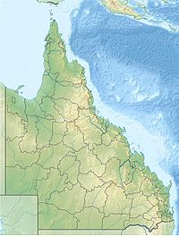
Mount Superbus lies 99 kilometres (62 miles) south-west of the centre of Brisbane, Australia and is South East Queensland's highest peak at 1,375 metres (4,511 feet).[1] At this elevation it is the fifth-highest peak in Queensland, after Mount Bartle Frere at 1,622 metres (5,322 feet), Mount Bellenden Ker at 1,593 metres (5,226 feet), Mount Fisher at 1,385 metres (4,544 feet) and Mount Carbine Tableland at 1,383 metres (4,537 feet), all in Far North Queensland.
| Mount Superbus | |
|---|---|
Queensland, Australia | |
| Highest point | |
| Elevation | 1,375 m (4,511 ft) |
| Coordinates | 28°12′59″S 152°27′59″E |
| Geography | |
| Location | Queensland, Australia |
| Parent range | Main Range |
| Geology | |
| Mountain type | Volcanic plug |
It has an extensive logging history dating back to the mid-19th century. Mount Superbus was originally covered in dense hoop pine forests. Red cedar and other valuable timbers were also heavily logged in the area. It is now part of the Main Range National Park.
The peak is a remnant of the Main Range shield volcano which erupted between 25 and 22 million years ago.[2]
On the southernmost peak just below the summit lies the wreck of a RAAF Lincoln bomber.[3] It crashed into the mountain in the early hours of Easter Saturday morning on 9 April 1955, during a medical evacuation of a sick baby from Townsville to Eagle Farm airfield in Brisbane.[3] The crew of four RAAF personnel and the two passengers were all killed in this accident.[3] Most of the wreckage still lies near the summit and is a popular day walk for bushwalkers.
The Condamine River rises from a spring located on the western slopes of Mount Superbus. Teviot Brook, a major tributary of the Logan River, has its headwaters on the eastern facing slopes of the mountain.
See also
References
- "About Main Range, Goomburra, Queen Mary Falls". The State of Queensland (Environmental Protection Agency). Archived from the original on 11 July 2011. Retrieved 1 October 2010.
- Neville Stevens and Warwick Willmott. "The Main Range" (PDF). Rocks and Landscape Notes. Geological Society of Australia. Archived from the original (PDF) on 19 July 2008. Retrieved 1 July 2009.
- Finley, Peter. "Mercy Flight to Disaster - Lincoln A73-64" (PDF). www.adf-serials.com. Retrieved 16 May 2013.
External links
На других языках
[de] Mount Superbus
Der Mount Superbus im australischen Main Range-Gebirge ist der höchste Berg in South East Queensland.[1] Er ist 1375 m hoch und befindet sich im Main-Range-Nationalpark in der Nähe von Brisbane.- [en] Mount Superbus
[fr] Mont Superbus
Le mont Superbus (1 375 m) se trouve à 150 km au sud-ouest de Brisbane et est le point culminant du Sud-Est du Queensland en Australie. Il a une longue histoire d'exploitation forestière qui remonte au milieu du XIXe siècle. Il était à l'origine couvert de denses forêts de pins. On y trouvait aussi le cèdre rouge et d'autres espèces d'arbres. Il fait maintenant partie du parc national du Main Range.[ru] Супербус
Супербус (англ. Mount Superbus) — гора на юго-востоке Квинсленда, Австралия. Высшая точка Юго-восточного Квинсленда и пятая по высоте гора штата. Высота Супербуса — 1375 метров[1]. Находится на территории национального парка Мейн-Рейндж (англ.). Раньше склоны горы были покрыты густыми сосновыми лесами. На южном склоне Супербуса лежат обломки бомбардировщика RAAF Lincoln, который врезался в гору утром 9 апреля 1955 года[2]. Считается, что на Супербусе берет начало река Кондамин (англ.).Другой контент может иметь иную лицензию. Перед использованием материалов сайта WikiSort.org внимательно изучите правила лицензирования конкретных элементов наполнения сайта.
WikiSort.org - проект по пересортировке и дополнению контента Википедии
