geo.wikisort.org - Mountains
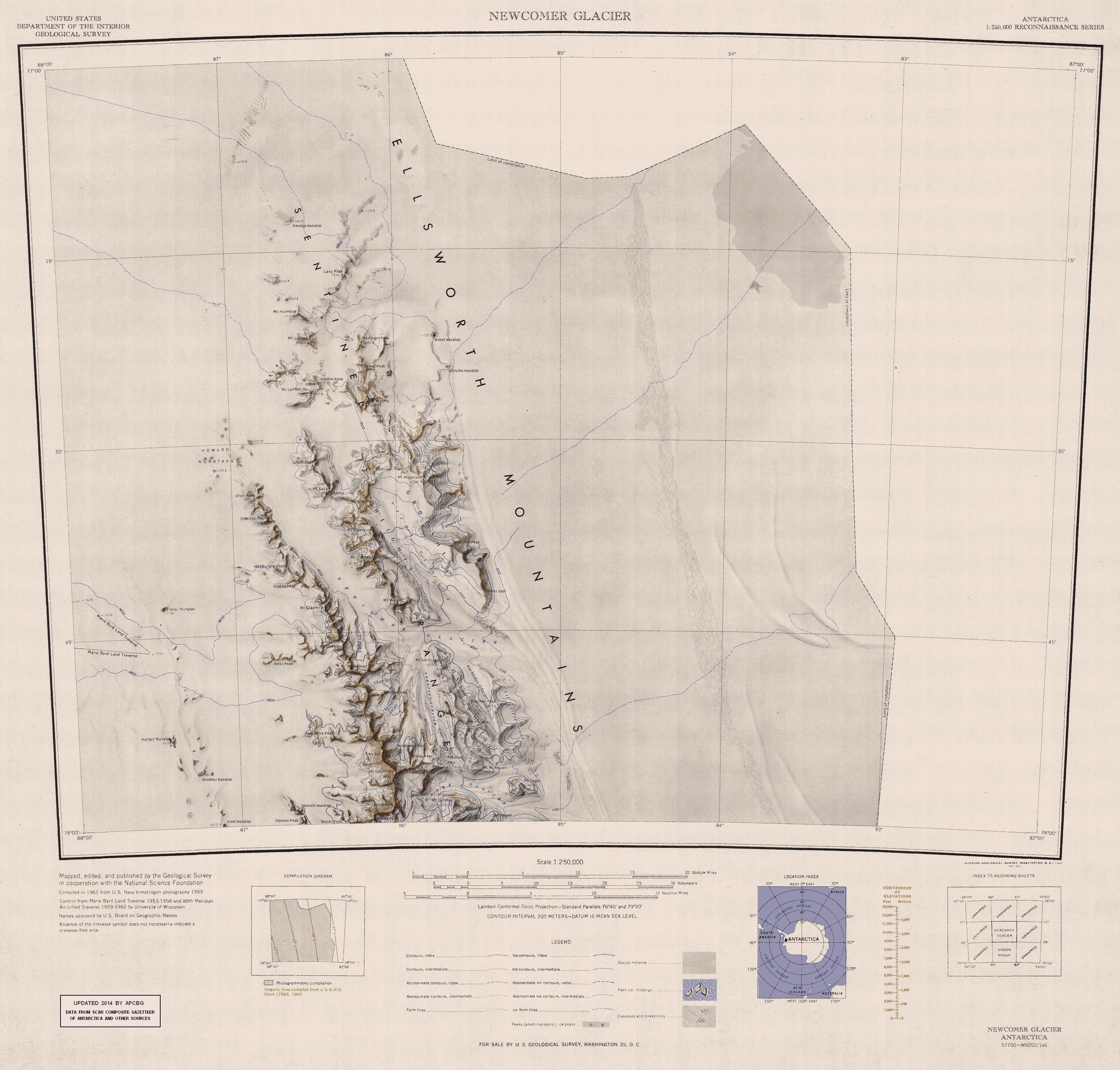
Mount Schmid (77°58′S 85°40′W) is a mountain on the south side of Embree Glacier, rising 8 km east of Mount Goldthwait in Bangey Heights in the northern portion of the Sentinel Range, Antarctica. Mapped by USGS from surveys and US Navy air photos, 1957–59. Named by the US-ACAN for Captain Ernest A. Schmid, USAF, who participated in the establishment of the IGY South Pole Station during the 1956–57 season.[1]

References
- "Mount Schmid". Geographic Names Information System. United States Geological Survey, United States Department of the Interior. Retrieved 2 October 2005.
![]() This article incorporates public domain material from the United States Geological Survey document: "Mount Schmid". (content from the Geographic Names Information System)
This article incorporates public domain material from the United States Geological Survey document: "Mount Schmid". (content from the Geographic Names Information System)
This Ellsworth Land location article is a stub. You can help Wikipedia by expanding it. |
На других языках
[de] Mount Schmid
Mount Schmid ist ein 2430 m hoher Berg im westantarktischen Ellsworthland. Er ragt an der Südseite des Embree-Gletschers in einer Entfernung von 8 km östlich des Mount Goldthwait in der Sentinel Range des Ellsworthgebirges auf.- [en] Mount Schmid
Текст в блоке "Читать" взят с сайта "Википедия" и доступен по лицензии Creative Commons Attribution-ShareAlike; в отдельных случаях могут действовать дополнительные условия.
Другой контент может иметь иную лицензию. Перед использованием материалов сайта WikiSort.org внимательно изучите правила лицензирования конкретных элементов наполнения сайта.
Другой контент может иметь иную лицензию. Перед использованием материалов сайта WikiSort.org внимательно изучите правила лицензирования конкретных элементов наполнения сайта.
2019-2025
WikiSort.org - проект по пересортировке и дополнению контента Википедии
WikiSort.org - проект по пересортировке и дополнению контента Википедии