geo.wikisort.org - Mountains
Mount Mecheva (Bulgarian: връх Мечева, romanized: vrah Mecheva, IPA: [ˈvrɤx ˈmɛt͡ʃɛvɐ]) is the broad ice-covered peak with precipitous rocky north, east and southwest slopes that peaks at 1367 m[1] in the Bigla Ridge on Foyn Coast, Antarctic Peninsula. It surmounts Beaglehole Glacier to the southwest, Sleipnir Glacier to the northwest and Cabinet Inlet to the northeast.
| Mount Mecheva | |
|---|---|
| връх Мечева | |
 Mount Mecheva Antarctica | |
| Highest point | |
| Elevation | 1,367 m (4,485 ft) |
| Coordinates | 66°30′11″S 64°00′12″W |
| Geography | |
| Location | Antarctica |
| Parent range | Bigla Ridge |
The feature is named after Rumyana Mecheva, biologist at St. Kliment Ohridski Base in 1999/2000 and subsequent seasons.
Location
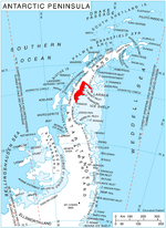
Mount Mecheva is located in the Bigla Ridge, 13 km southwest of Balder Point, 13.7 km northwest of Spur Point, 14.9 km north of Varad Point and 6.87 km northeast of Chuypetlovo Knoll. British mapping in 1974 and 1976.
Maps
- British Antarctic Territory: Graham Land. Scale 1:250000 topographic map. BAS 250 Series, Sheet SQ 19-20. London, 1974.
- British Antarctic Territory. Scale 1:200000 topographic map. DOS 610 Series, Sheet W 66 64. Directorate of Overseas Surveys, Tolworth, UK, 1976.
- Antarctic Digital Database (ADD). Scale 1:250000 topographic map of Antarctica. Scientific Committee on Antarctic Research (SCAR). Since 1993, regularly upgraded and updated.
Notes
- Reference Elevation Model of Antarctica. Polar Geospatial Center. University of Minnesota, 2019
References
- Mount Mecheva. SCAR Composite Antarctic Gazetteer.
- Bulgarian Antarctic Gazetteer. Antarctic Place-names Commission. (details in Bulgarian, basic data in English)
External links
- Mount Mecheva. Copernix satellite image
This article includes information from the Antarctic Place-names Commission of Bulgaria which is used with permission.
This Foyn Coast location article is a stub. You can help Wikipedia by expanding it. |
На других языках
[de] Mount Mecheva
Mount Mecheva (englisch; bulgarisch връх Мечева .mw-parser-output .Latn{font-family:"Akzidenz Grotesk","Arial","Avant Garde Gothic","Calibri","Futura","Geneva","Gill Sans","Helvetica","Lucida Grande","Lucida Sans Unicode","Lucida Grande","Stone Sans","Tahoma","Trebuchet","Univers","Verdana"}wrach Metschewa) ist ein wuchtiger, vereister und 850 m hoher Berg im Bigla Ridge an der Foyn-Küste des Grahamlands im Norden der Antarktischen Halbinsel. Er ragt 13 km südwestlich des Balder Point, 13,7 km nordwestlich des Spur Point, 14,9 km nördlich des Varad Point und 6,87 km nordöstlich des Chuypetlovo Knoll auf. Der Beaglehole-Gletscher liegt südwestlich, der Sleipnir-Gletscher nordwestlich und das Cabinet Inlet nordöstlich von ihm. Besonders markant sind seine felsigen Nord-, Ost- und Südwesthänge.- [en] Mount Mecheva
Другой контент может иметь иную лицензию. Перед использованием материалов сайта WikiSort.org внимательно изучите правила лицензирования конкретных элементов наполнения сайта.
WikiSort.org - проект по пересортировке и дополнению контента Википедии