geo.wikisort.org - Mountains
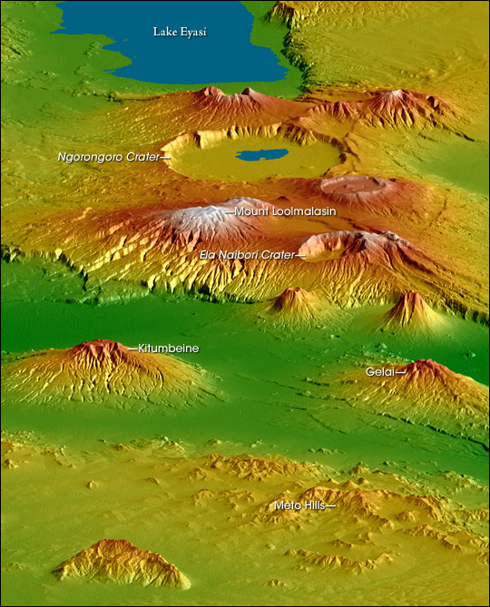
Mount Loolmalasin (sometimes spelled "Loolmalassin")[1] is a mountain located in the Ngorongoro District of the Arusha Region, Tanzania. It has a peak elevation of 3,682 metres (12,080 ft)[1] above sea level. It is, after Mount Kilimanjaro and Mount Meru, the third-highest mountain in Tanzania if Kilimanjaro's three peaks are considered to be one mountain. Mount Loolmalasin is the second tallest mountain in Arusha Region and the tallest point in Ngorongoro District. The mountain also is the source of Simiyu River, which flows west to Lake Victoria in Simiyu Region. [2]
| Mount Loolmalasin | |
|---|---|
 | |
| Highest point | |
| Elevation | 3,682 m (12,080 ft)[1] |
| Prominence | 2,040 m (6,690 ft)[1] |
| Listing | Ultra |
| Coordinates | 3°03′06″S 35°49′00″E[1] |
| Geography | |
 Mount Loolmalasin Tanzania | |
| Location | Arusha Region, Tanzania |
See also
References
- "Africa Ultra-Prominences" Peaklist.org. Retrieved 2016-01-14.
- Tanzania Travel Guide (6 ed.). Lonely Planet. June 2015. p. 217. ISBN 978-1742207797.
На других языках
[de] Loolmalasin
Der Loolmalasin ist ein erloschener Vulkan in der tansanischen Region Arusha im Distrikt Ngorongoro. Mit 3648 Meter Höhe ist er nach dem Kilimandscharo und dem Mount Meru der dritthöchste Berg in Tansania.[1]- [en] Mount Loolmalasin
Текст в блоке "Читать" взят с сайта "Википедия" и доступен по лицензии Creative Commons Attribution-ShareAlike; в отдельных случаях могут действовать дополнительные условия.
Другой контент может иметь иную лицензию. Перед использованием материалов сайта WikiSort.org внимательно изучите правила лицензирования конкретных элементов наполнения сайта.
Другой контент может иметь иную лицензию. Перед использованием материалов сайта WikiSort.org внимательно изучите правила лицензирования конкретных элементов наполнения сайта.
2019-2026
WikiSort.org - проект по пересортировке и дополнению контента Википедии
WikiSort.org - проект по пересортировке и дополнению контента Википедии