geo.wikisort.org - Mountains
Mount Kupe or Mont Koupé is a plutonic mountain in the Western High Plateau of Cameroon, part of the Cameroon line of volcanoes. It is the highest of the Bakossi mountains, rising to 2,064 metres (6,772 ft).[1]
| Mount Kupe | |
|---|---|
| Mont Koupé | |
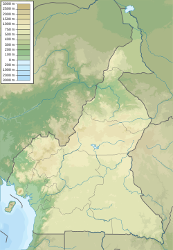 Mount Kupe Location in Cameroon | |
| Highest point | |
| Elevation | 2,064 m (6,772 ft) |
| Coordinates | 4°48′05″N 9°42′29″E |
| Geography | |
| Location | Cameroon |
| Parent range | Cameroon line |
The mountain is revered by the local Bakossi people as the home of their ancestral and forest spirits.[2] Missionaries in the 1890s observed that the mountain had a strong magical reputation, and it still has an important role in beliefs related to ekong, a form of witchcraft.[3] The mountain used to be forest-covered apart from a few small grassy areas near the summit. The causes of deforestation in the Bakossi landscape, are shifting cultivation, logging for timber, felling for fuelwood, growth and expansion of human settlements and establishment of pasture lands.[4] All sides of the mountain have been steadily converted to agricultural use. Forest has been cleared up to 1,500m on the eastern slopes and up to between 750m and 1,100m on the western and northern sides, above the villages of Mbule and Nyasoso.[5]
As of 2010, there was still primary mid-altitude and montane rainforest on the northern side.[5] The cloud forest supports rich biodiversity, and is home to chimpanzees and several species of threatened primates.[2] The Mount Kupe bushshrike Telophorus kupeensis is known to be endangered due to its small range and declining quality of its habitat.[6] The Mount Kupe Forest Project was at first managed by BirdLife International, later by WWF-UK and then by WWF-Cameroon. As of 2010 the project was dormant.[7]
References
- Piet Stoffelen; Martin Cheek; Diana Bridson; Elamr Robbrecht (1997). "A new species of Coffea (Rubiaceae) and notes on Mount Kupe (Cameroon)". Kew Bulletin. 52: 989–994. doi:10.2307/4117826. JSTOR 4117826.
- Jim Hudgens; Richard Trillo (2003). "Mount Kupe". The rough guide to West Africa. Rough Guides. p. 1190. ISBN 1-84353-118-6.
- James Kiernan (2006). The power of the occult in modern Africa: continuity and innovation in the renewal of African cosmologies. LIT Verlag Münster. pp. 51–52. ISBN 3-8258-8761-8.
- Environmental Problems in the Bakossi Landscape: A Handbook for Environmental Educators by Ekpe Inyang
- "Mount Kupe". BirdLife International. Retrieved 2011-02-04.
- "Mount Kupe Bush-shrike Telophorus kupeensis". BirdLife International. Retrieved 2011-02-04.
- "Western Cameroon Projects: Mount Kupe & the Bakossi Mountains". Royal Botanic Gardens, Kew. Retrieved 2011-02-04.
Authority control | |
|---|---|
| General |
|
| National libraries | |
На других языках
[de] Kupe (Berg)
Der Kupe ist ein erloschener Schichtvulkan an der Grenze der Provinzen Sud-Ouest und Littoral in Kamerun. Er erreicht eine Höhe von 2064 Meter über den Meeresspiegel, ist der höchste Berg der Bakossi-Berge und ein Teil der Kamerunlinie. Die nächstgelegenen Städte sind Loum und Tombel. Nördlich des Kupe liegt das Bambouto-Massiv (ca. 70 km), nordöstlich der Manengouba (ca. 30 km) und südwestlich der Kamerunberg (ca. 90 km).[1]- [en] Mount Kupe
[es] Monte Kupe
El monte Kupe o Mont Koupé es una montaña plutónica en el altiplano occidental de Camerún, que forma parte de la línea de volcanes de Camerún. Es la más alta de las montañas Bakossi, con 2 064 m . [1][fr] Mont Koupé
Le mont Koupé se trouve à cheval sur l’ancienne frontière entre les parties anglophones et francophones du Cameroun. Il forme un complexe montagneux avec les monts Bakossi à l’ouest et est connecté par une crête descendante via la réserve forestière de Manéhas et la forêt de Mbumbe avec le mont Manengouba et ses cratères vers le nord. Le mont Koupé lui-même est un volcan conique de la Ligne du Cameroun, dont le sommet culmine à 2 064 m d'altitude et qui est entouré par des pics secondaires. Les pentes raides du mont Koupé sont recouvertes par une forêt de nuage vierge, qui se transforme graduellement vers le haut en arbustes montagneux et des prairies.[it] Kupe (montagna)
Il Kupe o Koupé e' una montagna del Camerun che raggiunge un'altezza di oltre 2000 metri, rilievo appartenente al cosiddetto tipo plutonico e facente parte della Linea vulcanica del Camerun. Il Kupe è la cima più alta delle montagne Bakossi, Catena montuosa che si trova sull'Altopiano occidentale del Camerun.Другой контент может иметь иную лицензию. Перед использованием материалов сайта WikiSort.org внимательно изучите правила лицензирования конкретных элементов наполнения сайта.
WikiSort.org - проект по пересортировке и дополнению контента Википедии