geo.wikisort.org - Mountains
Mount Inasa (稲佐山, Inasa-yama) is a hill to the west of Nagasaki which rises to a height of 333 metres (1,093 ft). The Nagasaki Ropeway allows visitors to travel to the top from Nagasaki. A short walk from the cable car station are several buildings that house transmitters for TV and radio stations that serve Nagasaki and the surrounding area.
| Mount Inasa | |
|---|---|
| 稲佐山 Inasa-yama | |
 View of Mount Inasa from Nagasaki Harbor. | |
| Highest point | |
| Elevation | 333 m (1,093 ft) |
| Coordinates | 32°45′10″N 129°50′58″E |
| Geography | |
 Mount Inasa Nagasaki, Nagasaki Prefecture, Japan | |


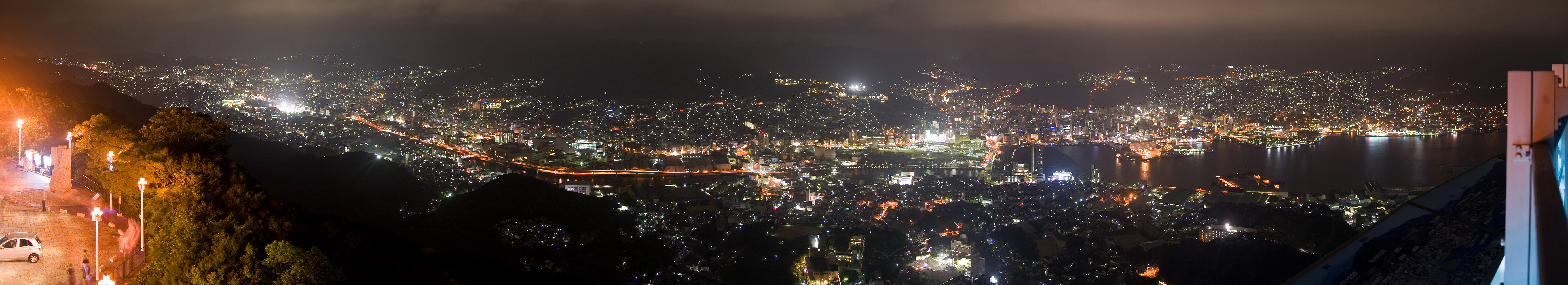
There is an observation platform that is popular with tourists as it provides extensive views of Nagasaki's "10 Million Dollar Night View" (1000万ドルの夜景, Issenmandoru no yakei).[1]
References
- 稲佐山山頂展望台のお知らせ [About the Mount Inasa Summit Viewing Platform] (in Japanese). City of Nagasaki. Archived from the original on November 4, 2011. Retrieved January 28, 2012.
External links
 Media related to Mount Inasa at Wikimedia Commons
- Nagasaki Ropeway
- Guide to Mount Inasa (published by Nagasaki Prefecture) (in Japanese)
 | This Nagasaki Prefecture location article is a stub. You can help Wikipedia by expanding it. |
На других языках
- [en] Mount Inasa
[fr] Mont Inasa
Le mont Inasa (稲佐山, Inasayama?) est une colline du Japon de 333 mètres d'altitude situé au sud-ouest de la ville de Nagasaki.Текст в блоке "Читать" взят с сайта "Википедия" и доступен по лицензии Creative Commons Attribution-ShareAlike; в отдельных случаях могут действовать дополнительные условия.
Другой контент может иметь иную лицензию. Перед использованием материалов сайта WikiSort.org внимательно изучите правила лицензирования конкретных элементов наполнения сайта.
Другой контент может иметь иную лицензию. Перед использованием материалов сайта WikiSort.org внимательно изучите правила лицензирования конкретных элементов наполнения сайта.
2019-2026
WikiSort.org - проект по пересортировке и дополнению контента Википедии
WikiSort.org - проект по пересортировке и дополнению контента Википедии