geo.wikisort.org - Mountains
Mount Henry is a 12,196-foot-elevation (3,717 meter) mountain summit located in the Sierra Nevada mountain range, in Fresno County of northern California, United States.[3] It is situated on the Le Conte Divide, along the shared boundary of John Muir Wilderness and Kings Canyon National Park, and 3.7 miles (6.0 km) northwest of Emerald Peak, the nearest higher neighbor. Topographic relief is significant as the east aspect rises 3,800 feet (1,158 meters) above South Fork San Joaquin River in two miles. The John Muir Trail passes to the northeast, providing an approach option.
| Mount Henry | |
|---|---|
 Mount Henry, from the northwest | |
| Highest point | |
| Elevation | 12,196 ft (3,717 m)[1] |
| Prominence | 876 ft (267 m)[2] |
| Parent peak | Emerald Peak (12,546 ft)[2] |
| Isolation | 3.72 mi (5.99 km)[2] |
| Listing | Sierra Peaks Section |
| Coordinates | 37°10′59″N 118°49′38″W[3] |
| Naming | |
| Etymology | Joseph Henry[4] |
| Geography | |
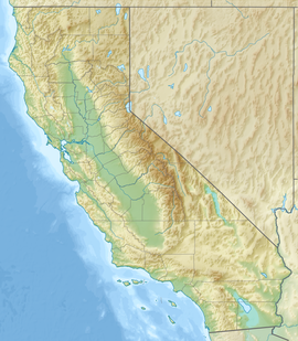 Mount Henry Location in California  Mount Henry Mount Henry (the United States) | |
| Location | Kings Canyon National Park Fresno County California, U.S. |
| Parent range | Sierra Nevada |
| Topo map | USGS Mount Henry |
| Climbing | |
| Easiest route | class 2[2] |
Etymology
The peak's name was applied in 1904 by Joseph Nisbet LeConte to honor Joseph Henry (1797–1878), an eminent American scientist noted for his investigations of electromagnetism, and who served as the first Secretary of the Smithsonian Institution.[5] This geographical feature's name has been officially adopted by the United States Board on Geographic Names.[3]
Climate
According to the Köppen climate classification system, Mount Henry is located in an alpine climate zone.[6] Most weather fronts originate in the Pacific Ocean, and travel east toward the Sierra Nevada mountains. As fronts approach, they are forced upward by the peaks, causing them to drop their moisture in the form of rain or snowfall onto the range (orographic lift). Precipitation runoff from this mountain drains into the San Joaquin River watershed.
Climbing
It is unknown when, or by whom, the first ascent was made.
Established climbing routes:[7]
- Northeast ridge – class 2 – July 7, 1939, by a Sierra Club party led by David Brower
- Southwest slope – class 2 – August 14, 1939, by a party of eight
- West slope – class 2 – August 29, 1940, by Bob Helliwell and Alden Bryant
- North ridge – class 3 – July 10, 1951 by Art Reyman
See also

References
- "Mount Henry, California". Peakbagger.com. Retrieved 2021-05-04.
- "Henry, Mount - 12,196' CA". listsofjohn.com. Retrieved 2021-05-04.
- "Mount Henry". Geographic Names Information System. United States Geological Survey. Retrieved 2021-05-04.
- Francis P. Farquhar, Place Names of the High Sierra (1926)
- Erwin G. Gudde, California Place Names, page 164.
- Peel, M. C.; Finlayson, B. L.; McMahon, T. A. (2007). "Updated world map of the Köppen−Geiger climate classification". Hydrol. Earth Syst. Sci. 11. ISSN 1027-5606.
- Fred L. Jones, A Climber's Guide to the High Sierra (1954)
External links
- Weather forecast: National Weather Service
Другой контент может иметь иную лицензию. Перед использованием материалов сайта WikiSort.org внимательно изучите правила лицензирования конкретных элементов наполнения сайта.
WikiSort.org - проект по пересортировке и дополнению контента Википедии