geo.wikisort.org - Mountains
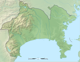
Mount Hakone (箱根山, Hakoneyama) is a complex volcano in Kanagawa Prefecture, Japan that is truncated by two overlapping calderas, the largest of which is 10 × 11 km wide. The calderas were formed as a result of two major explosive eruptions about 180,000 and 49,000–60,000 years ago. Lake Ashi lies between the southwestern caldera wall and a half dozen post-caldera lava domes that arose along a southwest–northeastern trend cutting through the center of the calderas. Dome growth occurred progressively to the south, and the largest and youngest of them, Kami-yama, forms the high point of Hakone. The calderas are breached to the east by the Haya-kawa canyon. Mount Ashigara is a parasitic cone.[1]
| Mount Hakone | |
|---|---|
 Hakone volcano from the SW. | |
| Highest point | |
| Elevation | 1,438 metres (4,718 ft) |
| Coordinates | 35.230°N 139.024°E[1] |
| Naming | |
| Native name | 箱根山 (Japanese) |
| Geography | |
| Geology | |
| Mountain type | Complex calderas |
| Last eruption | June to July 2015[1] |

The latest magmatic eruptive activity at Hakone occurred 2,900 years ago. It produced a pyroclastic flow and a lava dome in the explosion crater, although phreatic eruptions took place as recently as the 12–13th centuries AD.[1]
According to the nearby Hakone Shrine, the Komagatake peak has been the object of religious veneration since ancient times.[2]
Gallery
 Topographic map
 Central cones of Mount Hakone
 Lake Ashi viewed from the central cone of Mt. Komagatake's lava dome.


See also
- List of volcanoes in Japan
- List of mountains in Japan
References
- "Hakoneyama". Global Volcanism Program. Smithsonian Institution. Retrieved 2015-05-07.
- 御際神、由緒、例祭日 [Gods worshipped, origins, ceremony days] (in Japanese). Hakone Shrine. Retrieved 7 December 2017.
External links
- Hakoneyama - Japan Meteorological Agency (in Japanese)
- "Hakoneyama: National catalogue of the active volcanoes in Japan" (PDF). - Japan Meteorological Agency
- Hakone Volcano Group - Geological Survey of Japan
- Hakoneyama: Global Volcanism Program - Smithsonian Institution
- Hakone Geopark(in Japanese)
На других языках
[de] Hakone (Vulkan)
Der Hakone (jap. 箱根山, Hakone-yama) ist ein Vulkan auf der japanischen Insel Honshū. Er liegt etwa 80 Kilometer südwestlich von Tokio in der Präfektur Kanagawa, wobei ein kleiner Teil zur Präfektur Shizuoka gehört. Der komplexe Vulkan ist bis zu 1438 m hoch und ist von einer Caldera umgeben. Die Gegend des Vulkans gehört seit dem 19. Jahrhundert zu den bedeutendsten Tourismusregionen des Landes. Sie ist Teil des Fuji-Hakone-Izu-Nationalparks, der auch den Vulkan Fuji im Westen und die Izu-Halbinsel im Süden umfasst.- [en] Mount Hakone
[fr] Hakone (volcan)
Le Hakone (箱根山, Hakoneyama?) est un volcan de la région de Hakone, au Japon. Il est composé de deux caldeiras coalescentes, de onze kilomètres de longueur pour dix kilomètres de largeur[1]. Le diamètre du volcan est cependant de quinze kilomètres environ. Avec ses 1 438 mètres d'altitude, le mont Kami est le point culminant du Hakone[1]. Les sources thermales (onsen), découlant de l'activité du volcan font partie des principales attractions touristiques du Hakone et participent grandement à sa renommée.[ru] Хаконе (вулкан)
Хако́не[2] (яп. 箱根山 Хаконэ яма) — комплекс вулканов в центре острова Хонсю. В двух древних перекрывающихся кальдерах, бо́льшая из которых имеет размер около 10 × 11 км, расположено 6 вершин более молодых вулканов, некоторые из которых курятся до сих пор. В центре кальдеры находится горное озеро Аси.Другой контент может иметь иную лицензию. Перед использованием материалов сайта WikiSort.org внимательно изучите правила лицензирования конкретных элементов наполнения сайта.
WikiSort.org - проект по пересортировке и дополнению контента Википедии