geo.wikisort.org - Mountains
Mount Giles is one of the highest mountains in the Northern Territory, Australia, at 1,389 metres (4,557 ft) AHD . It lies along the MacDonnell Ranges, dominating Ormiston Pound, in the West MacDonnell National Park, approximately 80 kilometres (50 mi) west of Alice Springs. It can be visited via the celebrated Larapinta Trail and has views of Mount Sonder, Ormiston Gorge and Pound, and the surrounding range.
- See also Mount Giles (Antarctica)
| Mount Giles | |
|---|---|
 Mount Giles from the opposite side of Ormiston Pound in the south | |
| Highest point | |
| Elevation | 1,389 m (4,557 ft)AHD |
| Coordinates | 23°37′44″S 132°51′42″E |
| Geography | |
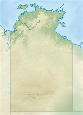 Mount Giles Location in the Northern Territory | |
| Location | Northern Territory, Australia |
| Parent range | MacDonnell Ranges |
| Climbing | |
| Easiest route | Larapinta Trail |
Climbing the mountain requires a hard two- or three-day hike.[1]
See also
References
- Stanton, Jenny (2000). The Australian Geographic Book of the Red Centre. Terrey Hills, New South Wales: Australian Geographic. p. 100. ISBN 1-86276-013-6.
External links
This Northern Territory geography article is a stub. You can help Wikipedia by expanding it. |
Текст в блоке "Читать" взят с сайта "Википедия" и доступен по лицензии Creative Commons Attribution-ShareAlike; в отдельных случаях могут действовать дополнительные условия.
Другой контент может иметь иную лицензию. Перед использованием материалов сайта WikiSort.org внимательно изучите правила лицензирования конкретных элементов наполнения сайта.
Другой контент может иметь иную лицензию. Перед использованием материалов сайта WikiSort.org внимательно изучите правила лицензирования конкретных элементов наполнения сайта.
2019-2025
WikiSort.org - проект по пересортировке и дополнению контента Википедии
WikiSort.org - проект по пересортировке и дополнению контента Википедии