geo.wikisort.org - Mountains

Search / Calendar

The Monts du Toura, also known as the Toura Mountains, are a range of mountains rising to 1300 metres in elevation, extending westward across Côte d’Ivoire from the Sassandra River to the border with Liberia and Guinea. Mont Nimba, at the western end of the range, reaches 1,752 m.[1]

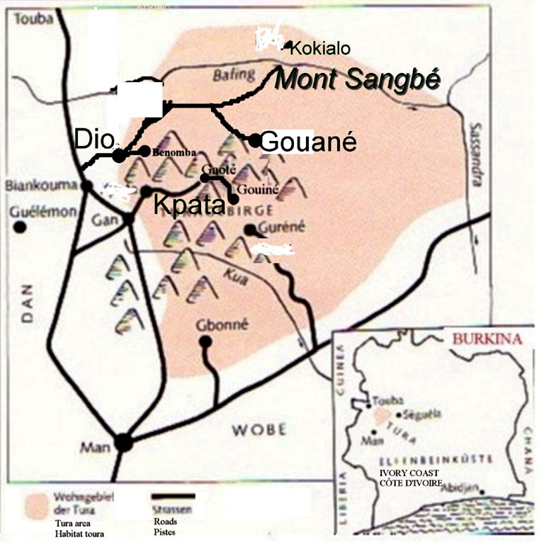
The Mont Sangbé National Park, one of the world's principal national parks,[2] covering an area of 95,000 ha (950 km2/360 sq m) north of Man and west of the Sassandra, between Biankouma and Touba, is located entirely within the Toura mountains (including 14 peaks over 1000 m). The park is very densely vegetated savanna woodland with wildlife populations of elephants, buffaloes, warthog, antelopes, and monkeys.[1][2]

Other protected areas include the Gueoule and Mont Glo forest reserves.


References


  1. U.S. Library of Congress Country Studies - Ivory Coast, accessed 25 December 2010.
  2. Encyclopædia Britannica at Universitat de Valencia[permanent dead link], accessed 25 December 2010


На других языках


- [en] Monts du Toura

[fr] Monts du Toura

Les monts du Toura sont une chaîne de montagnes culminant à plus de 1 300 mètres d'altitude, s'étendant dans l'Ouest de la Côte d'Ivoire, du fleuve Sassandra à la frontière avec la Guinée.


Текст в блоке "Читать" взят с сайта "Википедия" и доступен по лицензии Creative Commons Attribution-ShareAlike; в отдельных случаях могут действовать дополнительные условия.

Другой контент может иметь иную лицензию. Перед использованием материалов сайта WikiSort.org внимательно изучите правила лицензирования конкретных элементов наполнения сайта.

2019-2024
WikiSort.org - проект по пересортировке и дополнению контента Википедии