geo.wikisort.org - Mountains
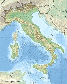
Monte Priaforà is a mountain of the Veneto, Italy. It has an elevation of 1,659 metres. It is part of the Little Dolomites with Cima Palon (the highest peak).
This article may be expanded with text translated from the corresponding article in Italian. (June 2010) Click [show] for important translation instructions.
|
| Monte Priaforà | |
|---|---|
 | |
| Highest point | |
| Elevation | 1,659 m (5,443 ft) |
| Coordinates | 45°47′13″N 11°19′08″E |
| Geography | |
На других языках
- [en] Monte Priaforà
[fr] Mont Priaforà
Le mont Priaforà est un sommet des Alpes italiennes s'élevant à 1 659 m d'altitude, dans la commune de Velo d'Astico dans la province de Vicence en Vénétie (Italie). La montagne tient son nom d'un trou (foro en italien) dans la roche d'un diamètre supérieur à 3 mètres et visible à l'œil nu à plusieurs kilomètres. On y célèbre une fête le premier dimanche du mois d'août à l'alpage de Campedello, situé à 30 minutes du sommet.[it] Monte Priaforà
Il Monte Priaforà (1.659 m s.l.m.) è una delle cime delle Prealpi vicentine, situata nel comune di Velo d'Astico.Текст в блоке "Читать" взят с сайта "Википедия" и доступен по лицензии Creative Commons Attribution-ShareAlike; в отдельных случаях могут действовать дополнительные условия.
Другой контент может иметь иную лицензию. Перед использованием материалов сайта WikiSort.org внимательно изучите правила лицензирования конкретных элементов наполнения сайта.
Другой контент может иметь иную лицензию. Перед использованием материалов сайта WikiSort.org внимательно изучите правила лицензирования конкретных элементов наполнения сайта.
2019-2025
WikiSort.org - проект по пересортировке и дополнению контента Википедии
WikiSort.org - проект по пересортировке и дополнению контента Википедии
