geo.wikisort.org - Mountains
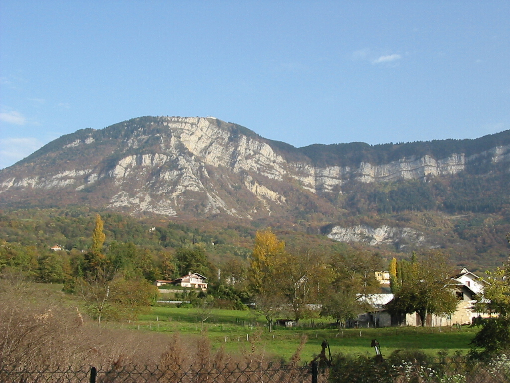
Mont Revard (French pronunciation: [mɔ̃ ʁəvaʁ], 1,562 m (5,125 ft)) is a mountain in the Bauges Massif near Aix-les-Bains in Savoie, France. The mountain is crossed by the D913 road between the villages of Saint-Jean-d'Arvey and Pugny-Chatenod near Aix-les-Bains. The ski resort of Le Revard is situated on the northern edge of the mountain at an elevation of 1,537 m (5,043 ft).[1]
| Mont Revard | |
|---|---|
 | |
| Highest point | |
| Elevation | 1,562 m (5,125 ft) |
| Coordinates | 45°40′55″N 05°58′32″E |
| Geography | |
 Mont Revard France | |
| Location | Savoie, France |
| Parent range | Bauges |
The summit on the D913 is at an elevation of 1,463 m (4,800 ft) and was crossed on the penultimate stage of the 2013 Tour de France (Stage 20).[2][3] The Tour de France had crossed the pass twice previously and has had a stage finish twice on the summit.[4]
Climate
Mont Revard features a warm-summer humid continental climate (Köppen: Dfb) due to its altitude and far inland position. The climate can also be qualified as mountainous and the seasons are well marked.
Located at the western end of the french Alps, Mont Revard receives a lot of precipitation over the year and significant accumulations of snow, up to 8 m (26 ft 3 in) during the winter of 2012-2013.[5] Summers are quite warm and sunny but thunderstorms are not uncommon while winters are very cold and snowy.
Details of the climb
In 2013, the climb used by the Tour de France commences at Saint-Jean-d'Arvey and climbs 866 m (2,841 ft) in 15.9 km (9.9 mi) at an average gradient of 5.6%, and is ranked a Category 1 climb.[2]
From Aix-les-Bains, the climb to the ski resort at Le Revard via the D913 is 21.4 km (13.3 mi) long, climbing 1,277 m (4,190 ft) at an average gradient of 6%.[1] From Chambery, the climb via the D912/D913 is 25.0 km (15.5 mi) long with 1,267 m (4,157 ft) height gained at an average of 5.1%.[6]
Caving
The limestone plateau is conducive to karst formations. In the Bauges massif, collapse wells and snow pits are called tannes; they sometimes give access to active underground networks, such as the Garde-Cavale network accessible in particular from the Trou du Garde and the Creux de la Cavale.[7] This network totals a development of more than 50 km explored. The waters come out at the cave of the Doria,[8] whose flow varies from 14 l / s to 7 m3 / s, cave visible from Chambéry.
Tour de France
The mountain was crossed in 1991, when the altitude was shown as 1,418 m (4,652 ft)[4] and again in 1998, when the altitude was shown as 1,448 m (4,751 ft). The latter stage was neutralized in the wake of the 1998 Festina affair.[4]
In 1965 and 1972, the ski resort of Le Revard was used as a stage finish with the finishing line being situated at 1,500 m (4,921 ft). The 1965 stage was a mountain time trial won by Felice Gimondi.[4]
Appearances in Tour de France
| Year | Stage | Category | Start | Finish | Leader at the summit |
|---|---|---|---|---|---|
| 2013 | 20 | 1 | Annecy | Annecy Semnoz | |
| 1998 | 17 | 1 | Albertville | Aix-les-Bains | Stage neutralized |
| 1991 | 19 | 2 | Morzine | Aix-les-Bains | |
Tour de France stage finishes
| Year | Stage | Start of stage | Distance (km) | Category | Stage winner | Yellow jersey |
|---|---|---|---|---|---|---|
| 1972 | 15 | Aix-les-Bains | 28 | 1 | ||
| 1965 | 18 | Aix-les-Bains | 26.9 | 1 (ITT) | ||
References
- "Mont Revard: Aix les Bains". climbbybike.com. Retrieved 11 July 2013.
- "Stage 20: Annecy / Annecy - Semnoz". Le Tour de France. Archived from the original on 27 May 2013. Retrieved 11 July 2013.
- "Le Tour de France à Savoie Grand Revard" (in French). www.savoiegrandrevard.com. Archived from the original on 12 July 2013. Retrieved 11 July 2013.
- "Le Mont Revard ou Le Revard dans le Tour de France" (in French). ledicodutour. Retrieved 12 August 2022.
- "Grand Revard : 8 m durant l'hiver... un record d'enneigement". 27 April 2013.
{{cite web}}: CS1 maint: date and year (link). - "Mont Revard: Chambery". climbbybike.com. Retrieved 11 July 2013.
- "Réseau souterrain du Garde-Cavale" (PDF). Retrieved 2017-04-06.
- "Grotte de la Doria" (PDF). Retrieved 2017-04-06.
External links
На других языках
- [en] Mont Revard
[fr] Mont Revard
Le mont Revard est un sommet du département français de la Savoie s'élevant à 1 563 mètres d'altitude à la Tour de l'Angle Est, dans les contreforts septentrionaux du massif des Bauges. Il domine la région d'Aix-les-Bains et du lac du Bourget. La partie supérieure de la montagne est un plateau constitué, comme la plupart des sommets des Préalpes, de calcaire urgonien. La montagne est intégrée à plusieurs zones naturelles d'intérêt écologique, faunistique et floristique. Des espèces végétales et animales rares résident en effet dans ses forêts. En raison de sa richesse naturelle et son histoire, le site est reconnu à l'échelle nationale.Другой контент может иметь иную лицензию. Перед использованием материалов сайта WikiSort.org внимательно изучите правила лицензирования конкретных элементов наполнения сайта.
WikiSort.org - проект по пересортировке и дополнению контента Википедии