geo.wikisort.org - Mountains
Mont Durand (or Arbenhorn) is a mountain in the Swiss Pennine Alps in the canton of Valais. It is located west of the Ober Gabelhorn between the valleys of Zinal and Zmutt. The Glacier Durand flows on its northern side before reaching the larger Zinal Glacier.
| Mont Durand | |
|---|---|
| Arbenhorn | |
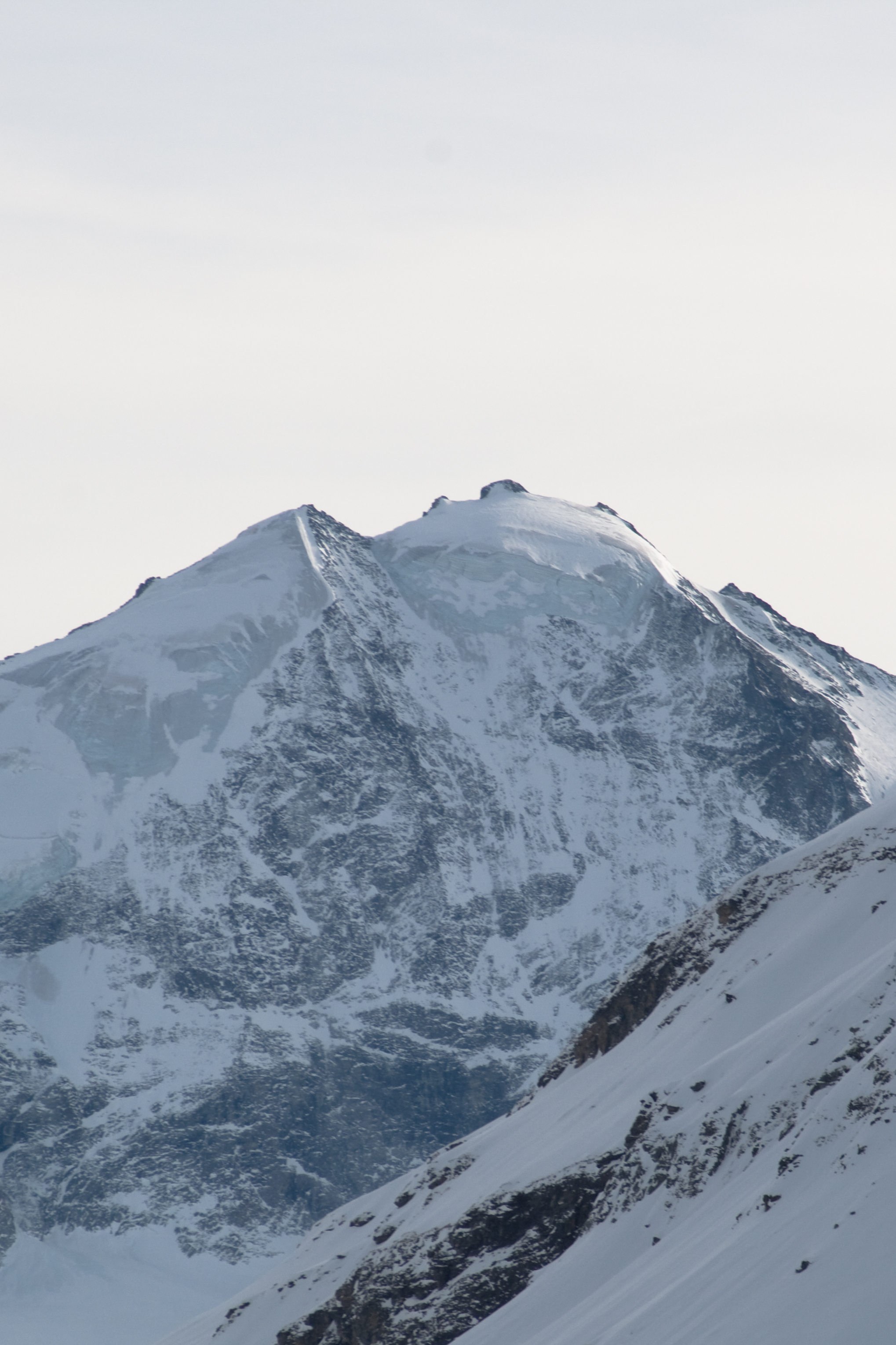 Mont Durand north face seen from Sorebois | |
| Highest point | |
| Elevation | 3,713 m (12,182 ft) |
| Prominence | 169 m (554 ft) [1] |
| Parent peak | Ober Gabelhorn |
| Coordinates | 46°02′01.5″N 7°39′01.9″E |
| Geography | |
 Mont Durand Location in Switzerland | |
| Location | Valais, Switzerland |
| Parent range | Pennine Alps |
References
- Retrieved from the Swisstopo topographic maps. The key col is the Arbenjoch (3,544 m).
External links
This article about a mountain, mountain range, or peak located in Valais is a stub. You can help Wikipedia by expanding it. |
На других языках
[de] Mont Durand
Der Mont Durand / Arbenhorn ist ein 3713 m ü. M. hoher Berg im Schweizer Kanton Wallis und liegt zwischen Zermatt im Mattertal und Zinal im Val d’Anniviers. Der Gipfel liegt westlich des Ober Gabelhorns. Der Mont Durand / Arbenhorn ist Teil der Sprachgrenze und einer der wenigen Berge in der Schweiz, die auf den amtlichen Landkarten des Bundesamts für Landestopografie Swisstopo zweisprachig benannt sind.- [en] Mont Durand
[fr] Mont Durand
La mont Durand, ou Arbenhorn, est un sommet des Alpes valaisannes, en Suisse, situé dans le canton du Valais, qui culmine à 3 712 m d'altitude[1].[it] Mont Durand
Il Mont Durand (3.713 m s.l.m. - detto anche Arbenhorn) è una montagna delle Alpi del Weisshorn e del Cervino nelle Alpi Pennine.Текст в блоке "Читать" взят с сайта "Википедия" и доступен по лицензии Creative Commons Attribution-ShareAlike; в отдельных случаях могут действовать дополнительные условия.
Другой контент может иметь иную лицензию. Перед использованием материалов сайта WikiSort.org внимательно изучите правила лицензирования конкретных элементов наполнения сайта.
Другой контент может иметь иную лицензию. Перед использованием материалов сайта WikiSort.org внимательно изучите правила лицензирования конкретных элементов наполнения сайта.
2019-2026
WikiSort.org - проект по пересортировке и дополнению контента Википедии
WikiSort.org - проект по пересортировке и дополнению контента Википедии