geo.wikisort.org - Mountains
Moel Cynghorion (the Hill of the Councillors) is a mountain in Snowdonia, North Wales. It lies two miles north-west of Snowdon, and forms part of the Moel Eilio Horseshoe walk. The summit is situated on a wide plateau, marked by a pile of stones. The southern slopes are gentle, while the northern aspect is precipitous. The summit has close views of Clogwyn Du'r Arddu and Yr Wyddfa. Views from the summit can extend as far as Holyhead in Anglesey to nearby towns and villages in Gwynedd such as Caernarfon, Llanrug and Llanberis. On a clear day the Wicklow Mountains in Ireland can be seen across the Irish Sea, at a distance of approximately 80 miles.[1][2][3]
| Moel Cynghorion | |
|---|---|
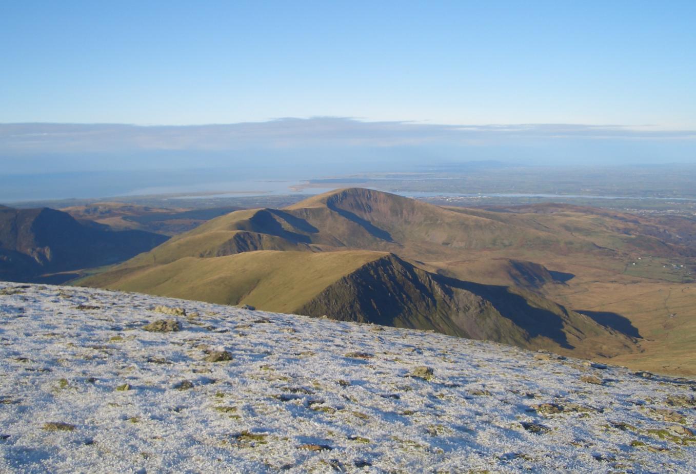 Moel Cynghorion with Moel Eilio behind from Crib y Ddysgl. | |
| Highest point | |
| Elevation | 674 m (2,211 ft) |
| Prominence | 176 m (577 ft) |
| Parent peak | Snowdon |
| Listing | Marilyn, Hewitt, Nuttall |
| Naming | |
| English translation | (bare/treeless) hill of counsels |
| Language of name | Welsh |
| Pronunciation | Welsh: [ˈmɔil kəŋˈhɔɾiɔn] |
| Geography | |
| Location | Gwynedd, Wales |
| Parent range | Snowdonia |
| OS grid | SH586563 |
| Topo map | OS Landranger 115 |
References
- Marsh, Terry (1984). The Summits of Snowdonia (London: Robert Hale, 1984). ISBN 0-7090-1456-2.
- Marsh, Terry. The Mountains of Wales (London: Hodder and Stoughton, 1985). ISBN 0-340-34827-5.
- Nuttall, John & Anne (1999). The Mountains of England & Wales – Volume 1: Wales (2nd edition ed.). Milnthorpe, Cumbria: Cicerone. ISBN 1-85284-304-7.
External links
This Gwynedd location article is a stub. You can help Wikipedia by expanding it. |
Текст в блоке "Читать" взят с сайта "Википедия" и доступен по лицензии Creative Commons Attribution-ShareAlike; в отдельных случаях могут действовать дополнительные условия.
Другой контент может иметь иную лицензию. Перед использованием материалов сайта WikiSort.org внимательно изучите правила лицензирования конкретных элементов наполнения сайта.
Другой контент может иметь иную лицензию. Перед использованием материалов сайта WikiSort.org внимательно изучите правила лицензирования конкретных элементов наполнения сайта.
2019-2026
WikiSort.org - проект по пересортировке и дополнению контента Википедии
WikiSort.org - проект по пересортировке и дополнению контента Википедии