geo.wikisort.org - Mountains
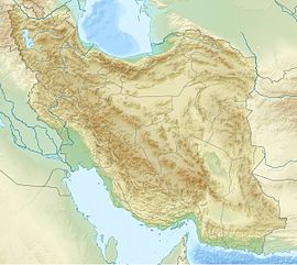
Mishoodaghi Mount is a mountain range in East Azerbaijan Province of Iran. It is located between Tasouj, Marand, and Shabestar cities. Mishodaghi peak has several peaks including: Ali-Alamdar (highest peak 3155 m), Falak daghi, Kooseh-Baba, and Uzoun-Bel.[1] Yam Ski Resort is located in northern foot hills of Mishodaghi.[2]
| Mishoodaghi | |
|---|---|
 Mishoodaghi and its foothills in spring. | |
| Highest point | |
| Elevation | 2,847 m (9,341 ft) 2,855 m (9,367 ft) |
| Coordinates | 38°19′33″N 45°37′14″E |
| Geography | |
| Location | East Azerbaijan, Iran |
Mishoodaghi has a diverse wild life. Since 2007, it is considered a protected area by Department of Environmental of Iran.
The best access route to Mishoodaghi is Road 32 (Iran) in between Tabriz-Marand. This road passes through north eastern hills of Mishoodaghi.
References
- "میشو داغی از جاذبه های گردشگری شهرستان مرند | پایگاه خبری صبح مرند". Archived from the original on 2015-04-07. Retrieved 2016-03-08. صبح مرند
- "پیست اسکی پیام | پیست پیام".
External link
 Media related to Mount Mishodaghi at Wikimedia Commons
Текст в блоке "Читать" взят с сайта "Википедия" и доступен по лицензии Creative Commons Attribution-ShareAlike; в отдельных случаях могут действовать дополнительные условия.
Другой контент может иметь иную лицензию. Перед использованием материалов сайта WikiSort.org внимательно изучите правила лицензирования конкретных элементов наполнения сайта.
Другой контент может иметь иную лицензию. Перед использованием материалов сайта WikiSort.org внимательно изучите правила лицензирования конкретных элементов наполнения сайта.
2019-2025
WikiSort.org - проект по пересортировке и дополнению контента Википедии
WikiSort.org - проект по пересортировке и дополнению контента Википедии
