geo.wikisort.org - Mountains
Malnesberget (Mount Malnes) is a 529-meter (1,736 ft)[1] mountain in the municipality of Bø in Nordland county, Norway. The mountain stands on the western side of the large island of Langøya, along the Malnesfjorden, just south of the villages of Hovden and Malnes (hence the name).[2] It can be climbed from the village of Malnes starting about 500 meters (1,600 ft) north of Tussen (elevation: 198 meters or 650 feet), a smaller hill located along Norwegian County Road 915, just west of Malnesberget.
| Malnesberget | |
|---|---|
 Malnesberget seen from Hovden | |
| Highest point | |
| Elevation | 529 m (1,736 ft)[1] |
| Coordinates | 68.7993°N 14.5662°E[2] |
| Geography | |
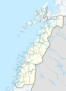 Malnesberget Location of the mountain  Malnesberget Malnesberget (Norway) | |
| Location | Nordland, Norway |
| Climbing | |
| Easiest route | From below Tussen near Malnes |
References
- "Malnesberget" (in Norwegian). Statens kartverk Norgeskart.no.
- "Malnesberget, Bø (Nordland)" (in Norwegian). yr.no. Retrieved 2018-12-29.
This article about a mountain, mountain range, or peak in Nordland is a stub. You can help Wikipedia by expanding it. |
Текст в блоке "Читать" взят с сайта "Википедия" и доступен по лицензии Creative Commons Attribution-ShareAlike; в отдельных случаях могут действовать дополнительные условия.
Другой контент может иметь иную лицензию. Перед использованием материалов сайта WikiSort.org внимательно изучите правила лицензирования конкретных элементов наполнения сайта.
Другой контент может иметь иную лицензию. Перед использованием материалов сайта WikiSort.org внимательно изучите правила лицензирования конкретных элементов наполнения сайта.
2019-2026
WikiSort.org - проект по пересортировке и дополнению контента Википедии
WikiSort.org - проект по пересортировке и дополнению контента Википедии