geo.wikisort.org - Mountains
Maithai jama Haphong[1] is the 6th highest peak of Bangladesh. It is located at the south-eastern part of the Chittagong hill tracts in the Bangladesh-India border area. It is not officially recognized by the Bangladesh government. This peak is also the 2nd highest peak of Reng Tlang range after Dumlong. On 7 December 2014, Fahim Hasan from Dhaka, a member of an adventure team BD Explorer[2] with the help of the adjacent local villagers summited the peak of Maithai jama Haphong[3] and measured this peak as 3,174 feet (967 meters)[4] by Garmin GPS device for the first time. The exact geo location of the highest point is N 22°00.714',E 92°35.863'.[5]
This article is being considered for deletion in accordance with Wikipedia's deletion policy. Please share your thoughts on the matter at this article's deletion discussion page. |
| Maithai jama Haphong | |
|---|---|
 View of Maithai jama Haphong from pukur para trail | |
| Highest point | |
| Elevation | 967.43 m (3,174.0 ft) |
| Prominence | 170 m (560 ft) |
| Isolation | 3 km (1.9 mi) |
| Listing | List of mountains of Bangladesh |
| Coordinates | 22°00′43″N 92°35′52″E |
| Geography | |
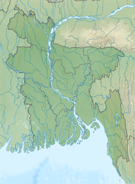
 Maithai jama Haphong Geo position of Maithai jama Haphong | |
| Location | Bilaichori Rangamati |
| Parent range | Reng Tlang |
| Geology | |
| Mountain type | Mountain |
Stream (jhiri) route to the summit is very adventurous & the view from the peak is extraordinary.[6]
See also
- Geography of Bangladesh
- List of countries by highest point
- List of mountains of Bangladesh
References
- www.panoramio.com https://web.archive.org/web/20141219052551/http://www.panoramio.com/map. Archived from the original on 2014-12-19.
{{cite web}}: Missing or empty|title=(help) - "'The Last Horizon'-2013 by BD Explorer". Wikiloc. Archived from the original on 2015-10-02. Retrieved 9 February 2021.
- "Panoramio - Photo of Big body of Maithai jama Haphong". Panoramio. Archived from the original on 2016-03-04. Retrieved 9 February 2021.
- "Wikiloc | Picture of Maithai JAMA Haphong by BD Explorer (2/3)".
- "Photo of Maithai Jama Haphong by BD Explorer". Wikiloc. December 17, 2014. Archived from the original on 2016-03-08.
- "Panoramio - Photo of View from the top". Panoramio. Archived from the original on 2016-02-20. Retrieved 9 February 2021.
На других языках
[de] Maithai Jama Haphong
Der Maithai Jama Haphong (auch Maithaijama Haphong) ist ein Berg in Bangladesch an der Grenze zu Indien.- [en] Maithai jama Haphong
Другой контент может иметь иную лицензию. Перед использованием материалов сайта WikiSort.org внимательно изучите правила лицензирования конкретных элементов наполнения сайта.
WikiSort.org - проект по пересортировке и дополнению контента Википедии