geo.wikisort.org - Mountains
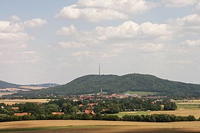
The Löbauer Berg (Upper Sorbian: Lubijska hora) is an extinct volcano and, with a height of 447.9 m above sea level (NHN),[1] the Hausberg or local hill of the eponymous town of Löbau in the county of Görlitz in southeastern Saxony. It is covered in mixed mountain woodland consisting of common oak, hornbeam and small-leave lime.
| Löbauer Berg / Upper Sorbian: Lubijska hora | |
|---|---|
 Schafberg (left) and Löbauer Berg (right), seen from Bubenik. The town of Löbau is in the foreground. | |
| Highest point | |
| Elevation | 447.9 m above sea level (NHN) (1,469 ft) |
| Isolation | 0.6 km → Schafberg (Löbau) |
| Listing | – King Frederick Augustus Tower (observation tower) – Double summit with the Schafberg |
| Coordinates | 51°05′27″N 14°41′33″E |
| Geography | |
 Löbauer Berg / Upper Sorbian: Lubijska hora near Löbau, Görlitz county, Saxony (Germany) | |
| Parent range | Lusatian Highlands |
| Geology | |
| Mountain type | volcanic pipe |
| Type of rock | Basalt (Nephelin dolerite) |
References
- Map services of the Federal Agency for Nature Conservation
На других языках
[de] Löbauer Berg
Der Löbauer Berg (obersorbisch Lubijska hora) ist ein erloschener Vulkan und mit einer Höhe von 447,9 m ü. NHN[1] der Hausberg der namensgebenden Stadt Löbau im Landkreis Görlitz im südöstlichen Sachsen. Er ist bestanden mit Bergmischwald, bestehend aus Stieleiche, Hainbuche und Winter-Linde.- [en] Löbauer Berg
Текст в блоке "Читать" взят с сайта "Википедия" и доступен по лицензии Creative Commons Attribution-ShareAlike; в отдельных случаях могут действовать дополнительные условия.
Другой контент может иметь иную лицензию. Перед использованием материалов сайта WikiSort.org внимательно изучите правила лицензирования конкретных элементов наполнения сайта.
Другой контент может иметь иную лицензию. Перед использованием материалов сайта WikiSort.org внимательно изучите правила лицензирования конкретных элементов наполнения сайта.
2019-2025
WikiSort.org - проект по пересортировке и дополнению контента Википедии
WikiSort.org - проект по пересортировке и дополнению контента Википедии