geo.wikisort.org - Mountains
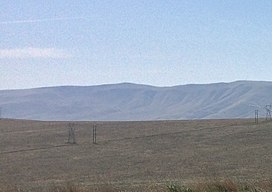
Lookout Summit—officially listed as "Lookout" in the Geographic Names Information System[3]—is the highest point in Benton County,[4] in the U.S. state of Washington. The mountain is also the highest point in the Rattlesnake Hills,[5] with an elevation 98 ft (30 m) higher than the neighboring, more-well-known Rattlesnake Mountain—which is the second highest peak in the range (as well as the county).[5]
| Lookout Summit | |
|---|---|
 The summit of Lookout Summit | |
| Highest point | |
| Elevation | 3,629 ft (1,106 m)[1][2] |
| Prominence | 1,829 ft (557 m)[1] |
| Isolation | 12.94 mi (20.82 km)[1] |
| Listing |
|
| Coordinates | 46°26′51″N 119°50′24″W[3] |
| Geography | |
| Location | Benton County, Washington |
| Parent range | Rattlesnake Hills |
| Topo map | USGS Maiden Spring[2] |
References
- "Rattlesnake Hills Lookout". Peakbagger.com. Retrieved May 3, 2018.
- "Maiden Spring Topographic Map". United States Geological Survey. Retrieved May 3, 2018.
- "Lookout". Geographic Names Information System. Retrieved May 3, 2018.
- "Washington County High Points". Peakbagger.com. Retrieved May 3, 2018.
- "Rattlesnake Hills". Peakbagger.com. Retrieved May 3, 2018.
На других языках
[de] Lookout Summit
Der Lookout Summit — offiziell als „Lookout“ im Geographic Names Information System geführt[3] — ist der höchste Punkt im Benton County[4] im US-Bundesstaat Washington. Der Berg ist ebenso der höchste Punkt der Rattlesnake Hills,[5] denn mit 1.106 Metern ist er 30 m höher als der benachbarte Rattlesnake Mountain.[5]- [en] Lookout Summit
Текст в блоке "Читать" взят с сайта "Википедия" и доступен по лицензии Creative Commons Attribution-ShareAlike; в отдельных случаях могут действовать дополнительные условия.
Другой контент может иметь иную лицензию. Перед использованием материалов сайта WikiSort.org внимательно изучите правила лицензирования конкретных элементов наполнения сайта.
Другой контент может иметь иную лицензию. Перед использованием материалов сайта WikiSort.org внимательно изучите правила лицензирования конкретных элементов наполнения сайта.
2019-2025
WikiSort.org - проект по пересортировке и дополнению контента Википедии
WikiSort.org - проект по пересортировке и дополнению контента Википедии
