geo.wikisort.org - Mountains
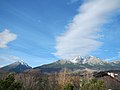
Lomnický štít (English: Lomnica Peak[1][2] or Lomnický Peak[3][4], Hungarian: Lomnici-csúcs, German: Lomnitzer Spitze, Polish: Łomnica) is one of the highest and most visited mountain peaks in the High Tatras mountains of Slovakia. Connected by cable car to Tatranská Lomnica, its summit is 2,634 metres (8,642 ft) above sea level, making it the second highest peak in the High Tatras after Gerlachovský štít (2654 m).
This article needs additional citations for verification. (November 2018) |
| Lomnický štít | |
|---|---|
 Lomnický štít (left) and Kežmarský štít (2558 m) | |
| Highest point | |
| Elevation | 2,634.4 m (8,643 ft) |
| Prominence | 434 m (1,424 ft) |
| Coordinates | 49°11′45″N 20°12′46″E |
| Naming | |
| Nickname | Lomničák |
| Geography | |
 Lomnický štít Location in Slovakia | |
| Location | Tatra National Park, Poprad, Prešov, Slovakia |
| Parent range | High Tatras |
| Climbing | |
| First ascent | Štefan Fábry, around 1760-1790 |
| Easiest route | cable car |
Local shoemaker and amateur miner Jakab Fábry stated he made an ascent around 1760–1790, but the first recorded ascent was made by the English traveler Robert Townson and guide on 16 August 1793. He measured the elevation of the peak to be 2633 m, a meter below the actual elevation.[5] The first winter ascent was made in 1891.
In the past, Lomnický štít was called as Vater (Father), Grossvater (Grandfather), Königsberg (King's Mountain), Królowa Tatr and Królowa Tatrzańska (Princess of the Tatra), Petra altissima kesmarkiensis and allerhöchster Kaisermärkerfels (Highest cliff of Kežmarok), höchste Kaisermärker Spitze (Highest peak of Kežmarok), késmárki hegyek (Hills of Kežmarok), Kesmarker Spitze or Lumnitzer Spitze (Peak of Kežmarok or Peak of Lomnica)[citation needed].
Since 1940, tourists have reached the peak by cable car. They are allowed to stay on the peak for 50 minutes. The cable car system is normally closed in the month of May for annual maintenance. It is also possible to climb the peak from Lomnický Saddle, but this is only permitted with a mountain guide.
There is a solar observatory and weather station permanently manned year round at the terminus of the cable car.
Access
After Gerlachovský štít is Lomnický štít the second most guided peak in High Tatras. The most used is the Classic route also known as Emericyho nárek. The path is popular mostly because of easy access. You can take a lift from Tatranská Lomnica up to Lomnické sedlo (2189 meters above sea level) and from there straight forward to the top. The harder sections of the path are secured by steel steps and chains.
Another very popular route is called Jordanova cesta. The route begins at Starý Smokovec and within 3 hours and 35 minutes of hiking you will end up at Téryho Chata, where the challenging section begins. The route from here is relatively hard for orientation, the steep sections are however secured by chains.
The route called Medené Lávky starts at chata pri Zelenom plese, we head along an unmarked sidewalk over a kneeling path to the Čierny štít massif. At the waterfall we climb to the right to a pillar secured by chains. After it we will climb the threshold of the Veľká zmrzlá dolina, cross the stream and head left to the Medená kotlina. Through lifeless rubble fields we get to the main gutter, falling from the saddle between Kežmarok peaks. The path is very exposed to stone fall and recently is not as popular.
Gypsyho ferrata just like the classic route Emericyho nárek starts at Lomnické Sedlo, the real starting point is however hard to find. Gypsyho ferrata is secured with chains and steel steps, however full ferrata gear is due to extreme exposure in the upper section necessary.
The route through Cmiter starts at Skalnaté pleso, leading through Skalnatá dolina underneath to the massifs of Vidlové veže and Kežmarský štít. The route is exposed to stone fall. The harder sections require rope, since the path is not secured by any additional gear such as chains.
Climate
| Climate data for Lomnický štít (1991−2020 normals, extremes 1980−present) | |||||||||||||
|---|---|---|---|---|---|---|---|---|---|---|---|---|---|
| Month | Jan | Feb | Mar | Apr | May | Jun | Jul | Aug | Sep | Oct | Nov | Dec | Year |
| Record high °C (°F) | 3.1 (37.6) |
6.2 (43.2) |
8.5 (47.3) |
9.0 (48.2) |
14.5 (58.1) |
17.4 (63.3) |
19.5 (67.1) |
24.0 (75.2) |
14.3 (57.7) |
12.5 (54.5) |
10.5 (50.9) |
8.4 (47.1) |
24.0 (75.2) |
| Mean maximum °C (°F) | −0.3 (31.5) |
−0.6 (30.9) |
1.4 (34.5) |
4.6 (40.3) |
9.2 (48.6) |
14.1 (57.4) |
15.3 (59.5) |
15.1 (59.2) |
10.9 (51.6) |
8.2 (46.8) |
4.2 (39.6) |
1.4 (34.5) |
16.3 (61.3) |
| Average high °C (°F) | −8.2 (17.2) |
−8.4 (16.9) |
−6.3 (20.7) |
−1.9 (28.6) |
2.6 (36.7) |
6.7 (44.1) |
8.4 (47.1) |
8.7 (47.7) |
4.1 (39.4) |
0.6 (33.1) |
−3.3 (26.1) |
−7.0 (19.4) |
−0.3 (31.5) |
| Daily mean °C (°F) | −10.1 (13.8) |
−10.5 (13.1) |
−8.8 (16.2) |
−4.5 (23.9) |
0.1 (32.2) |
3.8 (38.8) |
5.6 (42.1) |
6.0 (42.8) |
1.8 (35.2) |
−1.4 (29.5) |
−5.3 (22.5) |
−8.8 (16.2) |
−2.7 (27.1) |
| Average low °C (°F) | −11.9 (10.6) |
−12.6 (9.3) |
−11.0 (12.2) |
−7.0 (19.4) |
−2.4 (27.7) |
1.1 (34.0) |
2.9 (37.2) |
3.4 (38.1) |
−0.3 (31.5) |
−3.3 (26.1) |
−6.9 (19.6) |
−10.5 (13.1) |
−4.9 (23.2) |
| Mean minimum °C (°F) | −21.9 (−7.4) |
−22.6 (−8.7) |
−19.8 (−3.6) |
−16.0 (3.2) |
−9.9 (14.2) |
−5.7 (21.7) |
−3.6 (25.5) |
−3.3 (26.1) |
−7.4 (18.7) |
−12.9 (8.8) |
−16.7 (1.9) |
−20.3 (−4.5) |
−25.1 (−13.2) |
| Record low °C (°F) | −30.8 (−23.4) |
−29.9 (−21.8) |
−31.2 (−24.2) |
−22.3 (−8.1) |
−17.0 (1.4) |
−9.4 (15.1) |
−7.2 (19.0) |
−11.0 (12.2) |
−11.6 (11.1) |
−19.2 (−2.6) |
−23.2 (−9.8) |
−28.5 (−19.3) |
−31.2 (−24.2) |
| Average precipitation mm (inches) | 161.3 (6.35) |
153.2 (6.03) |
162.8 (6.41) |
144.3 (5.68) |
144.5 (5.69) |
147.8 (5.82) |
188.2 (7.41) |
142.6 (5.61) |
110.7 (4.36) |
119.2 (4.69) |
140.4 (5.53) |
156.1 (6.15) |
1,771.1 (69.73) |
| Average precipitation days (≥ 1.0 mm) | 16.2 | 16.1 | 16.7 | 15.7 | 16.6 | 15.8 | 16.9 | 13.2 | 11.8 | 13.1 | 14.4 | 16.4 | 182.9 |
| Source: infoclimat.fr[6][better source needed] | |||||||||||||
Gallery
 Slavkovský štít (left) and Lomnický štít (center right) as seen from Tatranská Lomnica, Slovakia
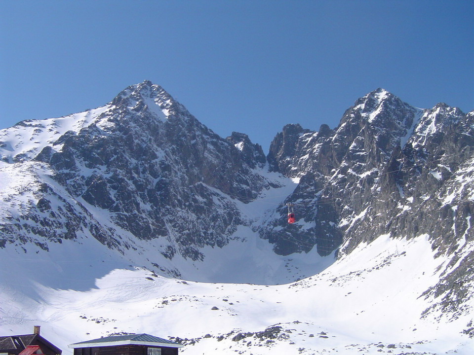
 From left: Lomnický štít, Vidlové veže, Kežmarský štít, and Malý Kežmarský štít, as viewed from Skalnaté pleso
 Solar observatory Lomnický štít (Slovakia) built in 1962
 The observatory as seen from Tatranská Lomnica


References
- Nározná, Renáta, & Colin Saunders. 2012. The High Tatras: Slovakia and Poland, Including the Western & White Tatras. Milnthorpe, UK: Cicerone, p. 156.
- Cohen, Saul Bernard. 2008. The Columbia Gazetteer of the World: P to Z. New York: Columbia University Press, p. 3822.
- Brooks, Andrew. 2016. Children's Illustrated Atlas. London: Dorling Kindersley, p. 69.
- Lovejoy, Alice Osborne. 2014. Army Film and the Avant Garde: Cinema and Experiment in the Czechoslovak Military. Bloomington: Indiana University Press, p. 223.
- Gajewski, Jerzy W. "Robert Townson - The Great Explorer of the Tatra" (PDF). Alpine Journal: 114.
- "Normales et records pour la période 1991-2020 à Lomnický štít". infoclimat.fr. Retrieved February 18, 2022.
Sources
External links
- UNESCO — Natural Reserves of Tatras Mountains
- Tatry.org: Tatry Open Directory
- High Tatra Mountains visualized in 3D
- 3D scan of Lomnický peak, one of the highest mountain peaks in the High Tatras mountains.
Authority control | |
|---|---|
| General |
|
| National libraries | |
This Prešov Region geography article is a stub. You can help Wikipedia by expanding it. |
На других языках
[de] Lomnický štít
Der Lomnický štít (slowakisch umgangssprachlich Lomničák, deutsch Lomnitzer Spitze, ungarisch Lomnici-csúcs, polnisch Łomnica)[1] ist mit 2634 m n.m. nach dem Gerlachovský štít und Gerlachovská veža der dritthöchste Berg der Hohen Tatra und der Slowakei. Er gilt als der höchste permanente Arbeitsplatz der Slowakei.- [en] Lomnický štít
[es] Lomnický štít
Lomnický štít (en español: pico Lomnica[1][2] o pico Lomnický,[3][4] húngaro: Lomnici-csúcs, alemán: Lomnitzer Spitze, polaco: Łomnica) es uno de los picos más altos y visitados de los Altos Tatras de Eslovaquia. Conectado por un teleférico con Tatranská Lomnica, su cima está a 2.634 metros sobre el nivel del mar, lo que lo convierte en el segundo pico más alto de los Altos Tatras después del Gerlachovský štít (2.654 m).[fr] Lomnický štít
Le Lomnický štít (prononciation : /lɔmɲɪt͡skiː ʃciːt/ ; hongrois : Lomnici-csúcs ; allemand : Lomnitzer Spitze ; polonais : Łomnica) est, avec ses 2 634 mètres d'altitude, le troisième plus haut sommet de la Slovaquie, de la chaîne des Tatras et de toutes les Carpates mais fut jusqu'au XIXe siècle considéré comme le plus haut.[ru] Ломницки-Штит
Ломницки-Штит[2] (словацк. Lomnický štít) — гора в Высоких Татрах. Её высота над уровнем моря составляет 2634 м. Название горы происходит от местечка Татранска Ломница у её подножья. Штит по-словацки означает «щит», «пик», «вершина».Другой контент может иметь иную лицензию. Перед использованием материалов сайта WikiSort.org внимательно изучите правила лицензирования конкретных элементов наполнения сайта.
WikiSort.org - проект по пересортировке и дополнению контента Википедии