geo.wikisort.org - Mountains
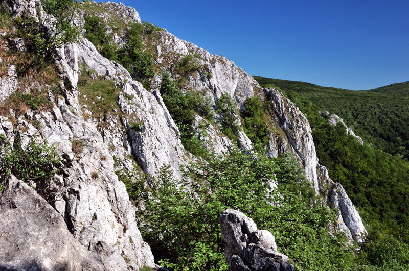
The Little Carpathians (also: Lesser Carpathians, Slovak: Malé Karpaty; German: Kleine Karpaten; Hungarian: Kis-Kárpátok) are a low, about 100 km long, mountain range, part of the Carpathian Mountains. The mountains are situated in Western Slovakia, covering the area from Bratislava to Nové Mesto nad Váhom, and northeastern Austria, where a very small part called Hundsheimer Berge (or Hainburger Berge) is located south of the Devín Gate. The Little Carpathians are bordered by Záhorie Lowland in the west and the Danubian Lowland in the east.
| Little Carpathians | |
|---|---|
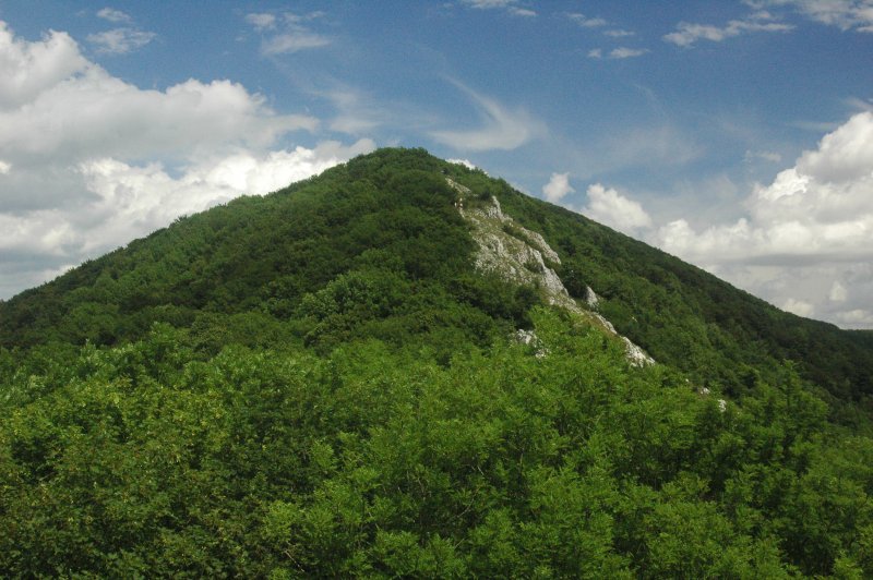
 Little Carpathians near Plavecké Podhradie | |
| Highest point | |
| Peak | Záruby |
| Elevation | 768 m (2,520 ft) |
| Coordinates | 48°31′25″N 17°23′33″E |
| Geography | |
 Little Carpathians (shown in grey cross-hatching) within the geomorphological division of Slovakia
| |
| Countries | Slovakia and Austria |
| Range coordinates | 48°25′N 17°15′E |
| Parent range | Western Carpathians |
In 1976, the Little Carpathians were declared a protected area under the name Little Carpathians Protected Landscape Area, covering 646.1 km2 (249.5 sq mi). The area is rich in flora and fauna diversity and contains numerous castles, most notably the Bratislava Castle, and caves. Driny is the only cave open to the public. The three highest mountains are Záruby at 768 m (2,520 ft), Vysoká at 754 m (2,474 ft), and Vápenná at 752 m (2,467 ft).
Description
Geomorphologically, the Little Carpathians belong into the Alps-Himalaya System, the Carpathian Mountains sub-system, its province Western Carpathians, and its subprovince the Inner Western Carpathians.
The Little Carpathians are further divided into four parts (from south to north): Devín Carpathians (Slovak: Devínske Karpaty), Pezinok Carpathians (Slovak: Pezinské Karpaty), Brezová Carpathians (Slovak: Brezovské Karpaty) and Čachtice Carpathians (Slovak: Čachtické Karpaty).
| Mountain range | Division | Subdivision |
| Little Carpathians | Devín Carpathians (Slovak: Devínske Karpaty) – in Bratislava | Devínska Kobyla (Slovak: Devínska Kobyla) |
| Bratislava Foothills (Slovak: Bratislavské predhorie) | ||
| Lamač Gate (Slovak: Lamačská brána) | ||
| Devín Gate (Slovak: Devínska brána) | ||
| Pezinok Carpathians (Slovak: Pezinské Karpaty) – from Bratislava to Buková | Homoľa Carpathians (Slovak: Homoľské Karpaty) | |
| Kuchynská hornatina | ||
| Stupava Foothills (Slovak: Stupavské predhorie) | ||
| Biele hory | ||
| Smolenická vrchovina | ||
| Lošonská kotlina | ||
| Plavecké predhorie | ||
| Bukovská brázda | ||
| Brezová Carpathians (Slovak: Brezovské Karpaty) – from Buková to Prašník | Dobrovodská kotlina | |
| Čachtice Carpathians (Slovak: Čachtické Karpaty) – from Prašník to Nové Mesto nad Váhom | Plešivec | |
| Nedze |
The mountains are densely forested (90% being broad-leaved trees), and the southeastern part contains extensive vineyards (e.g. Rača, Pezinok, Modra). Several castles or castle ruins are situated in the Little Carpathians, for example Devín, Čachtice, Červený Kameň, and Smolenice castles.
Geologically, the mountain range is part of the Tatra-Fatra Belt of core mountains. There are several active faults, which have produced earthquakes. Of them the most notable is the Dobra Voda fault (1906 and 1930 produced 8.5° and 7.5° EMS-98 or equal to = 5.7 and 5.0).[2] This particular fault is closely monitored because of its proximity to the NPP Jaslovske Bohunice (approx. 15 km away). The Little Carpathians are seismically one of the most active regions in Slovakia and epicentres of earthquakes with approximate magnitude of 2.5 on Richter magnitude scale are located here.[3]

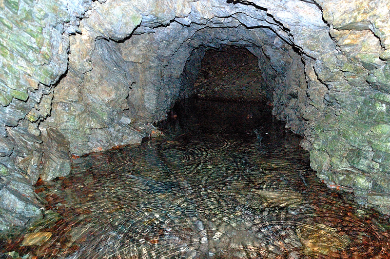
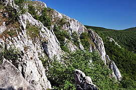
There are a total of eight karst areas in the Little Carpathians: the Devín Carpathians, Borinka (Pajštún), Cajlan, Kuchyňa-orešany, Plavecký, Smolenice, Dobrovodský, and Čachtice karsts. The most important karst forms include caves Deravá, Tmavá skala, Driny, and Čachtická, and caves along the Borinský potok. Driny, a limestone cave, is the only cave open to public. Major streams include Vydrica and Suchý jarok.
Highest peaks
| Image | Slovak name | Height | Location & Notes |
|---|---|---|---|
 |
Záruby | 767.4 meters AMSL |
Above the village Smolenice |
 |
Vysoká | 754.3 meters AMSL |
Outside of the main ridge of the Little Carpathians, above the village Kuchyňa, summit offers extensive views |
 |
Vápenná (Roštún) | 752.2 meters AMSL |
Features a 4-meter tall concrete observation obelisk built in 2003 |
 |
Čertov kopec (vrch) | 751.8 meters AMSL |
Forested summit with no marked trails leading here |
 |
Veterlín | 723.5 meters AMSL |
|
 |
Havranica | 717.1 meters AMSL |
|
 |
Čelo | 716.0 meters AMSL |
Forested summit with no marked trails leading here |
 |
Veľká homoľa | 709.2 meters AMSL |
Since 2001, it has featured a 20-meter-tall observation tower on the summit |
 |
Čmeľok | 709.0 meters AMSL |
Features a military radar on the summit |
 |
Skalnatá | 704.2 meters AMSL |
Offers extensive views |
History
While being a low mountain range, the Little Carpathians were always considered a mountain barrier, often attaining a height of 500 meters, as they were surrounded by various lowlands, . In the past, various types of ore were mined in the Little Carpathians used for the production of gold, silver, antimony, manganese and pyrite.
During the Second World War, the Little Carpathians were the birthplace of the partisan group Janko Kráľ. Insurgency in the mountains lasted until the occupation by the Soviet Red Army in 1945.
Tourism
The Little Carpathians are a popular tourist destination in Western Slovakia. The mountains are used for hiking, cycling, tramping, backpacking, automobile and motorcycle tourism, skiing, cross-country skiing, and other winter sports. The mountain range contains a dense network of trails, and the recreational infrastructure is relatively well developed, especially in the south. The Little Carpathians are a popular destination for the inhabitants of Bratislava and other larger cities in the region.
Since the Middle Ages, the area has been known for its wines and wine-making traditions. Well known centers of local wine-making include Svätý Jur, Modra and Pezinok. The main tourist centers include the Slovak capital Bratislava, Pezinská Baba (halfway between Pezinok and Pernek) and Zochova chata (near Modra).
Images
 Kršlenica rocks
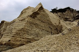 Sandstone rock Sandberg
 Hlboča waterfall
 Cave Piesková
 Cave Kabele
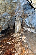 Speleothems in the cave PP1


See also
| Wikimedia Commons has media related to Little Carpathians. |
- Geomorphological division of Slovakia
- Tourism in Slovakia
References
- Mazúr, E., Lukniš, M. 1986, Geomorfologické členenie SSR a ČSSR. Časť Slovensko. Slovenská kartografia, Bratislava
- Madarás J. et al., Mineralia Slovaca 4/2012
- Moczo, P. (2011). Výsledky v seizmológii v r. 2009–2011 v SR. In Bratislava (Slovak Republic): Katedra astronómie, fyziky Zeme a meteorológie Fakulty fyziky, matematiky a informatiky Univerzity Komenského.: IX. Slovenská geofyzikálna konferencia. 22.6.2011
External links
Authority control | |
|---|---|
| General |
|
| National libraries | |
На других языках
[de] Kleine Karpaten
Die Kleinen Karpaten (slowakisch Malé Karpaty) sind ein zirka 85 Kilometer langer, bewaldeter Gebirgszug im Westen der Slowakei und im Osten Niederösterreichs. Sie markieren den Beginn des Karpatenbogens im Westen. Es handelt sich um ein Gebirge im geologischen Fatra-Tatra-Gebiet.- [en] Little Carpathians
[es] Pequeños Cárpatos
Los Pequeños Cárpatos, también Cárpatos Menores (en eslovaco, Malé Karpaty; en alemán, Kleine Karpaten en húngaro, Kis-Kárpátok) son una pequeña cadena montañosa de baja altitud de alrededor de 100 km de largo, parte de los montes Cárpatos. Las montañas están situadas en Eslovaquia Occidental, abarcando una área desde Bratislava a Nové Mesto nad Váhom, una muy pequeña parte llamada Hundsheimer Berge (o Hainburger Berge) está situada al sur de la puerta Devín en el noreste de Austria. Los Pequeños Cárpatos están limitados por la llanura Záhorie en el oeste y por la llanura danubiana en el este.[fr] Petites Carpates
Les Petites Carpates (slovaque : Malé Karpaty, allemand : Kleine Karpaten) sont un massif montagneux qui fait partie des Carpates occidentales, situé dans l’Ouest de la Slovaquie et, pour une petite partie, dans l’Est de l’Autriche. Elles s’étendent de Hainburg an der Donau et Bratislava à Nové Mesto nad Váhom.[it] Piccoli Carpazi
I Piccoli Carpazi (in slovacco Malé Karpaty, in tedesco Kleine Karpaten, in ungherese Kis-Kárpátok) sono una catena montuosa dei Carpazi. Si trovano nella Slovacchia e, marginalmente, in Austria.[ru] Малые Карпаты
Ма́лые Карпа́ты[1] (словацк. Malé Karpaty, нем. Kleine Karpaten) — часть Западных Карпат в Словакии, протянувшаяся от Нового Места-над-Вагом до Братиславы. Наивысшая точка — гора Заруби, 768 м над уровнем моря, расположенная недалеко от деревни Смоленице. Часть Малых Карпат находится также в Австрии, это Хундсхаймер-Берге с высшей точкой Хундсхаймер-Берг, 480 м.Другой контент может иметь иную лицензию. Перед использованием материалов сайта WikiSort.org внимательно изучите правила лицензирования конкретных элементов наполнения сайта.
WikiSort.org - проект по пересортировке и дополнению контента Википедии