geo.wikisort.org - Mountains
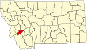
There are at least 34 named mountains in Deer Lodge County, Montana.
- Bear Mountain, 45°54′38″N 113°00′30″W, el. 8,648 feet (2,636 m)[1]
- Beaverhead Mountain, 46°00′02″N 113°23′56″W, el. 9,613 feet (2,930 m)[2]
- Blizzard Hill, 46°15′07″N 112°34′17″W, el. 7,638 feet (2,328 m)[3]
- Cottonwood Mountain, 46°13′19″N 112°38′28″W, el. 6,942 feet (2,116 m)[4]
- East Goat Peak, 45°57′22″N 113°22′47″W, el. 10,390 feet (3,170 m)[5]
- East Pintler Peak, 45°56′54″N 113°30′01″W, el. 9,442 feet (2,878 m)[6]
- Fish Peak, 46°00′19″N 113°20′07″W, el. 10,197 feet (3,108 m)[7]
- Garrity Mountain, 46°08′46″N 113°05′24″W, el. 8,045 feet (2,452 m)[8]
- Gospel Hill, 46°14′27″N 112°36′15″W, el. 7,270 feet (2,220 m)[9]
- Grassy Mountain, 46°01′48″N 113°00′51″W, el. 7,985 feet (2,434 m)[10]
- Grouse Hill, 46°10′55″N 113°10′23″W, el. 7,116 feet (2,169 m)[11]
- Hidden Lake Hill, 46°12′58″N 113°11′43″W, el. 7,716 feet (2,352 m)[12]
- Johnson Hill, 46°12′37″N 113°08′19″W, el. 8,041 feet (2,451 m)[13]
- Long Peak, 45°58′08″N 113°21′18″W, el. 9,521 feet (2,902 m)[14]
- McGlaughlin Peak, 45°58′06″N 113°28′06″W, el. 9,478 feet (2,889 m)[15]
- Mount Evans (Montana), 46°03′00″N 113°11′26″W, el. 10,594 feet (3,229 m)[16]
- Mount Haggin, 46°05′14″N 113°05′47″W, el. 10,607 feet (3,233 m)[17]
- Mount Howe, 46°02′53″N 113°12′59″W, el. 10,472 feet (3,192 m)[18]
- Needle Peak, 45°57′56″N 113°20′43″W, el. 9,226 feet (2,812 m)[19]
- Nipple Peak, 45°56′33″N 113°23′02″W, el. 9,662 feet (2,945 m)[20]
- Olson Mountain, 46°12′27″N 113°04′42″W, el. 8,865 feet (2,702 m)[21]
- Orofino Mountain, 46°14′29″N 112°38′35″W, el. 6,883 feet (2,098 m)[22]
- Pine Hill, 45°50′21″N 113°20′45″W, el. 6,558 feet (1,999 m)[23]
- Pintler Peak, 45°56′55″N 113°30′00″W, el. 9,478 feet (2,889 m)[24]
- Queener Mountain, 46°01′24″N 113°18′03″W, el. 10,148 feet (3,093 m)[25]
- Saddle Mountain, 45°57′33″N 113°23′15″W, el. 10,197 feet (3,108 m)[26]
- Saratoga Mountain, 46°15′39″N 112°35′53″W, el. 6,952 feet (2,119 m)[27]
- Short Peak, 46°03′34″N 113°06′25″W, el. 10,282 feet (3,134 m)[28]
- Silver Hill, 46°08′24″N 113°13′57″W, el. 7,831 feet (2,387 m)[29]
- Spring Hill, 46°10′37″N 113°10′17″W, el. 6,890 feet (2,100 m)[30]
- Sugarloaf Mountain, 46°00′47″N 112°57′23″W, el. 7,677 feet (2,340 m)[31]
- Tower Peak, 45°57′51″N 113°20′06″W, el. 8,809 feet (2,685 m)[32]
- West Goat Peak, 45°57′46″N 113°23′42″W, el. 10,784 feet (3,287 m)[33]
- Wraith Hill, 46°10′26″N 113°13′15″W, el. 7,201 feet (2,195 m)[34]
This list is incomplete; you can help by adding missing items. (February 2011) |
See also
Notes
- "Bear Mountain". Geographic Names Information System. United States Geological Survey.
- "Beaverhead Mountain". Geographic Names Information System. United States Geological Survey.
- "Blizzard Hill". Geographic Names Information System. United States Geological Survey.
- "Cottonwood Mountain". Geographic Names Information System. United States Geological Survey.
- "East Goat Peak". Geographic Names Information System. United States Geological Survey.
- "East Pintler Peak". Geographic Names Information System. United States Geological Survey.
- "Fish Peak". Geographic Names Information System. United States Geological Survey.
- "Garrity Mountain". Geographic Names Information System. United States Geological Survey.
- "Gospel Hill". Geographic Names Information System. United States Geological Survey.
- "Grassy Mountain". Geographic Names Information System. United States Geological Survey.
- "Grouse Hill". Geographic Names Information System. United States Geological Survey.
- "Hidden Lake Hill". Geographic Names Information System. United States Geological Survey.
- "Johnson Hill". Geographic Names Information System. United States Geological Survey.
- "Long Peak". Geographic Names Information System. United States Geological Survey.
- "McGlaughlin Peak". Geographic Names Information System. United States Geological Survey.
- "Mount Evans". Geographic Names Information System. United States Geological Survey.
- "Mount Haggin". Geographic Names Information System. United States Geological Survey.
- "Mount Howe". Geographic Names Information System. United States Geological Survey.
- "Needle Peak". Geographic Names Information System. United States Geological Survey.
- "Nipple Peak". Geographic Names Information System. United States Geological Survey.
- "Olson Mountain". Geographic Names Information System. United States Geological Survey.
- "Orofino Mountain". Geographic Names Information System. United States Geological Survey.
- "Pine Hill". Geographic Names Information System. United States Geological Survey.
- "Pintler Peak". Geographic Names Information System. United States Geological Survey.
- "Queener Mountain". Geographic Names Information System. United States Geological Survey.
- "Saddle Mountain". Geographic Names Information System. United States Geological Survey.
- "Saratoga Mountain". Geographic Names Information System. United States Geological Survey.
- "Short Peak". Geographic Names Information System. United States Geological Survey.
- "Silver Hill". Geographic Names Information System. United States Geological Survey.
- "Spring Hill". Geographic Names Information System. United States Geological Survey.
- "Sugarloaf Mountain". Geographic Names Information System. United States Geological Survey.
- "Tower Peak". Geographic Names Information System. United States Geological Survey.
- "West Goat Peak". Geographic Names Information System. United States Geological Survey.
- "Wraith Hill". Geographic Names Information System. United States Geological Survey.
Municipalities and communities of Deer Lodge County, Montana, United States | ||
|---|---|---|
County seat: Anaconda | ||
| City |
|  |
| Unincorporated communities |
| |
| Ghost town |
| |
| Footnotes | ‡This populated place also has portions in an adjacent county or counties | |
| ||
Текст в блоке "Читать" взят с сайта "Википедия" и доступен по лицензии Creative Commons Attribution-ShareAlike; в отдельных случаях могут действовать дополнительные условия.
Другой контент может иметь иную лицензию. Перед использованием материалов сайта WikiSort.org внимательно изучите правила лицензирования конкретных элементов наполнения сайта.
Другой контент может иметь иную лицензию. Перед использованием материалов сайта WikiSort.org внимательно изучите правила лицензирования конкретных элементов наполнения сайта.
2019-2025
WikiSort.org - проект по пересортировке и дополнению контента Википедии
WikiSort.org - проект по пересортировке и дополнению контента Википедии