geo.wikisort.org - Mountains
Lake Amatitlán (Lago Amatitlán, Spanish pronunciation: [laɣo amatiˈtlan]) is a lake located within the Amatitlán caldera in south-central Guatemala, fairly close to Guatemala City. It lies in the central highlands, 1,186 m (3890 feet) above sea level.[2] Its maximum depth is 33 m (108 feet) and an average of 18 m (59 feet). The lake is 11 km (7 miles) long and 3 km (2 miles) wide; with an area of 15.2 square kilometers (5.9 sq mi) and a water volume of 0.286 cubic kilometers.
| Lake Amatitlán | |
|---|---|
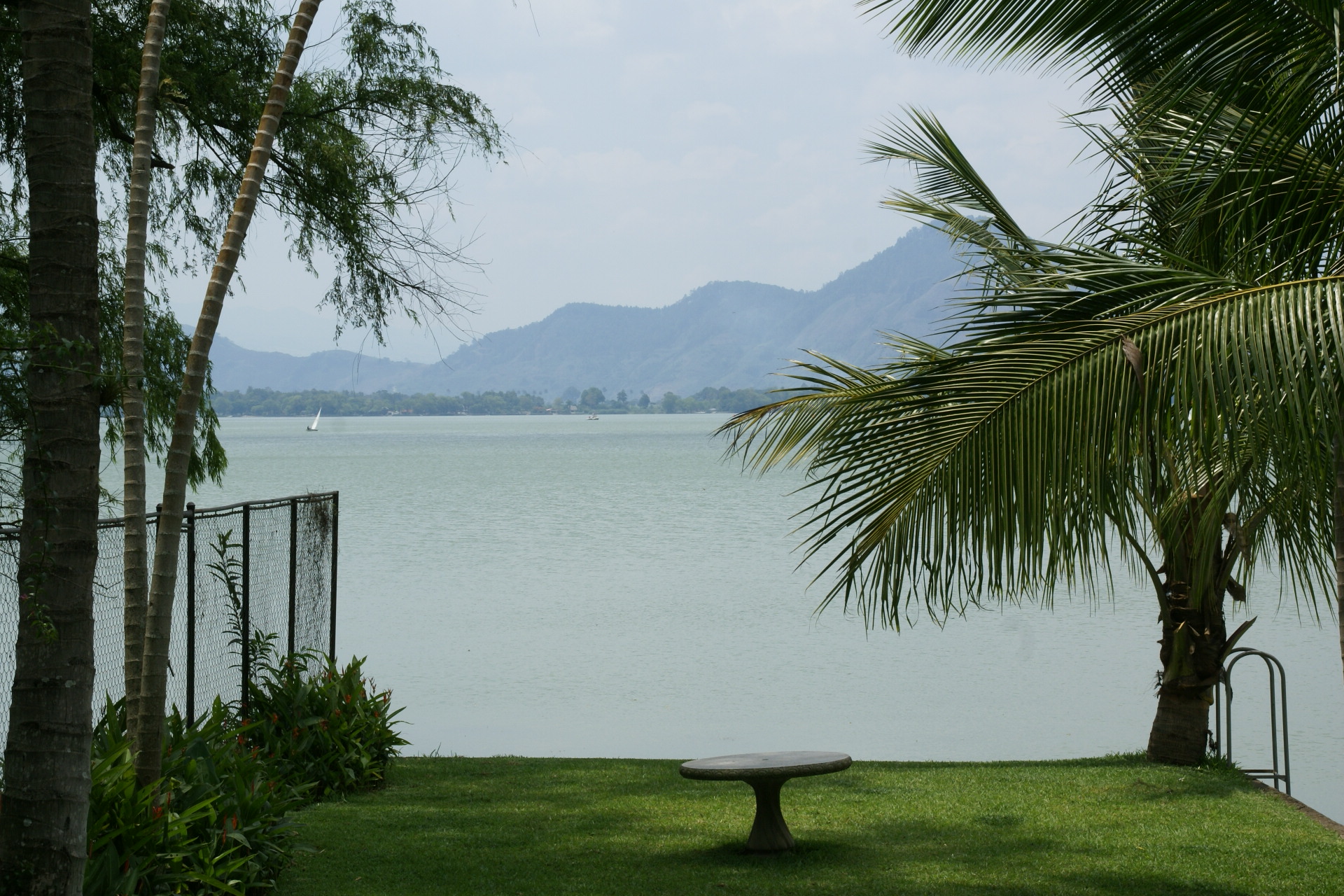
 The lake under Pacaya volcano (in background right) | |
 Lake Amatitlán | |
| Location | south-central Guatemala |
| Coordinates | 14°28′16″N 90°34′54″W |
| Primary inflows | Villalobos River |
| Primary outflows | Michatoya River |
| Catchment area | 368 km2 (100 sq mi)[1] |
| Basin countries | Guatemala |
| Max. length | 11 km (6.8 mi) |
| Max. width | 3 km (1.9 mi) |
| Surface area | 15.2 km2 (5.9 sq mi)[1] |
| Max. depth | 33 m (108.3 ft)[1] |
| Water volume | 0.286 km3 (0.1 cu mi)[1] |
| Surface elevation | 1,188 m (3,897.6 ft)[1] |
| Frozen | Never[1] |
| Settlements | Amatitlán, Villa Canales, Villa Nueva |
| References | [1] |
The lake's primary inflow is the Villalobos River, and the lake is drained by the Michatoya River, an important tributary of the María Linda River. The town of Amatitlán is situated at the head of the Michatoya river. A dam with a railway on top was constructed at the narrowest point, thus effectively dividing the lake into two water bodies with different physical, chemical and biological characteristics: a north-western and a south-eastern basin.
The lake is used as a water source, for navigation and transportation, sightseeing and tourism (10,000 visitors annually), recreation (swimming, sport-fishing, water skiing, yachting) and fisheries.
History
As of 1850, the lake was used as a bathing lake and a resort area in the spring. Nearby hot springs were also popular with visitors.[3]
Economy
In the mid 19th century, the lake was plentiful with crawfish, sardines, and other seafood. The seafood was captured and sold for the local region, as seafood was rarely imported into the area.[3]
Pollution
Amatitlán lake's catchment area includes Guatemala City. Each year large quantities of untreated sewage, industrial waste and a staggering 500,000 tons of sediment are carried into the lake through the Villalobos River.[4] This has contributed to high levels of pollution of the lake's water, and an accelerated eutrophication and siltation.[1][5] This has seriously affected the lake's former function as a source of drinking water and irrigation, and reduced its recreational functions.
In the early 1990s under President Jorge Serrano Elias, a deal was made with a German company to use specialized machinery to clean the lake. But while the lake was already half way cleaned, corrupt political rivals staged a coup with the help of Soap and detergent manufacturers who were contaminating the lake along with other Guatemalan businesses and kick him out of office and the deal was canceled, and the lake was never cleaned and all other attempts to clean it have been futile.
In early 2015, the Lake Amatitlan Authority commission granted a contract to the Israeli company M. Tarcic Engineering Ltd. for 137.8 million quetzals, to purchase 93 000 liters of an alleged decontaminant that it would apply to Lake Amatitlán. However, after complains and legal action from scientists, academia, politicians and environmentalists who questioned the Israeli company contract, then vice president Roxana Baldetti suspended the project on 30 March 2015 and froze both the payment to the company and any decontaminant pouring into the lake.[6] Furthermore, Baldetti was forced to resign in early May 2015 due to the La Linea corruption case.
Gallery
![]() Media related to Lago de Amatitlán at Wikimedia Commons
Media related to Lago de Amatitlán at Wikimedia Commons
![1897[7]](//upload.wikimedia.org/wikipedia/commons/thumb/f/f6/Amatitlan1897.jpg/175px-Amatitlan1897.jpg) 1897[7]
1897[7]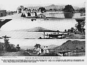 Early 20th century
 Lake model in «La Aurora» zoo in Guatemala City, ca. 1925.
![1897[7]](http://upload.wikimedia.org/wikipedia/commons/f/f6/Amatitlan1897.jpg)


Notes and references
References
- "Data Summary: Lago de Amatitilan". International Lake Environment Committee Foundation - ILEC. Archived from the original on 2008-05-26. Retrieved 2009-01-03.
- INSIVUMEH. "Indice de lagos". Retrieved 13 July 2008.
- Baily, John (1850). Central America; Describing Each of the States of Guatemala, Honduras, Salvador, Nicaragua, and Costa Rica. London: Trelawney Saunders. p. 60.
- Reyna, Evelyn Irene. "Integrated Management of the Lake Amatitlan Basin: Authority for the Sustainable Management of Lake Amatitlan and its Basin". Archived from the original on 2009-01-08. Retrieved 2009-03-05.
- Global Nature Fund. "Lake Amatitlan - Guatemala". Retrieved 13 July 2008.
- Rodríguez, Manuel (30 March 2015). "Baldetti suspende plan para "limpiar" lago de Amatitlán". Diario La Hora (in Spanish). Guatemala. Archived from the original on April 23, 2015. Retrieved 23 April 2015.
- Valdeavellano 1897, p. 200.
Bibliography
- Anton, Danilo J. (1993). Thirsty Cities: Urban Environments and Water Supply in Latin America. Ottawa, Ont.: International Development Research Centre (IDRC). ISBN 0-88936-666-7.
- Muñoz, c.; Velasquez, E.; Aragon, Y.R. (1978). Estudio de aguas subterráneas en el Valle de la Ciudad de Guatemala (in Spanish). Guatemala City: Ministerio de Comunicaciones y Obras Publicas, Instituto Nacional de Sismología, Vulcanología, Meteorología e Hidrológica.
- Valdeavellano, Alberto G. (1897). "Orillas del Lago de Amatitlán". La Ilustración Guatemalteca (in Spanish). Guatemala. I (14). Retrieved 27 April 2015.
External links
- Instituto Nacional de Sismología, Vulcanología, Meteorología e Hidrolagía (INSIVUMEH)
- Global Nature Fund - Lake Amatitlan - Guatemala
| Authority control |
|
|---|
На других языках
[de] Amatitlán-See
Der Amatitlán-See ist der viertgrößte See in Guatemala.- [en] Lake Amatitlán
[es] Lago Amatitlán
El lago de Amatitlán es un lago de cráter situado en Guatemala. Se encuentra a 26 km de la Ciudad de Guatemala, a una altitud de 1188 msnm. Tiene 12 km de largo, 3 km de ancho, y una superficie de 15.2 km² y es el cuarto cuerpo de agua más grande de Guatemala.[3] Su profundidad máxima es de 33 m y su profundidad media es 18 m. El volumen del cuerpo de agua es aproximadamente 0.286 km³.[2] Administrativamente el lago se encuentra dentro del Departamento de Guatemala, no obstante en el interior del lago se encuentra la división administrativa de Villa Nueva, Villa Canales, San Miguel Petapa y Amatitlán por lo que cada uno de esos municipios tienen parte del lago dentro de su jurisdicción, además la cuenca del lago esta formada por 14 municipios, 7 de ellos influyen directamente en el lago debido a la degradación de los recursos naturales, siendo estos: Ciudad de Villa Nueva, Villa Canales, Santa Catarina Pinula, San Miguel Petapa, Ciudad de Mixco, Amatitlán y las zonas 11, 12 y 21 de la Ciudad de Guatemala. La población de la cuenca es de más de 2 millones de habitantes; siendo Villa Nueva el municipio más poblado.[4][fr] Lac Amatitlán
Le lac Amatitlán (Lago Amatitlán, prononcé en espagnol : [laɣo amatiˈtlan]) est un lac volcanique du centre Sud du Guatemala, à proximité de Guatemala City. Situé dans les hautes terres du centre, à 1186 mètres au-dessus du niveau de la mer[1]. Sa profondeur maximale est de 33 mètres pour une moyenne générale de 18 mètres. Il s'étend sur 11 km de long et 3 km de large sur une surface de l'ordre de 15,2 km2 pour un volume avoisinant les 0,286 km3.[ru] Аматитлан (озеро)
Аматитла́н (исп. Lago de Amatitlán) — пресноводное озеро в Гватемале, четвёртое по величине в этой стране.Другой контент может иметь иную лицензию. Перед использованием материалов сайта WikiSort.org внимательно изучите правила лицензирования конкретных элементов наполнения сайта.
WikiSort.org - проект по пересортировке и дополнению контента Википедии