geo.wikisort.org - Mountains
Laguna de Ayarza (Spanish pronunciation: [laˈɣuna ðe aˈʝaɾsa]) is a crater lake in Guatemala. The lake is a caldera that was created some 20,000 years ago by a catastrophic eruption that destroyed a twinned volcano and blanketed the entire region with a layer of pumice.[1] The lake has a surface area of 14 km² and a maximum depth of 230 m.[2] The lake has a surface elevation of 1409 m.[3]
| Laguna de Ayarza | |
|---|---|
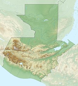
 Laguna de Ayarza, Guatemala | |
| Location | Casillas, Santa Rosa |
| Coordinates | 14°25′N 90°7′W |
| Lake type | Crater lake |
| Primary inflows | none |
| Primary outflows | none |
| Basin countries | Guatemala |
| Surface area | 14 km2 (5.4 sq mi) |
| Max. depth | 230 m (750 ft) |
| Surface elevation | 1,409 m (4,623 ft) |
References
- Poppe, L.; Paull, C; Newhall, C; Bradbury, J; Ziagos, J (June 1985). "A geophysical and geological study of Laguna de Ayarza, a Guatemalan caldera lake". Journal of Volcanology and Geothermal Research. 25 (1–2): 125–144. Bibcode:1985JVGR...25..125P. doi:10.1016/0377-0273(85)90008-3.
- "Wetland Inv - Guatemala" (xls). Ducks Unlimited. Retrieved 18 July 2008.
{{cite journal}}: Cite journal requires|journal=(help) - Bohnenberger, Otto H. "Los focos eruptivos cuaternarios de Guatemala". INSIVUMEH. Retrieved 2010-05-05.
External links
![]() Media related to Laguna de Ayarza at Wikimedia Commons
Media related to Laguna de Ayarza at Wikimedia Commons
- "Ayarza". Global Volcanism Program. Smithsonian Institution. Retrieved 2021-06-28.
На других языках
- [en] Laguna de Ayarza
[es] Laguna de Ayarza
La laguna de Ayarza (también llamado lago de Ayarza) es un lago de origen volcánico tipo caldera [1] en el departamento de Santa Rosa perteneciente a la Región IV o Sur Oriente de Guatemala. Fue creado hace aproximadamente 20,000 años como resultado de una erupción catastrófica que destruyó un volcán gemelo y que cubrió todo la región con pumita.[1][fr] Lagune d'Ayarza
La Lagune d'Ayarza (prononcé en espagnol : [laˈɣuna ðe aˈʝarsa]) est un lac volcanique du Guatemala.Текст в блоке "Читать" взят с сайта "Википедия" и доступен по лицензии Creative Commons Attribution-ShareAlike; в отдельных случаях могут действовать дополнительные условия.
Другой контент может иметь иную лицензию. Перед использованием материалов сайта WikiSort.org внимательно изучите правила лицензирования конкретных элементов наполнения сайта.
Другой контент может иметь иную лицензию. Перед использованием материалов сайта WikiSort.org внимательно изучите правила лицензирования конкретных элементов наполнения сайта.
2019-2025
WikiSort.org - проект по пересортировке и дополнению контента Википедии
WikiSort.org - проект по пересортировке и дополнению контента Википедии
