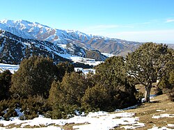
geo.wikisort.org - Mountains
The Kyrgyz Ala-Too (Kyrgyz: Кыргыз Ала-Тоосу, romanized: Kyrgyz Ala-Toosu, [qɯrˈɣɯz ɑlɑˈtoːsu]; Kazakh: Қырғыз Алатауы, romanized: Qyrǵyz Alataýy; Chinese: 吉尔吉斯阿拉套) also known as Kyrgyz Alatau, Kyrgyz Range, and Alexander Range (until 1933) is a large range in the North Tien-Shan. It stretches for a total length of 454 km from the west-end of Issyk-Kul to the town Taraz in Kazakhstan. It runs in the east–west direction, separating Chüy Valley from Kochkor Valley, Suusamyr Valley, and Talas Valley. Talas Ala-Too Range adjoins the Kyrgyz Ala-Too in vicinity of Töö Ashuu Pass. The western part of Kyrgyz Ala-Too serves as a natural border between Kyrgyzstan and Kazakhstan.[1]
| Kyrgyz Ala-Too | |
|---|---|
| Alexander Range (until 1933) | |
 | |
| Highest point | |
| Peak | Semenov-Tian-Shansky Peak |
| Elevation | 4,895 m (16,060 ft) |
| Dimensions | |
| Length | 454 km (282 mi) E-W |
| Width | 40 km (25 mi) N-S |
| Naming | |
| Native name | Кыргыз Ала-Тоосу (Kyrgyz) |
| Geography | |
 | |
| Countries | Kyrgyzstan and Kazakhstan |
| Region | Chüy Region |
| Range coordinates | 42°30′N 74°35′E |
| Geology | |
| Type of rock | Meganticline |
Parts of the range are contained within Ala Archa National Park, a popular alpine recreation area.
Notable peaks
- Semenov-Tian-Shansky Peak (4895m)
- Korona Peak (4860m)
- Free Korea Peak (4740m)
- Vladimir Putin Peak (4446m)
See also
- Ysyk-Ata Resort
References
- Чүй облусу:Энциклопедия [Encyclopedia of Chüy Oblast] (in Kyrgyz and Russian). Bishkek: Chief Editorial Board of Kyrgyz Encyclopedia. 1994. p. 718. ISBN 5-89750-083-5.
На других языках
[de] Kirgisisches Gebirge
Das Kirgisische Gebirge (auch Kirgisischer Alatau genannt; kirgisisch Кыргыз Ала-Тоо) ist ein bis 4895,4 m[1] hohes Hochgebirge in Kirgisistan und Kasachstan (Zentralasien).- [en] Kyrgyz Ala-Too Range
[it] Alatau kirghiso
L'Alatau kirghiso (in kirghiso: Кыргыз Ала-Тоосу?) è una catena montuosa che si trova nella parte settentrionale del sistema del Tien Shan. Si estende in direzione est-ovest per più di quattrocento chilometri dall'estremità occidentale dell'Ysyk-Köl alla città di Taraz, separando la valle di Čuj dalle valli di Kočkor, Suusamyr e Talas; nella sua porzione occidentale fa da confine naturale tra il Kirghizistan e il Kazakistan.[1][ru] Киргизский хребет
Кирги́зский хребе́т[1][2], Кирги́зский Алата́у[3] (кирг. Кыргыз Ала-Тоо, каз. Қырғыз Алатауы) — горный хребет, ограничивающий с юга Чуйскую долину и пустыню Мойынкум.Другой контент может иметь иную лицензию. Перед использованием материалов сайта WikiSort.org внимательно изучите правила лицензирования конкретных элементов наполнения сайта.
WikiSort.org - проект по пересортировке и дополнению контента Википедии