geo.wikisort.org - Mountains
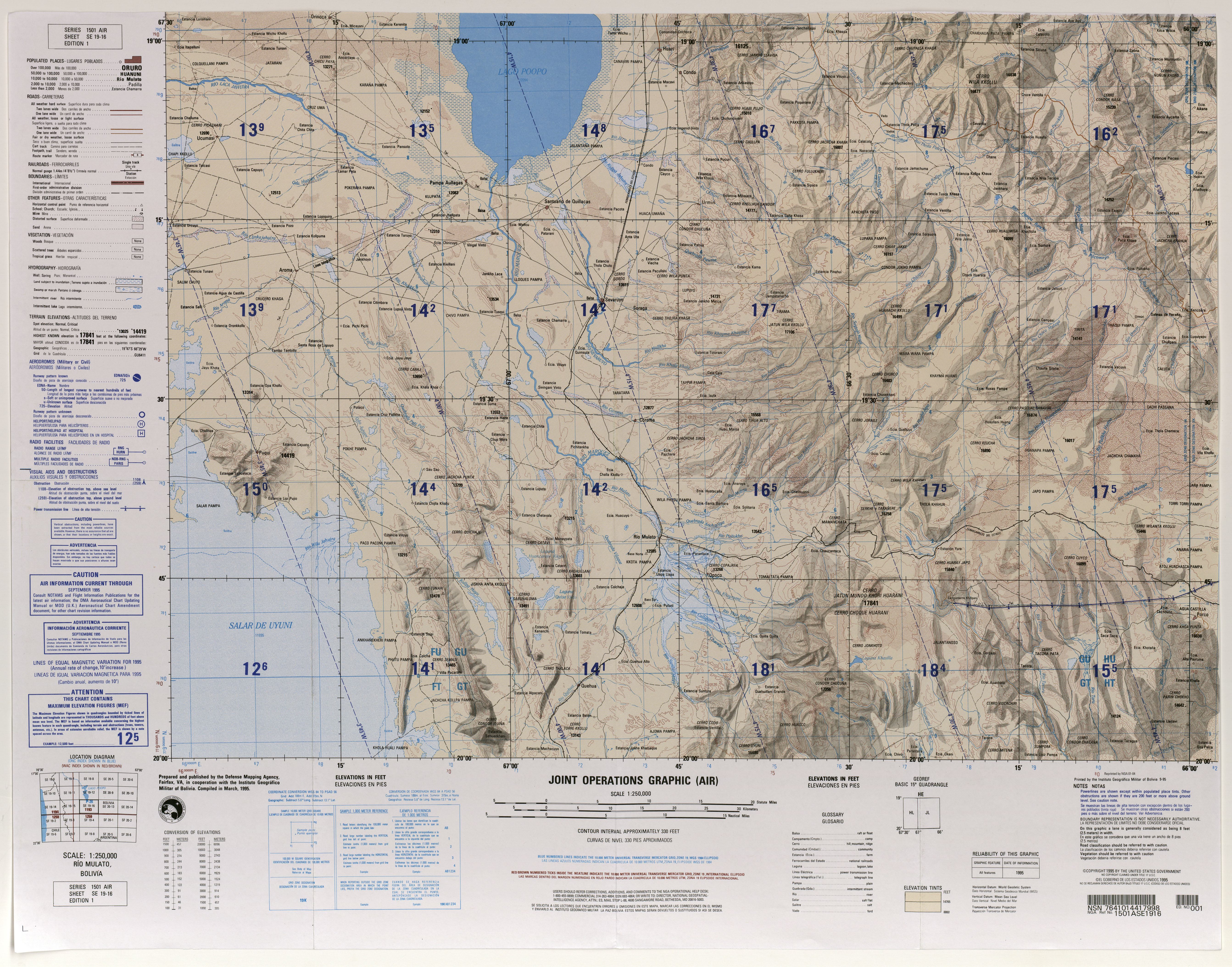
Kuntur Chukuña (Aymara kunturi condor, chukuña to squat, to cower,[3][4] 'where the condor squats', also spelled Condor Chucuna, Condor Chucuña) is a mountain in the Andes of Bolivia, about 5,290 m (17,360 ft) high. It is situated in the Potosí Department, Antonio Quijarro Province, Tomave Municipality,[5] between the Uyuni salt flat in the west and the town of Porco in the east and southwest of the Nuevo Mundo volcano (Jatun Mundo Quri Warani).
| Kuntur Chukuña | |
|---|---|
 Kuntur Chukuña Location within Bolivia | |
| Highest point | |
| Elevation | 5,290 m (17,360 ft)[1] |
| Coordinates | 19°55′S 66°31′W[2] |
| Geography | |
| Location | Bolivia, Potosí Department, Antonio Quijarro Province, Tomave Municipality |
| Parent range | Andes |
See also
- Sirk'i
- Mount Uyuni
- List of mountains in the Andes
References
- lib.utexas.edu Map (17,356 ft)
- getamap.net "Cerro Condor Chucuña"
- "Diccionario Bilingüe, Castellano - Aymara, 2002". Félix Layme Pairumani. Archived from the original on September 2, 2013. Retrieved March 27, 2016.
- Juan Carvajal Carvajal, Arturo Hernández Sallés, Nelly Ramos Pizarro, Diccionario Ilustrado Aymara-Español-Inglés (Aymara-Spanish-English dictionary)
- "Tomave". INE, Bolivia. Archived from the original on January 1, 2014. Retrieved March 27, 2016.
Текст в блоке "Читать" взят с сайта "Википедия" и доступен по лицензии Creative Commons Attribution-ShareAlike; в отдельных случаях могут действовать дополнительные условия.
Другой контент может иметь иную лицензию. Перед использованием материалов сайта WikiSort.org внимательно изучите правила лицензирования конкретных элементов наполнения сайта.
Другой контент может иметь иную лицензию. Перед использованием материалов сайта WikiSort.org внимательно изучите правила лицензирования конкретных элементов наполнения сайта.
2019-2025
WikiSort.org - проект по пересортировке и дополнению контента Википедии
WikiSort.org - проект по пересортировке и дополнению контента Википедии