geo.wikisort.org - Mountains
The Krottenkopf (German pronunciation: [ˈkʁɔtənˌkɔpf]), 2,086 metres/6,844 ft, is a peak in the Ester Mountains and the highest mountain in the Bavarian Prealps. It lies within the Bavarian district of Garmisch-Partenkirchen.
| Krottenkopf | |
|---|---|
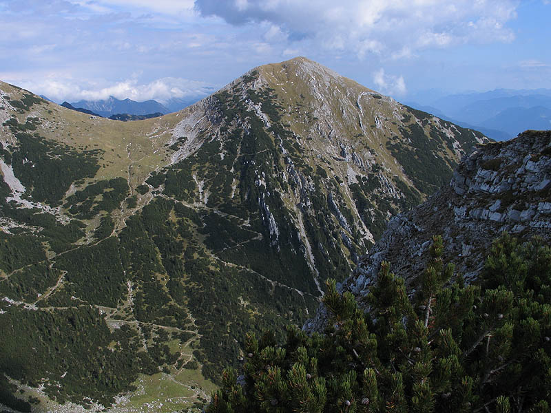 The Krottenkopf (2,086 m) from the Bischof (2033 m) | |
| Highest point | |
| Elevation | 2,086 m above sea level (NN) (6,844 ft) |
| Prominence | 1,156 m |
| Isolation | 12.7 km (7.9 mi) |
| Coordinates | 47°32′43″N 11°11′34″E |
| Geography | |
 Krottenkopf Bavaria, Germany | |
| Parent range | Ester Mountains |
| Geology | |
| Age of rock | Triassic |
| Mountain type | Oberrät Limestone in the summit region , otherwise Main Dolomite[1] |
| Climbing | |
| Normal route | Partenkirchen – Esterberg Alm – Weilheimer Hut – Krottenkopf |
Location and climbing options
It lies in the westernmost part of the Bavarian Prealps in the Ester Mountains near the town of Garmisch-Partenkirchen. Immediately below and a half an hour from the summit is the Weilheimer Hut (1,955 metres/6,414 ft), the highest Alpine Club hut in the Bavarian Prealps.
There are four climbing options:
- From Oberau a very steep climb, the Oberauer Steig, follows narrow mountain paths via the Frickenboden and later runs past the Bischof mountain, which is also over 2,000 metres high, but less well known. This climb requires about 4 hours.
- From Klais another path runs via the Krüner Alm (1,620 metres/5,310 ft) and the Michelfeld
- From Garmisch-Partenkirchen and Farchant the route goes via the Esterbergalm taking about 4½ hours to reach the top of the Krottenkopf.
- In addition, there is the even longer climb from Eschenlohe past the 1,922-metre/6,306 ft Hohe Kisten to the summit.
Gallery
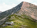 The Krottenkopf around 1900
 View from the Krottenkopf to the Kareck around 1900
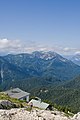 View from Heimgarten. Foreground: the Heimgarten Hut


See also
- List of mountains of the Alps
- List of Alpine peaks by prominence
References
- Bayerisches Geologisches Landesamt, 1998, Geological map of Bavaria with key 1:500,000
External links
Wikimedia Commons has media related to Krottenkopf.
- Tour description
- Tour description in winter with photos
- Annotated summit panorama from theKrottenkopf
- Description of tour via the Oberauer Steig incl. map and photos
| Authority control |
|
|---|
На других языках
[de] Krottenkopf
Der Krottenkopf ist ein 2086 m ü. NHN hoher Berg und der höchste der Bayerischen Voralpen.- [en] Krottenkopf
[fr] Krottenkopf
Le Krottenkopf est un sommet des Alpes, à 2 086 m d'altitude, point culminant des Préalpes bavaroises, et précisément du chaînon d'Ester, en Allemagne (Bavière).[it] Krottenkopf
Il Krottenkopf (2.086 m s.l.m.) è la montagna più alta delle Alpi del Wallgau nelle Alpi Bavaresi. Si trova nella Baviera.Текст в блоке "Читать" взят с сайта "Википедия" и доступен по лицензии Creative Commons Attribution-ShareAlike; в отдельных случаях могут действовать дополнительные условия.
Другой контент может иметь иную лицензию. Перед использованием материалов сайта WikiSort.org внимательно изучите правила лицензирования конкретных элементов наполнения сайта.
Другой контент может иметь иную лицензию. Перед использованием материалов сайта WikiSort.org внимательно изучите правила лицензирования конкретных элементов наполнения сайта.
2019-2026
WikiSort.org - проект по пересортировке и дополнению контента Википедии
WikiSort.org - проект по пересортировке и дополнению контента Википедии